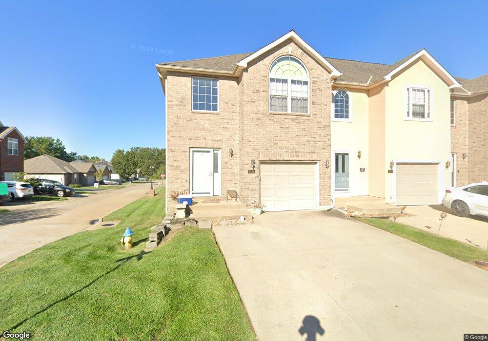
1226 Dustins Way Warrensburg, MO 64093
Estimated Value: $223,000 - $259,000
3
Beds
3
Baths
1,852
Sq Ft
$129/Sq Ft
Est. Value
About This Home
This home is located at 1226 Dustins Way, Warrensburg, MO 64093 and is currently estimated at $238,941, approximately $129 per square foot. 1226 Dustins Way is a home located in Johnson County with nearby schools including Maple Grove Elementary School, Martin Warren Elementary School, and Warrensburg Middle School.
Ownership History
Date
Name
Owned For
Owner Type
Purchase Details
Closed on
Apr 1, 2010
Sold by
Mears Charles J and Mears Brittany D
Bought by
Holmberg John S and Holmberg Cindy T
Current Estimated Value
Home Financials for this Owner
Home Financials are based on the most recent Mortgage that was taken out on this home.
Original Mortgage
$137,902
Outstanding Balance
$91,665
Interest Rate
4.96%
Mortgage Type
VA
Estimated Equity
$147,276
Purchase Details
Closed on
Nov 7, 2007
Sold by
Moorman Stephen S and Moorman Diana Y
Bought by
Mears Charles J and Mears Brittany D
Create a Home Valuation Report for This Property
The Home Valuation Report is an in-depth analysis detailing your home's value as well as a comparison with similar homes in the area
Home Values in the Area
Average Home Value in this Area
Purchase History
| Date | Buyer | Sale Price | Title Company |
|---|---|---|---|
| Holmberg John S | -- | None Available | |
| Mears Charles J | -- | -- |
Source: Public Records
Mortgage History
| Date | Status | Borrower | Loan Amount |
|---|---|---|---|
| Open | Holmberg John S | $137,902 |
Source: Public Records
Tax History Compared to Growth
Tax History
| Year | Tax Paid | Tax Assessment Tax Assessment Total Assessment is a certain percentage of the fair market value that is determined by local assessors to be the total taxable value of land and additions on the property. | Land | Improvement |
|---|---|---|---|---|
| 2024 | $1,924 | $25,200 | $0 | $0 |
| 2023 | $1,924 | $25,200 | $0 | $0 |
| 2022 | $1,854 | $24,175 | $0 | $0 |
| 2021 | $1,848 | $24,175 | $0 | $0 |
| 2020 | $1,789 | $23,150 | $0 | $0 |
| 2019 | $1,788 | $23,150 | $0 | $0 |
| 2017 | $1,783 | $23,150 | $0 | $0 |
| 2016 | $1,644 | $23,150 | $0 | $0 |
| 2015 | $1,688 | $23,150 | $0 | $0 |
| 2014 | -- | $23,150 | $0 | $0 |
Source: Public Records
Map
Nearby Homes
- 1595 Essex Dr
- 1603 Roanoke Dr
- 1226 Pembrooke Dr
- 1503 Nottingham Dr
- 1326 Fawn Ln
- 1415 Kimberly Dr
- 1309 Kimberly Dr
- 1303 Kimberly Dr
- 153 SE 125 Rd
- 210 Parkway Dr
- 207 Summer Place
- 83 SE 381st Rd
- 1111 Tyler St
- 1120 Tyler St
- 1101 Anderson St
- 1112 Anderson St
- 706 Cedar Dr Unit B
- 106 Shady Ln
- 1006 Anderson St
- 991 S Mitchell St
- 1224 Dustins Way
- 1222 Dustins Way
- 1219 Half Day Dr
- 1218 Dustins Way
- 1902 Ender Ln
- 1904 Ender Ln
- 1900 Ender Ln
- 1906 Ender Ln
- 1216 Dustins Way
- 1216 Dustins Way Unit In Savannah Commons
- 1908 Ender Ln
- 1225 Dustins Way
- 1223 Dustins Way
- 1221 Dustins Way
- 1227 Dustins Way
- 1214 Dustins Way
- 1219 Dustins Way
- 1212 Dustins Way
- 1215 Dustins Way
- 1213 Half Day Dr