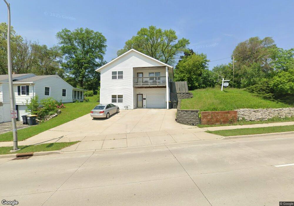
1226 E Moreland Blvd Waukesha, WI 53186
Estimated Value: $254,000 - $374,000
4
Beds
2
Baths
1,352
Sq Ft
$231/Sq Ft
Est. Value
About This Home
This home is located at 1226 E Moreland Blvd, Waukesha, WI 53186 and is currently estimated at $311,754, approximately $230 per square foot. 1226 E Moreland Blvd is a home located in Waukesha County with nearby schools including Banting Elementary School, Horning Middle School, and South High School.
Ownership History
Date
Name
Owned For
Owner Type
Purchase Details
Closed on
Aug 15, 2019
Sold by
Habitat For Humanity Of Waukesha Cnty In
Bought by
Trotter Donald Yolanda and Trotter Donald Robert
Current Estimated Value
Home Financials for this Owner
Home Financials are based on the most recent Mortgage that was taken out on this home.
Original Mortgage
$25,000
Outstanding Balance
$21,895
Interest Rate
3.7%
Mortgage Type
Commercial
Estimated Equity
$289,859
Purchase Details
Closed on
Mar 27, 2019
Sold by
Housing Development Partners Inc
Bought by
Habitat For Humanity Of Waukesha County
Purchase Details
Closed on
Mar 14, 2019
Sold by
Chiara Communites Inc
Bought by
Housing Development Partners Inc
Purchase Details
Closed on
May 27, 2004
Sold by
Sheehan Doris
Bought by
Community Land Development Assn Inc
Create a Home Valuation Report for This Property
The Home Valuation Report is an in-depth analysis detailing your home's value as well as a comparison with similar homes in the area
Home Values in the Area
Average Home Value in this Area
Purchase History
| Date | Buyer | Sale Price | Title Company |
|---|---|---|---|
| Trotter Donald Yolanda | $25,000 | None Available | |
| Habitat For Humanity Of Waukesha County | $20,000 | None Available | |
| Housing Development Partners Inc | $20,000 | None Available | |
| Community Land Development Assn Inc | $30,000 | -- |
Source: Public Records
Mortgage History
| Date | Status | Borrower | Loan Amount |
|---|---|---|---|
| Open | Trotter Donald Yolanda | $25,000 |
Source: Public Records
Tax History Compared to Growth
Tax History
| Year | Tax Paid | Tax Assessment Tax Assessment Total Assessment is a certain percentage of the fair market value that is determined by local assessors to be the total taxable value of land and additions on the property. | Land | Improvement |
|---|---|---|---|---|
| 2024 | $4,060 | $228,300 | $52,700 | $175,600 |
| 2023 | $3,218 | $228,300 | $52,700 | $175,600 |
| 2022 | $2,516 | $136,200 | $49,700 | $86,500 |
| 2021 | $2,561 | $136,200 | $49,700 | $86,500 |
| 2020 | $2,496 | $136,200 | $49,700 | $86,500 |
| 2019 | $2,406 | $136,200 | $49,700 | $86,500 |
| 2018 | $2,328 | $128,500 | $47,200 | $81,300 |
| 2017 | $2,688 | $128,500 | $47,200 | $81,300 |
| 2016 | $2,368 | $122,400 | $47,200 | $75,200 |
| 2015 | $2,358 | $122,400 | $47,200 | $75,200 |
| 2014 | $2,461 | $122,400 | $47,200 | $75,200 |
| 2013 | $2,461 | $122,400 | $47,200 | $75,200 |
Source: Public Records
Map
Nearby Homes
- 1234 E Moreland Blvd
- 1460 Paul Ln
- 1333 Niagara St
- 1349 Rose Ct Unit 62
- 1937 Jefferson Ave
- 1920 Cardinal Dr
- 936 Perkins Ave
- 1623 Square Cir
- 851 Perkins Ave
- 512 E Main St
- 1715 Stardust Dr Unit A
- 502 Gascoigne Dr
- 416 Riverview Ave
- 1825 Paramount Dr Unit F
- 1806 E Main St
- 1823 Paramount Dr Unit D
- 818 Pleasant St
- 169 NW Barstow St
- W225N217 Lexington Dr
- S17W22650 Lincoln Ave
- 1220 E Moreland Blvd
- 1200 E Moreland Blvd
- 1301 E Moreland Blvd Unit 1301
- 1221 E Moreland Blvd
- 1138 E Moreland Blvd
- 1132 E Moreland Blvd
- 1129 Margaret St
- 1125 Margaret St
- 1128 Margaret St
- 1132 Margaret St
- 1121 Margaret St
- 1510 Highland Ave
- 1209 E Moreland Blvd
- 1117 Margaret St
- 1205 E Moreland Blvd
- 1120 Margaret St
- 1474 Waukesha Ave
- 1116 Margaret St
- 1126 E Moreland Blvd
- 1201 E Moreland Blvd