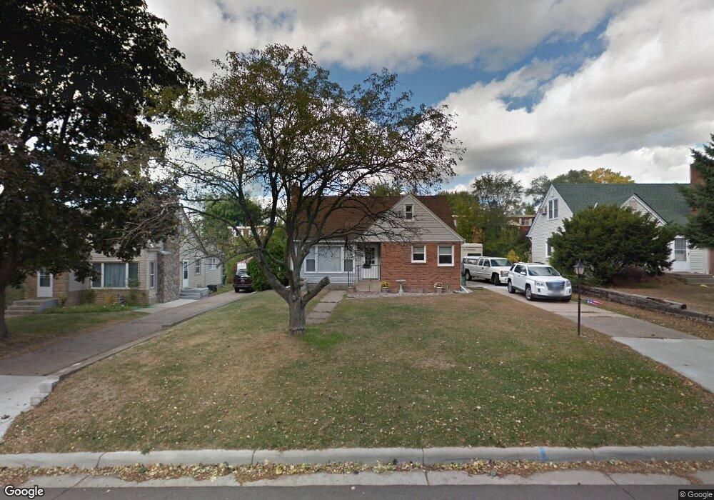
1227 Lark Ave Saint Paul, MN 55109
Sherwood Glen NeighborhoodEstimated Value: $269,000 - $286,211
3
Beds
1
Bath
1,051
Sq Ft
$261/Sq Ft
Est. Value
About This Home
This home is located at 1227 Lark Ave, Saint Paul, MN 55109 and is currently estimated at $274,803, approximately $261 per square foot. 1227 Lark Ave is a home located in Ramsey County with nearby schools including Weaver Elementary School, John Glenn Middle School, and St Jerome Elementary School.
Ownership History
Date
Name
Owned For
Owner Type
Purchase Details
Closed on
Nov 2, 2018
Sold by
Little Vicki L
Bought by
Hazard Alexander D
Current Estimated Value
Home Financials for this Owner
Home Financials are based on the most recent Mortgage that was taken out on this home.
Original Mortgage
$173,145
Interest Rate
4.8%
Mortgage Type
New Conventional
Create a Home Valuation Report for This Property
The Home Valuation Report is an in-depth analysis detailing your home's value as well as a comparison with similar homes in the area
Home Values in the Area
Average Home Value in this Area
Purchase History
| Date | Buyer | Sale Price | Title Company |
|---|---|---|---|
| Hazard Alexander D | $178,500 | Burnet Title |
Source: Public Records
Mortgage History
| Date | Status | Borrower | Loan Amount |
|---|---|---|---|
| Previous Owner | Hazard Alexander D | $173,145 |
Source: Public Records
Tax History Compared to Growth
Tax History
| Year | Tax Paid | Tax Assessment Tax Assessment Total Assessment is a certain percentage of the fair market value that is determined by local assessors to be the total taxable value of land and additions on the property. | Land | Improvement |
|---|---|---|---|---|
| 2025 | $3,948 | $267,500 | $49,400 | $218,100 |
| 2023 | $3,948 | $241,200 | $49,400 | $191,800 |
| 2022 | $3,088 | $232,600 | $49,400 | $183,200 |
| 2021 | $2,800 | $196,100 | $49,400 | $146,700 |
| 2020 | $2,836 | $190,100 | $49,400 | $140,700 |
| 2019 | $2,642 | $179,300 | $49,400 | $129,900 |
| 2018 | $2,642 | $152,100 | $49,400 | $102,700 |
| 2017 | $2,792 | $147,300 | $49,400 | $97,900 |
| 2016 | $2,476 | $0 | $0 | $0 |
| 2015 | $2,450 | $130,900 | $45,300 | $85,600 |
| 2014 | $2,330 | $0 | $0 | $0 |
Source: Public Records
Map
Nearby Homes
- 1467 County Road B E
- 1509 Sandhurst Ave E
- 1018 Sextant Ave
- 1201 Frost Ave
- 2420 Hazelwood St
- 955 Brooks Ct
- 1940 Barclay St
- 2020 Arcade St
- 1869 Birmingham St
- 1666 Laurie Rd E
- 1984 Prosperity Rd
- 1875 E Shore Dr Unit 302
- 1694 Laurie Rd E
- 1854 Barclay St
- 1779 Frank St
- 771 County Road B2 E
- 1730 Atlantic St
- 1740 English St
- 727 Laurie Ct
- 822 Palm Ct
- 1233 Lark Ave
- 1221 Lark Ave
- 1215 Lark Ave
- 2271 Atlantic St
- 2275 Atlantic St
- 2275 Atlantic St N
- 1209 Lark Ave
- 1224 Lark Ave
- 1216 Lark Ave
- 1232 Lark Ave
- 1214 Lark Ave
- 1203 Lark Ave
- 1251 Lark Ave
- 1244 Cope Ave E
- 1208 Lark Ave
- 1199 Lark Ave
- 1248 Lark Ave
- 1225 County Road B E
- 1233 Cope Ave E
- 1217 County Road B E