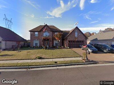
1227 Stable Run Dr Cordova, TN 38018
Gray's Creek NeighborhoodEstimated Value: $326,000 - $363,000
4
Beds
3
Baths
3,683
Sq Ft
$94/Sq Ft
Est. Value
About This Home
This home is located at 1227 Stable Run Dr, Cordova, TN 38018 and is currently estimated at $348,036, approximately $94 per square foot. 1227 Stable Run Dr is a home located in Shelby County with nearby schools including Macon-Hall Elementary School, Mt. Pisgah Middle School, and Germantown High School.
Ownership History
Date
Name
Owned For
Owner Type
Purchase Details
Closed on
Mar 18, 2004
Sold by
Summit Homes Llc
Bought by
Clayborn Lorene
Current Estimated Value
Home Financials for this Owner
Home Financials are based on the most recent Mortgage that was taken out on this home.
Original Mortgage
$196,700
Interest Rate
7.7%
Mortgage Type
Purchase Money Mortgage
Purchase Details
Closed on
Jun 4, 2002
Sold by
Richerson W V and Richerson Diane M
Bought by
Compass Pointe Properties
Create a Home Valuation Report for This Property
The Home Valuation Report is an in-depth analysis detailing your home's value as well as a comparison with similar homes in the area
Home Values in the Area
Average Home Value in this Area
Purchase History
| Date | Buyer | Sale Price | Title Company |
|---|---|---|---|
| Clayborn Lorene | $196,714 | Memphis Title Company | |
| Compass Pointe Properties | -- | -- |
Source: Public Records
Mortgage History
| Date | Status | Borrower | Loan Amount |
|---|---|---|---|
| Open | Clayborn Lorene | $173,600 | |
| Closed | Clayborn Lorene | $43,400 | |
| Closed | Clayborn Lorene | $196,700 |
Source: Public Records
Tax History Compared to Growth
Tax History
| Year | Tax Paid | Tax Assessment Tax Assessment Total Assessment is a certain percentage of the fair market value that is determined by local assessors to be the total taxable value of land and additions on the property. | Land | Improvement |
|---|---|---|---|---|
| 2024 | $2,067 | $60,975 | $10,075 | $50,900 |
| 2023 | $2,067 | $60,975 | $10,075 | $50,900 |
| 2022 | $2,067 | $60,975 | $10,075 | $50,900 |
| 2021 | $2,104 | $60,975 | $10,075 | $50,900 |
| 2020 | $1,825 | $45,050 | $9,500 | $35,550 |
| 2019 | $1,825 | $45,050 | $9,500 | $35,550 |
| 2018 | $1,825 | $45,050 | $9,500 | $35,550 |
| 2017 | $1,852 | $45,050 | $9,500 | $35,550 |
| 2016 | $1,780 | $40,725 | $0 | $0 |
| 2014 | $1,780 | $40,725 | $0 | $0 |
Source: Public Records
Map
Nearby Homes
- 1135 Mossy Knoll Dr
- 1296 Carlton Ridge Dr
- 10316 Hamilton View Dr
- 10167 Macon Rd
- 10152 Sterling Ridge Dr
- 10189 Kay Oak Cove
- 10148 Sterling Ridge Dr
- 10131 Macon Rd
- 1470 Carlton Ridge Dr
- 10279 Woodland Hills Dr
- 10433 Pisgah Forest Ln
- 10199 Woodland Hills Dr
- 1560 Sutton Meadow Ln
- 10133 Lynham Dr
- 10098 Sutton Ridge Ln
- 1639 Sawmill Creek Ln
- 1550 N Pisgah Rd
- 1336 Siskin Dr
- 1669 Stable Run Dr
- 1414 Siskin Dr
- 1227 Stable Run Dr
- 1221 Stable Run Dr
- 1235 Stable Run Dr
- 1215 Stable Run Dr
- 1243 Stable Run Dr
- 1228 Stable Run Dr
- 1258 Breezy Valley Dr
- 1236 Stable Run Dr
- 1211 Stable Run Dr
- 10317 Walden Pine Ct
- 1254 Breezy Valley Dr
- 1244 Stable Run Dr
- 1255 Stable Run Dr
- 1262 Breezy Valley Dr
- 10324 Walden Pine Ct
- 1266 Breezy Valley Dr
- 1250 Breezy Valley Dr
- 1207 Stable Run Dr
- 10323 Walden Pine Ct
- 1252 Stable Run Dr