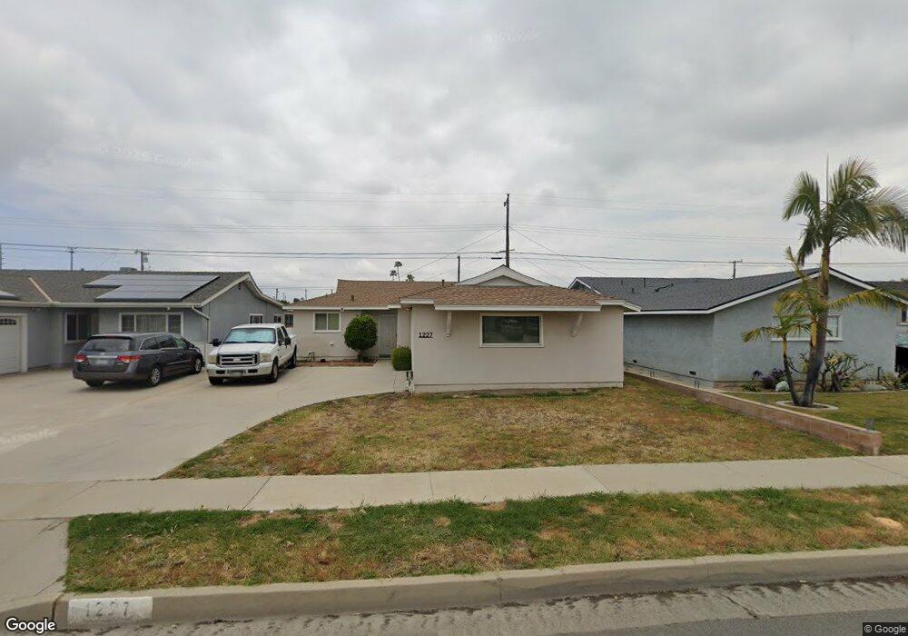
1227 W 213th St Torrance, CA 90502
West Carson NeighborhoodEstimated Value: $799,966 - $870,000
3
Beds
2
Baths
1,295
Sq Ft
$648/Sq Ft
Est. Value
About This Home
This home is located at 1227 W 213th St, Torrance, CA 90502 and is currently estimated at $839,242, approximately $648 per square foot. 1227 W 213th St is a home located in Los Angeles County with nearby schools including Halldale Elementary School, Stephen M. White Middle School, and Nathaniel Narbonne Senior High School.
Ownership History
Date
Name
Owned For
Owner Type
Purchase Details
Closed on
Mar 27, 2001
Sold by
Takata Philip T
Bought by
Walker James B and Walker Nadine O
Current Estimated Value
Home Financials for this Owner
Home Financials are based on the most recent Mortgage that was taken out on this home.
Original Mortgage
$184,000
Outstanding Balance
$67,627
Interest Rate
6.98%
Estimated Equity
$771,615
Purchase Details
Closed on
Dec 19, 1996
Sold by
Takata Philip T
Bought by
Takata Philip T and Takata Lynette N
Create a Home Valuation Report for This Property
The Home Valuation Report is an in-depth analysis detailing your home's value as well as a comparison with similar homes in the area
Home Values in the Area
Average Home Value in this Area
Purchase History
| Date | Buyer | Sale Price | Title Company |
|---|---|---|---|
| Walker James B | $230,000 | First American Title Co | |
| Takata Philip T | -- | -- |
Source: Public Records
Mortgage History
| Date | Status | Borrower | Loan Amount |
|---|---|---|---|
| Open | Walker James B | $184,000 |
Source: Public Records
Tax History Compared to Growth
Tax History
| Year | Tax Paid | Tax Assessment Tax Assessment Total Assessment is a certain percentage of the fair market value that is determined by local assessors to be the total taxable value of land and additions on the property. | Land | Improvement |
|---|---|---|---|---|
| 2025 | $4,574 | $346,553 | $276,798 | $69,755 |
| 2024 | $4,574 | $339,759 | $271,371 | $68,388 |
| 2023 | $4,493 | $333,098 | $266,050 | $67,048 |
| 2022 | $4,280 | $326,568 | $260,834 | $65,734 |
| 2021 | $4,233 | $320,166 | $255,720 | $64,446 |
| 2019 | $4,098 | $310,672 | $248,136 | $62,536 |
| 2018 | $3,975 | $304,581 | $243,271 | $61,310 |
| 2016 | $3,789 | $292,755 | $233,825 | $58,930 |
| 2015 | $3,722 | $288,358 | $230,313 | $58,045 |
| 2014 | $3,716 | $282,710 | $225,802 | $56,908 |
Source: Public Records
Map
Nearby Homes
- 21125 Normandie Ave
- 21141 Berendo Ave
- 22325 Sage Ct
- 22302 Sage Ct
- 22303 Sage Ct
- 1107 W 210th St
- 21322 Denker Ave
- 21726 Halldale Ave
- 941 W Carson St Unit 106
- 20907 Halldale Ave
- 21114 La Salle Ave
- 20813 Normandie Ave
- 20710 Raymond Ave
- 20612 Kenwood Ave
- 1569 W 218th St
- 1291 Bonnet Way
- 20616 Budlong Ave
- 946 W 220th St Unit 216
- 1145 Milton St
- 715 W 220th St Unit 32
- 1223 W 213th St
- 1233 W 213th St
- 1217 W 213th St
- 1237 W 213th St
- 1213 W 213th St
- 1243 W 213th St
- 1228 W 213th St
- 1232 W 213th St
- 1222 W 213th St
- 1238 W 213th St
- 1218 W 213th St
- 1207 W 213th St
- 1247 W 213th St
- 1218 Clarion Dr
- 1212 Clarion Dr
- 1222 Clarion Dr
- 1242 W 213th St
- 1212 W 213th St
- 1208 Clarion Dr
- 1228 Clarion Dr