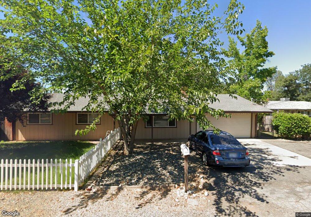
1228 Harpole Rd Redding, CA 96002
Enterprise NeighborhoodEstimated Value: $297,000 - $322,000
3
Beds
2
Baths
1,232
Sq Ft
$251/Sq Ft
Est. Value
About This Home
This home is located at 1228 Harpole Rd, Redding, CA 96002 and is currently estimated at $309,219, approximately $250 per square foot. 1228 Harpole Rd is a home located in Shasta County with nearby schools including Lassen View Elementary School, Parsons Junior High School, and Enterprise High School.
Ownership History
Date
Name
Owned For
Owner Type
Purchase Details
Closed on
Oct 15, 2012
Sold by
Adcock Samuel M and Adcock Tamara L
Bought by
Adcock Samuel M and Adcock Tamara L
Current Estimated Value
Purchase Details
Closed on
Jul 29, 2012
Sold by
Marshlain Kirk Alan and Marshlain Emily Rose
Bought by
Adcock Samuel M and Adcock Tamara L
Home Financials for this Owner
Home Financials are based on the most recent Mortgage that was taken out on this home.
Original Mortgage
$108,750
Outstanding Balance
$75,160
Interest Rate
3.62%
Mortgage Type
New Conventional
Estimated Equity
$234,059
Purchase Details
Closed on
Nov 21, 2011
Sold by
Federal Home Loan Mortgage Corporation
Bought by
Marshlain Kirk Alan and Marshlain Emily Rose
Home Financials for this Owner
Home Financials are based on the most recent Mortgage that was taken out on this home.
Original Mortgage
$121,831
Interest Rate
4.5%
Mortgage Type
FHA
Purchase Details
Closed on
Dec 7, 2010
Sold by
Boutte Khadijah J
Bought by
Federal Home Loan Mortgage Corporation
Purchase Details
Closed on
Jul 23, 2001
Sold by
Crane Gary W and Crane Elizabeth A
Bought by
Boutte Khadijah J
Home Financials for this Owner
Home Financials are based on the most recent Mortgage that was taken out on this home.
Original Mortgage
$82,000
Interest Rate
7.15%
Purchase Details
Closed on
Dec 22, 2000
Sold by
Delaplane Earnest Edward
Bought by
Crane Gary W and Crane Elizabeth A
Home Financials for this Owner
Home Financials are based on the most recent Mortgage that was taken out on this home.
Original Mortgage
$57,000
Interest Rate
12%
Purchase Details
Closed on
Jul 18, 1997
Sold by
Gipson Robert D and Gipson Amy L
Bought by
Heins Isabel R and Delaplane Earnest Edward
Purchase Details
Closed on
Mar 31, 1997
Sold by
Gipson Amy L
Bought by
Gipson Robert D
Create a Home Valuation Report for This Property
The Home Valuation Report is an in-depth analysis detailing your home's value as well as a comparison with similar homes in the area
Home Values in the Area
Average Home Value in this Area
Purchase History
We collect this data history from publicly available records. To have your information removed, we recommend requesting removal directly through your county’s website.
| Date | Buyer | Sale Price | Title Company |
|---|---|---|---|
| Adcock Samuel M | -- | None Available | |
| Adcock Samuel M | $145,000 | Fidelity Natl Title Co Of Ca | |
| Marshlain Kirk Alan | $125,000 | Ticor Title | |
| Federal Home Loan Mortgage Corporation | $133,075 | Accommodation | |
| Boutte Khadijah J | $95,000 | -- | |
| Crane Gary W | $88,000 | Chicago Title Co | |
| Heins Isabel R | -- | Fidelity National Title | |
| Gipson Robert D | $6,000 | Fidelity National Title |
Source: Public Records
Mortgage History
We collect this data history from publicly available records. To have your information removed, we recommend requesting removal directly through your county’s website.
| Date | Status | Borrower | Loan Amount |
|---|---|---|---|
| Open | Adcock Samuel M | $108,750 | |
| Previous Owner | Marshlain Kirk Alan | $121,831 | |
| Previous Owner | Boutte Khadijah J | $82,000 | |
| Previous Owner | Crane Gary W | $57,000 |
Source: Public Records
Tax History
| Year | Tax Paid | Tax Assessment Tax Assessment Total Assessment is a certain percentage of the fair market value that is determined by local assessors to be the total taxable value of land and additions on the property. | Land | Improvement |
|---|---|---|---|---|
| 2025 | $1,956 | $178,546 | $36,938 | $141,608 |
| 2024 | $1,929 | $175,046 | $36,214 | $138,832 |
| 2023 | $1,929 | $171,614 | $35,504 | $136,110 |
| 2022 | $1,874 | $168,250 | $34,808 | $133,442 |
| 2021 | $1,810 | $164,952 | $34,126 | $130,826 |
| 2020 | $1,802 | $163,262 | $33,777 | $129,485 |
| 2019 | $1,788 | $160,062 | $33,115 | $126,947 |
| 2018 | $1,767 | $156,924 | $32,466 | $124,458 |
| 2017 | $1,798 | $153,848 | $31,830 | $122,018 |
| 2016 | $1,682 | $150,832 | $31,206 | $119,626 |
| 2015 | $1,669 | $148,568 | $30,738 | $117,830 |
| 2014 | $1,657 | $145,658 | $30,136 | $115,522 |
Source: Public Records
Map
Nearby Homes
- 1152 Echo Rd
- 3759 Alma Ave
- 1397 Empress Ln
- 1513 Harpole Rd
- 3360 Lawrence Rd
- 1091 Del Sol Place
- 1228 Ledell Dr
- 4020 Churn Creek Rd
- 3293 Middleton Ln
- 3305 Saint Moritz Ct
- 1144 Denton Way
- 1198 Denton Way
- 1613 Galaxy Way
- 1075 Le Brun Ln
- 3178 Lawrence Rd
- 1785 Soda Springs Cir
- 3540 Ricardo Ave
- 1773 Soda Springs Cir
- 1209 C St
- 3283 Middleton Ln
- 3693 Echo Rd
- 3693 Echo 1weup7ny0hdu
- 1235 Harpole Rd
- 3681 Echo Rd
- 1246 Harpole Rd
- 1215 Harpole Rd
- 1206 Harpole Rd
- 3605 Alma Ave
- 3660 Echo Rd
- 1251 Harpole Rd
- 3665 Echo Rd
- 3646 Echo Rd
- 1201 Harpole Rd
- 3619 Alma Ave
- 1188 Harpole Rd
- 1195 Ruthie Ln
- 1279 Harpole Rd
- 1250 Harpole Rd
- 1341 Harpole Rd
- 1347 Harpole Rd
Your Personal Tour Guide
Ask me questions while you tour the home.