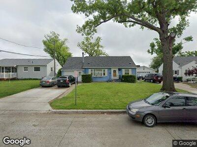
1229 20th St SW Cedar Rapids, IA 52404
Cleveland Area NeighborhoodEstimated Value: $173,000 - $202,000
3
Beds
1
Bath
2,871
Sq Ft
$67/Sq Ft
Est. Value
About This Home
This home is located at 1229 20th St SW, Cedar Rapids, IA 52404 and is currently estimated at $191,770, approximately $66 per square foot. 1229 20th St SW is a home located in Linn County with nearby schools including Cleveland Elementary School, Roosevelt Creative Corridor Business Academy, and Thomas Jefferson High School.
Ownership History
Date
Name
Owned For
Owner Type
Purchase Details
Closed on
Apr 10, 2001
Sold by
Busswitz Jason G and Busswitz Kristin M
Bought by
Reiling Mark E and Reiling Catherine I
Current Estimated Value
Home Financials for this Owner
Home Financials are based on the most recent Mortgage that was taken out on this home.
Original Mortgage
$96,500
Outstanding Balance
$40,282
Interest Rate
7.05%
Purchase Details
Closed on
Apr 28, 1999
Sold by
Cook Troy J and Cook Deann M
Bought by
Busswitz Jason G and Busswitz Kristin M
Home Financials for this Owner
Home Financials are based on the most recent Mortgage that was taken out on this home.
Original Mortgage
$94,951
Interest Rate
7.05%
Mortgage Type
FHA
Create a Home Valuation Report for This Property
The Home Valuation Report is an in-depth analysis detailing your home's value as well as a comparison with similar homes in the area
Home Values in the Area
Average Home Value in this Area
Purchase History
| Date | Buyer | Sale Price | Title Company |
|---|---|---|---|
| Reiling Mark E | $99,000 | -- | |
| Busswitz Jason G | $94,500 | -- |
Source: Public Records
Mortgage History
| Date | Status | Borrower | Loan Amount |
|---|---|---|---|
| Open | Reiling Mark E | $96,500 | |
| Previous Owner | Busswitz Jason G | $94,951 |
Source: Public Records
Tax History Compared to Growth
Tax History
| Year | Tax Paid | Tax Assessment Tax Assessment Total Assessment is a certain percentage of the fair market value that is determined by local assessors to be the total taxable value of land and additions on the property. | Land | Improvement |
|---|---|---|---|---|
| 2023 | $3,258 | $182,200 | $30,000 | $152,200 |
| 2022 | $3,030 | $163,300 | $25,500 | $137,800 |
| 2021 | $3,102 | $155,200 | $25,500 | $129,700 |
| 2020 | $3,102 | $149,200 | $24,000 | $125,200 |
| 2019 | $2,754 | $136,300 | $24,000 | $112,300 |
| 2018 | $2,674 | $136,300 | $24,000 | $112,300 |
| 2017 | $2,684 | $131,800 | $24,000 | $107,800 |
| 2016 | $2,729 | $128,400 | $24,000 | $104,400 |
| 2015 | $2,737 | $128,633 | $24,000 | $104,633 |
| 2014 | $2,552 | $133,039 | $24,000 | $109,039 |
| 2013 | $2,584 | $133,039 | $24,000 | $109,039 |
Source: Public Records
Map
Nearby Homes
- 2175 Chandler St SW
- 2241 Williams Blvd SW
- 908 18th St SW
- 143 21st St SW
- 1919 Holly Meadow Ave SW
- 2106 Shady Grove Rd SW
- 1913 Holly Meadow Ave SW
- 1907 Holly Meadow Ave SW
- 2410 8th Ave SW
- 2424 8th Ave SW
- 1807 Shady Grove Rd SW
- 1514 14th Ave SW
- 2404 25th St SW
- 2820 12th Ave SW
- 2025 18th St SW
- 2617 Matthew Dr SW
- 2150 Rockford Rd SW
- 1400 7th Ave SW
- 3013 Ravenwood Terrace NW
- 312 24th Ave NW
- 1229 20th St SW
- 1225 20th St SW
- 1233 20th St SW
- 1217 20th St SW
- 1237 20th St SW
- 1213 20th St SW
- 1228 20th St SW
- 1241 20th St SW
- 1224 20th St SW
- 1232 20th St SW
- 1218 20th St SW
- 1236 20th St SW
- 1201 20th St SW
- 1245 20th St SW
- 1240 20th St SW
- 1212 20th St SW
- 1125 20th St SW
- 1206 20th St SW
- 1244 20th St SW
- 2209 Chandler St SW