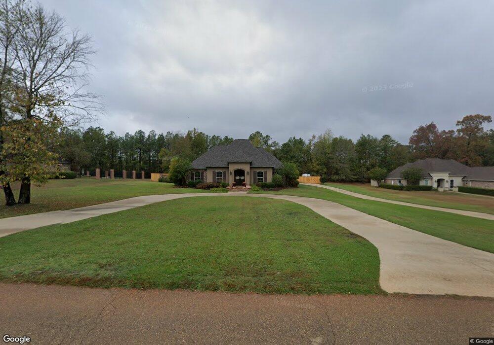
123 Creeks Edge Cir Ruston, LA 71270
Estimated Value: $349,000 - $488,000
3
Beds
3
Baths
2,229
Sq Ft
$198/Sq Ft
Est. Value
About This Home
This home is located at 123 Creeks Edge Cir, Ruston, LA 71270 and is currently estimated at $442,292, approximately $198 per square foot. 123 Creeks Edge Cir is a home located in Lincoln Parish with nearby schools including Choudrant Elementary School, Ruston Junior High School, and Choudrant High School.
Ownership History
Date
Name
Owned For
Owner Type
Purchase Details
Closed on
Oct 2, 2008
Sold by
Knowles William Scott and Knowles Tammy Rena Hodge
Bought by
Schimmel Michael D and Schimmel Sharron A
Current Estimated Value
Create a Home Valuation Report for This Property
The Home Valuation Report is an in-depth analysis detailing your home's value as well as a comparison with similar homes in the area
Purchase History
| Date | Buyer | Sale Price | Title Company |
|---|---|---|---|
| Schimmel Michael D | $42,000 | None Available |
Source: Public Records
Tax History
| Year | Tax Paid | Tax Assessment Tax Assessment Total Assessment is a certain percentage of the fair market value that is determined by local assessors to be the total taxable value of land and additions on the property. | Land | Improvement |
|---|---|---|---|---|
| 2025 | $3,197 | $40,455 | $5,938 | $34,517 |
| 2024 | $3,197 | $40,455 | $5,938 | $34,517 |
| 2023 | $2,901 | $35,191 | $3,700 | $31,491 |
| 2022 | $2,962 | $36,207 | $3,700 | $32,507 |
| 2021 | $2,915 | $36,207 | $3,700 | $32,507 |
| 2020 | $2,920 | $36,207 | $3,700 | $32,507 |
| 2019 | $3,075 | $37,610 | $3,700 | $33,910 |
| 2018 | $3,077 | $37,610 | $3,700 | $33,910 |
| 2017 | $3,084 | $37,610 | $3,700 | $33,910 |
| 2016 | $3,141 | $0 | $0 | $0 |
| 2015 | $3,158 | $34,918 | $3,640 | $31,278 |
| 2013 | $2,831 | $30,742 | $3,640 | $27,102 |
Source: Public Records
Map
Nearby Homes
- 144 Creeks Crossing
- 173 Oak Alley Dr
- 209 Mount Harmony Church Rd
- 209 Burgessville Rd
- 145 Woodshire Ln
- 128 Marlou Cir
- 185 Mount Harmony Church Rd
- Lot 1B Unit 1 Harmony Church Rd
- 136 Shade Tree Trace
- 197 Baxter Rd
- 641 Goodgoin Rd
- 294 Moody Rd
- 2420 Highway 33
- 0 Spillers Rd
- 1709 Rampart Dr
- 0 Louisiana 33
- 1950 Louisiana 821
- 634 Cheatwood Rd
- 201 Vintage Ln
- 2900 Post Oak Dr
- 111 Creeks Edge Cir
- 139 Creek's Edge Cir
- 112 Creeks Edge Cir
- 134 Creeks Edge Cir
- 151 Creeks Edge Cir
- 150 Creeks Edge Cir
- 160 Guy Rd
- 2860 Highway 821
- 9 Belle Pointe Dr
- 24 Belle Pointe Dr
- 116 Belle Pointe Dr
- 187 Creeks Edge Cir
- 2945 Highway 821
- 164 Creeks Edge Cir
- 2966 Highway 821
- 185 Guy Rd
- 2867 Highway 821
- 2867 Highway 821
- 2867 Highway 821
- 174 Creeks Edge Cir
Your Personal Tour Guide
Ask me questions while you tour the home.