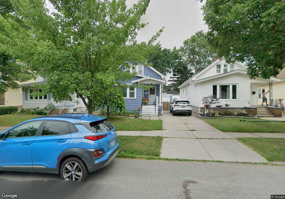
123 Westgate Rd Buffalo, NY 14217
Estimated Value: $236,377 - $265,000
2
Beds
1
Bath
1,614
Sq Ft
$155/Sq Ft
Est. Value
About This Home
This home is located at 123 Westgate Rd, Buffalo, NY 14217 and is currently estimated at $250,344, approximately $155 per square foot. 123 Westgate Rd is a home located in Erie County with nearby schools including Charles A Lindbergh Elementary School, Herbert Hoover Middle School, and Kenmore West Senior High School.
Ownership History
Date
Name
Owned For
Owner Type
Purchase Details
Closed on
Aug 22, 2021
Sold by
Huard Denise and Meyer Mary Kay
Bought by
Rymarczyk Tyler
Current Estimated Value
Home Financials for this Owner
Home Financials are based on the most recent Mortgage that was taken out on this home.
Original Mortgage
$184,140
Outstanding Balance
$166,562
Interest Rate
2.7%
Mortgage Type
VA
Estimated Equity
$83,782
Purchase Details
Closed on
Dec 6, 2016
Sold by
Gerlach Randy
Bought by
Huard Denise
Create a Home Valuation Report for This Property
The Home Valuation Report is an in-depth analysis detailing your home's value as well as a comparison with similar homes in the area
Home Values in the Area
Average Home Value in this Area
Purchase History
| Date | Buyer | Sale Price | Title Company |
|---|---|---|---|
| Rymarczyk Tyler | $180,000 | Chicago Title Insurance Co | |
| Huard Denise | -- | None Available |
Source: Public Records
Mortgage History
| Date | Status | Borrower | Loan Amount |
|---|---|---|---|
| Open | Rymarczyk Tyler | $184,140 |
Source: Public Records
Tax History
| Year | Tax Paid | Tax Assessment Tax Assessment Total Assessment is a certain percentage of the fair market value that is determined by local assessors to be the total taxable value of land and additions on the property. | Land | Improvement |
|---|---|---|---|---|
| 2024 | $6,016 | $42,700 | $6,200 | $36,500 |
| 2023 | $5,820 | $42,700 | $6,200 | $36,500 |
| 2022 | $5,734 | $42,700 | $6,200 | $36,500 |
| 2021 | $3,521 | $42,700 | $6,200 | $36,500 |
| 2020 | $5,056 | $42,700 | $6,200 | $36,500 |
| 2019 | $2,901 | $42,700 | $6,200 | $36,500 |
| 2018 | $4,430 | $42,700 | $6,200 | $36,500 |
| 2017 | $799 | $42,700 | $6,200 | $36,500 |
| 2016 | $4,207 | $42,700 | $6,200 | $36,500 |
| 2015 | -- | $42,700 | $6,200 | $36,500 |
| 2014 | -- | $42,700 | $6,200 | $36,500 |
Source: Public Records
Map
Nearby Homes
- 107 Wabash Ave
- 165 Tremont Ave
- 79 Lincoln Blvd
- 197 Tremont Ave
- 181 Mang Ave
- 80 Kinsey Ave
- 156 Hamilton Blvd
- 176 Lasalle Ave
- 312 Victoria Blvd
- 314 Tremont Ave
- 123 Palmer Ave
- 279 Hamilton Blvd
- 361 Westgate Rd
- 281 W Hazeltine Ave
- 1455 Kenmore Ave
- 50 Delwood Rd
- 201 Ramsdell Ave
- 32 E Hazeltine Ave
- 109 Argonne Dr
- 145 Hoover Ave
- 119 Westgate Rd
- 125 Westgate Rd
- 115 Westgate Rd
- 127 Westgate Rd
- 111 Westgate Rd
- 133 Westgate Rd
- 116 Wabash Ave
- 120 Wabash Ave
- 114 Wabash Ave
- 44 Hamilton Blvd
- 124 Wabash Ave
- 109 Westgate Rd
- 137 Westgate Rd
- 112 Wabash Ave
- 128 Wabash Ave
- 104 Wabash Ave
- 105 Westgate Rd
- 141 Westgate Rd
- 124 Westgate Rd
- 128 Westgate Rd
Your Personal Tour Guide
Ask me questions while you tour the home.