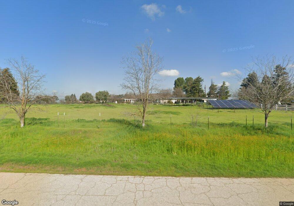
12304 E Paul Ave Clovis, CA 93619
Estimated Value: $938,000 - $1,024,000
4
Beds
3
Baths
3,319
Sq Ft
$296/Sq Ft
Est. Value
About This Home
This home is located at 12304 E Paul Ave, Clovis, CA 93619 and is currently estimated at $983,475, approximately $296 per square foot. 12304 E Paul Ave is a home located in Fresno County with nearby schools including Cedarwood Elementary School, Clark Intermediate School, and Clovis High School.
Ownership History
Date
Name
Owned For
Owner Type
Purchase Details
Closed on
Feb 9, 2011
Sold by
Kirk Morgan J
Bought by
Kirk Jenny R
Current Estimated Value
Purchase Details
Closed on
Nov 19, 2010
Sold by
Alvarado Rudy and Alvarado Maria Isabel
Bought by
Kirk Jenny R
Home Financials for this Owner
Home Financials are based on the most recent Mortgage that was taken out on this home.
Original Mortgage
$312,000
Interest Rate
4.67%
Mortgage Type
New Conventional
Purchase Details
Closed on
Feb 2, 2004
Sold by
Rayford Robert and Rayford Janice
Bought by
Alvarado Rudy and Alvarado Maria Isabel
Home Financials for this Owner
Home Financials are based on the most recent Mortgage that was taken out on this home.
Original Mortgage
$450,320
Interest Rate
5.69%
Mortgage Type
Stand Alone First
Create a Home Valuation Report for This Property
The Home Valuation Report is an in-depth analysis detailing your home's value as well as a comparison with similar homes in the area
Purchase History
| Date | Buyer | Sale Price | Title Company |
|---|---|---|---|
| Kirk Jenny R | -- | Fidelity National Title Co | |
| Kirk Jenny R | $390,000 | Fidelity National Title Co | |
| Alvarado Rudy | $563,000 | Stewart Title Of Fresno Cnty |
Source: Public Records
Mortgage History
| Date | Status | Borrower | Loan Amount |
|---|---|---|---|
| Previous Owner | Kirk Jenny R | $312,000 | |
| Previous Owner | Alvarado Rudy | $450,320 |
Source: Public Records
Tax History
| Year | Tax Paid | Tax Assessment Tax Assessment Total Assessment is a certain percentage of the fair market value that is determined by local assessors to be the total taxable value of land and additions on the property. | Land | Improvement |
|---|---|---|---|---|
| 2025 | $5,884 | $499,644 | $192,170 | $307,474 |
| 2023 | $5,660 | $480,244 | $184,708 | $295,536 |
| 2022 | $5,585 | $470,829 | $181,087 | $289,742 |
| 2021 | $5,428 | $461,598 | $177,537 | $284,061 |
| 2020 | $5,407 | $456,866 | $175,717 | $281,149 |
| 2019 | $5,302 | $447,909 | $172,272 | $275,637 |
| 2018 | $5,186 | $439,128 | $168,895 | $270,233 |
| 2017 | $5,097 | $430,519 | $165,584 | $264,935 |
| 2016 | $4,924 | $422,079 | $162,338 | $259,741 |
| 2015 | $4,848 | $415,740 | $159,900 | $255,840 |
| 2014 | $4,759 | $407,597 | $156,768 | $250,829 |
Source: Public Records
Map
Nearby Homes
- 6560 N Bethel Ave
- 12789 E Herndon Ave
- 11236 E Herndon Ave
- 13545 E Bullard Ave
- 12000 E Shaw Ave
- 13209 E Falcon Meadow Ln
- 13017 Violet Ln
- 12009 E Shaw Ave
- 13390 E Falcon Meadow Ln
- 10464 E Herndon Ave
- 11735 E Santa Ana Ave
- 10595 E San Felipe Ave
- 4793 N Emerald Peak Dr
- 4769 N Emerald Peak Dr
- 4674 N Arrow Ridge Way
- 4626 N Arrow Ridge Way
- 12096 E Shepherd Ave
- 10588 E Fieldstone Ave
- 10455 E Greenbury Way
- 10952 E Promontory Way
- 12394 E Paul Ave
- 12270 E Paul Ave
- 12305 E Paul Ave
- 12267 E Paul Ave
- 12410 E Paul Ave
- 12222 E Paul Ave
- 12396 E Paul Ave
- 12391 E Paul Ave
- 12200 E Paul Ave
- 12395 E Paul Ave
- 12216 E Paul Ave
- 12263 E Paul Ave
- 12152 E Paul Ave
- 12155 E Paul Ave
- 12443 E Paul Ave
- 12526 E Paul Ave
- 12223 E Herndon Ave
- 12277 E Herndon Ave
- 12337 E Herndon Ave
- 12555 E Paul Ave
Your Personal Tour Guide
Ask me questions while you tour the home.