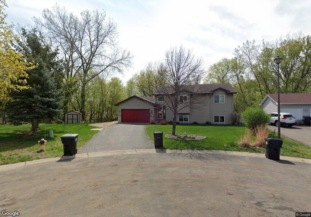
12307 Swallow St NW Coon Rapids, MN 55448
Estimated Value: $390,000 - $405,000
3
Beds
2
Baths
1,076
Sq Ft
$370/Sq Ft
Est. Value
About This Home
This home is located at 12307 Swallow St NW, Coon Rapids, MN 55448 and is currently estimated at $397,693, approximately $369 per square foot. 12307 Swallow St NW is a home located in Anoka County with nearby schools including Lucile Bruner Elementary School, Hoover Elementary School, and Laughlin Junior/Senior High School.
Ownership History
Date
Name
Owned For
Owner Type
Purchase Details
Closed on
May 30, 2001
Sold by
Traas Jeremy J and Traas Anne M
Bought by
Hacker John Martin and Busse Amy Marie
Current Estimated Value
Purchase Details
Closed on
Aug 4, 1999
Sold by
Shade Tree Construction Inc
Bought by
Traas Jeremy J and Traas Anne M
Purchase Details
Closed on
Apr 8, 1999
Sold by
Tsm Development Inc
Bought by
Shade Tree Construction Inc
Create a Home Valuation Report for This Property
The Home Valuation Report is an in-depth analysis detailing your home's value as well as a comparison with similar homes in the area
Home Values in the Area
Average Home Value in this Area
Purchase History
| Date | Buyer | Sale Price | Title Company |
|---|---|---|---|
| Hacker John Martin | $177,000 | -- | |
| Traas Jeremy J | $140,779 | -- | |
| Shade Tree Construction Inc | $154,200 | -- |
Source: Public Records
Tax History Compared to Growth
Tax History
| Year | Tax Paid | Tax Assessment Tax Assessment Total Assessment is a certain percentage of the fair market value that is determined by local assessors to be the total taxable value of land and additions on the property. | Land | Improvement |
|---|---|---|---|---|
| 2025 | $3,819 | $364,000 | $103,800 | $260,200 |
| 2024 | $3,819 | $363,100 | $114,800 | $248,300 |
| 2023 | $3,496 | $360,700 | $99,000 | $261,700 |
| 2022 | $3,214 | $356,100 | $84,500 | $271,600 |
| 2021 | $3,182 | $293,500 | $74,400 | $219,100 |
| 2020 | $3,310 | $284,300 | $79,400 | $204,900 |
| 2019 | $3,117 | $283,000 | $84,500 | $198,500 |
| 2018 | $2,879 | $260,400 | $0 | $0 |
| 2017 | $2,342 | $235,300 | $0 | $0 |
| 2016 | $2,329 | $188,300 | $0 | $0 |
| 2015 | -- | $188,300 | $56,100 | $132,200 |
| 2014 | -- | $171,800 | $55,300 | $116,500 |
Source: Public Records
Map
Nearby Homes
- 2068 124th Ln NW
- 2147 125th Ln NW
- 12760 Raven St NW
- 12365 Jay St NW
- 12019 Zion St NW
- 2675 128th Ave NW
- 1930 127th Cir NW
- 1727 121st Ln NW
- 12888 Nightingale St NW
- 12554 Grouse St NW
- 1593 126th Ln NW
- 12463 Drake St NW
- 11749 Crooked Lake Blvd NW
- 12759 Ibis St NW
- 12010 Eagle St NW
- 3074 121st Ave NW
- 1450 126th Ln NW
- 11444 Hanson Blvd NW
- 1449 119th Ln NW
- 1660 Northdale Blvd NW
- 12304 Swallow St NW
- 12313 Swallow St NW
- 12310 Swallow St NW
- 12319 Swallow St NW
- 12316 Swallow St NW
- 12303 Thrush St NW
- 12325 Swallow St NW
- 12322 Swallow St NW
- 12297 Thrush St NW
- 2224 123rd Ln NW
- 12315 Thrush St NW
- 12241 Thrush St NW
- 12309 Thrush St NW
- 2208 123rd Ln NW
- 12321 Thrush St NW
- 12235 Thrush St NW
- 12308 Thrush St NW
- 2245 123rd Ln NW
- 12217 Thrush St NW
- 12350 Swallow St NW