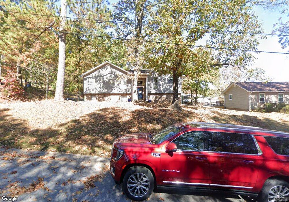
1232 Bennett Cir Alabaster, AL 35007
Estimated Value: $260,334 - $270,000
Studio
1
Bath
1,661
Sq Ft
$159/Sq Ft
Est. Value
About This Home
This home is located at 1232 Bennett Cir, Alabaster, AL 35007 and is currently estimated at $264,334, approximately $159 per square foot. 1232 Bennett Cir is a home located in Shelby County with nearby schools including Thompson Intermediate School, Thompson Middle School, and Thompson High School.
Ownership History
Date
Name
Owned For
Owner Type
Purchase Details
Closed on
Jun 19, 2020
Sold by
Hoge Stanley C and Hoge Jacqueline B
Bought by
Hoge Stanley Calvin and Hoge Jacqueline Braswell
Current Estimated Value
Purchase Details
Closed on
Nov 20, 2017
Sold by
Hoge Stanley Calvin and Hoge Stanley C
Bought by
Hoge Stanley C and Hoge Jacqueline B
Purchase Details
Closed on
Sep 27, 2002
Sold by
Armstrong Sherry E
Bought by
Hoge Stanley Calvin and Hoge Jacqueline Braswell
Home Financials for this Owner
Home Financials are based on the most recent Mortgage that was taken out on this home.
Original Mortgage
$119,700
Interest Rate
6.18%
Create a Home Valuation Report for This Property
The Home Valuation Report is an in-depth analysis detailing your home's value as well as a comparison with similar homes in the area
Home Values in the Area
Average Home Value in this Area
Purchase History
| Date | Buyer | Sale Price | Title Company |
|---|---|---|---|
| Hoge Stanley Calvin | -- | None Available | |
| Hoge Stanley C | -- | None Available | |
| Hoge Stanley Calvin | $126,000 | -- |
Source: Public Records
Mortgage History
| Date | Status | Borrower | Loan Amount |
|---|---|---|---|
| Previous Owner | Hoge Stanley Calvin | $119,700 |
Source: Public Records
Tax History
| Year | Tax Paid | Tax Assessment Tax Assessment Total Assessment is a certain percentage of the fair market value that is determined by local assessors to be the total taxable value of land and additions on the property. | Land | Improvement |
|---|---|---|---|---|
| 2024 | $1,133 | $20,980 | $0 | $0 |
| 2023 | $1,013 | $19,520 | $0 | $0 |
| 2022 | $940 | $18,160 | $0 | $0 |
| 2021 | $833 | $16,180 | $0 | $0 |
| 2020 | $726 | $14,200 | $0 | $0 |
| 2019 | $700 | $13,720 | $0 | $0 |
| 2017 | $687 | $13,480 | $0 | $0 |
| 2015 | $669 | $13,140 | $0 | $0 |
| 2014 | $653 | $12,860 | $0 | $0 |
Source: Public Records
Map
Nearby Homes
- 542 Navajo Trail
- 1222 Falling Star Ln
- 1317 Old Boston Rd
- 1349 Old Boston Rd
- 335 10th St NW
- 955 3rd Ave NW
- 104 Comanche Cir
- 2001 1st Ave W
- 109 Longfeather Cir
- 920 Independence Dr
- 940 2nd Ave SW
- 315 7th St NW
- 124 Kingsley Rd
- 412 10th St SW
- 109 Kingsley Cir
- 1208 Siskin Dr
- 620 Lovett Place
- 306 Mayfair Cir
- 120 Mayfair Park
- 537 Ramsgate Dr
- 1226 Bennett Cir
- 1238 Bennett Cir
- 1231 6th Ave NW
- 1225 6th Ave NW
- 1219 Bennett Cir
- 522 Bennett Dr
- 1220 Bennett Cir
- 521 13th St NW
- 1219 6th Ave NW
- 519 Bennett Dr
- 516 Bennett Dr
- 525 Bennett Dr
- 1214 Bennett Cir
- 1234 6th Ave NW
- 1213 6th Ave NW
- 511 13th St NW
- 531 Bennett Dr
- 1228 6th Ave NW
- 1240 6th Ave NW
- 507 Bennett Dr
Your Personal Tour Guide
Ask me questions while you tour the home.