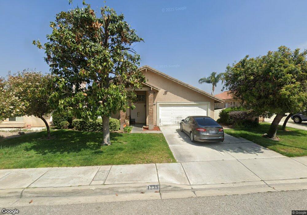
1233 Michael Darcy St Colton, CA 92324
Estimated Value: $557,732 - $653,000
4
Beds
2
Baths
1,721
Sq Ft
$343/Sq Ft
Est. Value
About This Home
This home is located at 1233 Michael Darcy St, Colton, CA 92324 and is currently estimated at $589,933, approximately $342 per square foot. 1233 Michael Darcy St is a home located in San Bernardino County with nearby schools including Ernest Garcia Elementary School, William G. Jehue Middle School, and Rialto High School.
Ownership History
Date
Name
Owned For
Owner Type
Purchase Details
Closed on
Jul 19, 2019
Sold by
Pairo Raul R and Pairo Damariz
Bought by
Pairo Raul R
Current Estimated Value
Home Financials for this Owner
Home Financials are based on the most recent Mortgage that was taken out on this home.
Original Mortgage
$288,750
Outstanding Balance
$252,867
Interest Rate
3.8%
Mortgage Type
Commercial
Estimated Equity
$337,066
Purchase Details
Closed on
Jun 2, 2008
Sold by
Pairo Raul and Pairo Damariz
Bought by
Pairo Raul R and Pairo Damariz
Purchase Details
Closed on
Mar 13, 1998
Sold by
Osborne Development Corp
Bought by
Pairo Raul and Pairo Damariz
Home Financials for this Owner
Home Financials are based on the most recent Mortgage that was taken out on this home.
Original Mortgage
$145,808
Interest Rate
7.07%
Mortgage Type
FHA
Create a Home Valuation Report for This Property
The Home Valuation Report is an in-depth analysis detailing your home's value as well as a comparison with similar homes in the area
Home Values in the Area
Average Home Value in this Area
Purchase History
| Date | Buyer | Sale Price | Title Company |
|---|---|---|---|
| Pairo Raul R | -- | Orange Coast Title Company | |
| Pairo Raul R | -- | Orange Coast Title Company | |
| Pairo Raul R | -- | None Available | |
| Pairo Raul | $150,000 | First American Title Ins Co |
Source: Public Records
Mortgage History
| Date | Status | Borrower | Loan Amount |
|---|---|---|---|
| Open | Pairo Raul R | $288,750 | |
| Closed | Pairo Raul | $145,808 |
Source: Public Records
Tax History
| Year | Tax Paid | Tax Assessment Tax Assessment Total Assessment is a certain percentage of the fair market value that is determined by local assessors to be the total taxable value of land and additions on the property. | Land | Improvement |
|---|---|---|---|---|
| 2025 | $3,225 | $239,518 | $63,870 | $175,648 |
| 2024 | $3,113 | $234,822 | $62,618 | $172,204 |
| 2023 | $3,298 | $230,217 | $61,390 | $168,827 |
| 2022 | $3,071 | $225,703 | $60,186 | $165,517 |
| 2021 | $3,046 | $221,278 | $59,006 | $162,272 |
| 2020 | $3,059 | $219,009 | $58,401 | $160,608 |
| 2019 | $2,988 | $214,715 | $57,256 | $157,459 |
| 2018 | $2,884 | $210,505 | $56,133 | $154,372 |
| 2017 | $2,874 | $206,377 | $55,032 | $151,345 |
| 2016 | $3,555 | $202,330 | $53,953 | $148,377 |
| 2015 | $3,561 | $199,291 | $53,143 | $146,148 |
| 2014 | $3,492 | $195,387 | $52,102 | $143,285 |
Source: Public Records
Map
Nearby Homes
- 1075 Leslie Ct
- 1065 Stevenson St Unit A & B
- 895 Orange St
- 711 N Meridian Ave
- 881 S Lamarr St
- 3004 Cardamon St
- 1210 Tejon Ave
- 1261 N Rancho Ave
- 1150 Express Cir
- 2250 W Mill St Unit 19
- 2250 W Mill St Unit 68
- 2250 W Mill #70 St
- 1844 Alston Ave
- 1734 Kippy Dr
- 941 W F St
- 494 S Macy St Unit 8
- 494 S Macy St Unit 116
- 773 W C St
- 1972 De Anza Dr
- 825 S Acacia Ave
- 1221 Michael Darcy St
- 1245 Michael Darcy St
- 1219 Michael Darcy St
- 1257 Michael Darcy St
- 1246 Reyes Hernandez jr Ln
- 1258 Reyes Hernandez jr Ln
- 1258 Reyes Hernandez jr Ln
- 1234 Reyes Hernandez jr Ln
- 1222 Reyes Hernandez jr Ln
- 1260 Reyes Hernandez jr Ln
- 1232 Michael Darcy St
- 1207 Michael Darcy St
- 1269 Michael Darcy St
- 1220 Michael Darcy St
- 1244 Michael Darcy St
- 1218 Michael Darcy St
- 1272 Reyes Hernandez jr Ln
- 1208 Reyes Hernandez jr Ln
- 1256 Michael Darcy St
- 1206 Michael Darcy St