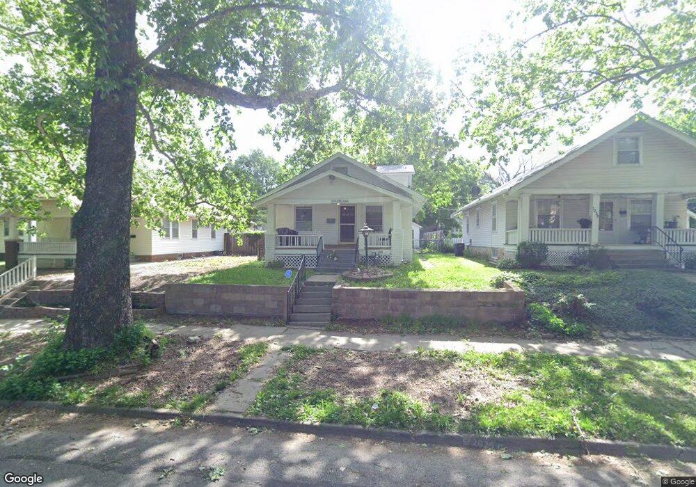
1234 SW Plass Ave Topeka, KS 66604
Norton NeighborhoodEstimated Value: $100,000 - $137,000
3
Beds
1
Bath
1,104
Sq Ft
$107/Sq Ft
Est. Value
About This Home
This home is located at 1234 SW Plass Ave, Topeka, KS 66604 and is currently estimated at $118,342, approximately $107 per square foot. 1234 SW Plass Ave is a home located in Shawnee County with nearby schools including Lowman Hill Elementary School, Landon Middle School, and Topeka High School.
Ownership History
Date
Name
Owned For
Owner Type
Purchase Details
Closed on
Apr 2, 2008
Sold by
Hsbc Bank Usa
Bought by
Knoettgen Robert R
Current Estimated Value
Home Financials for this Owner
Home Financials are based on the most recent Mortgage that was taken out on this home.
Original Mortgage
$40,000
Outstanding Balance
$25,628
Interest Rate
6.19%
Mortgage Type
Future Advance Clause Open End Mortgage
Estimated Equity
$92,714
Purchase Details
Closed on
Aug 17, 2007
Sold by
Hollis David A and Hollis Darlenea L
Bought by
Hsbc Bank Usa National Association
Create a Home Valuation Report for This Property
The Home Valuation Report is an in-depth analysis detailing your home's value as well as a comparison with similar homes in the area
Home Values in the Area
Average Home Value in this Area
Purchase History
| Date | Buyer | Sale Price | Title Company |
|---|---|---|---|
| Knoettgen Robert R | -- | Mokan Title Services Inc | |
| Hsbc Bank Usa National Association | $49,125 | None Available |
Source: Public Records
Mortgage History
| Date | Status | Borrower | Loan Amount |
|---|---|---|---|
| Open | Knoettgen Robert R | $40,000 |
Source: Public Records
Tax History Compared to Growth
Tax History
| Year | Tax Paid | Tax Assessment Tax Assessment Total Assessment is a certain percentage of the fair market value that is determined by local assessors to be the total taxable value of land and additions on the property. | Land | Improvement |
|---|---|---|---|---|
| 2025 | $1,584 | $12,147 | -- | -- |
| 2023 | $1,584 | $11,021 | $0 | $0 |
| 2022 | $1,390 | $9,583 | $0 | $0 |
| 2021 | $1,288 | $8,333 | $0 | $0 |
| 2020 | $1,210 | $7,936 | $0 | $0 |
| 2019 | $1,193 | $7,781 | $0 | $0 |
| 2018 | $1,159 | $7,555 | $0 | $0 |
| 2017 | $1,137 | $7,406 | $0 | $0 |
| 2014 | $1,183 | $7,618 | $0 | $0 |
Source: Public Records
Map
Nearby Homes
- 1222 SW Wayne Ave
- 1191 SW MacVicar Ave
- 1180 SW Woodward Ave
- 1181 SW MacVicar Ave
- 1164 SW MacVicar Ave
- 1191 SW Boswell Ave
- 1320 SW MacVicar Ave
- 1156 SW Woodward Ave
- 1801 SW Huntoon St
- 2516 SW Huntoon St
- 1327 SW College Ave
- 1432 SW MacVicar Ave
- 1224 SW Garfield Ave
- 1196 SW Garfield Ave
- 1022 SW MacVicar Ave
- 1533 SW MacVicar Ave
- 1717 SW 15th St
- 2812 SW Huntoon St
- 1038 SW Medford Ave
- 1600 SW Jewell Ave
- 1238 SW Plass Ave
- 1232 SW Plass Ave
- 1224 SW Plass Ave
- 2116 SW Huntoon St
- 1222 SW Plass Ave
- 1235 SW Woodward Ave
- 1231 SW Woodward Ave
- 2108 SW Huntoon St
- 1239 SW Woodward Ave
- 1227 SW Woodward Ave
- 1220 SW Plass Ave
- 1235 SW Plass Ave
- 1239 SW Plass Ave
- 1233 SW Plass Ave
- 2100 SW Huntoon St
- 1225 SW Woodward Ave
- 1229 SW Plass Ave
- 1243 SW Plass Ave
- 1218 SW Plass Ave
- 1225 SW Plass Ave