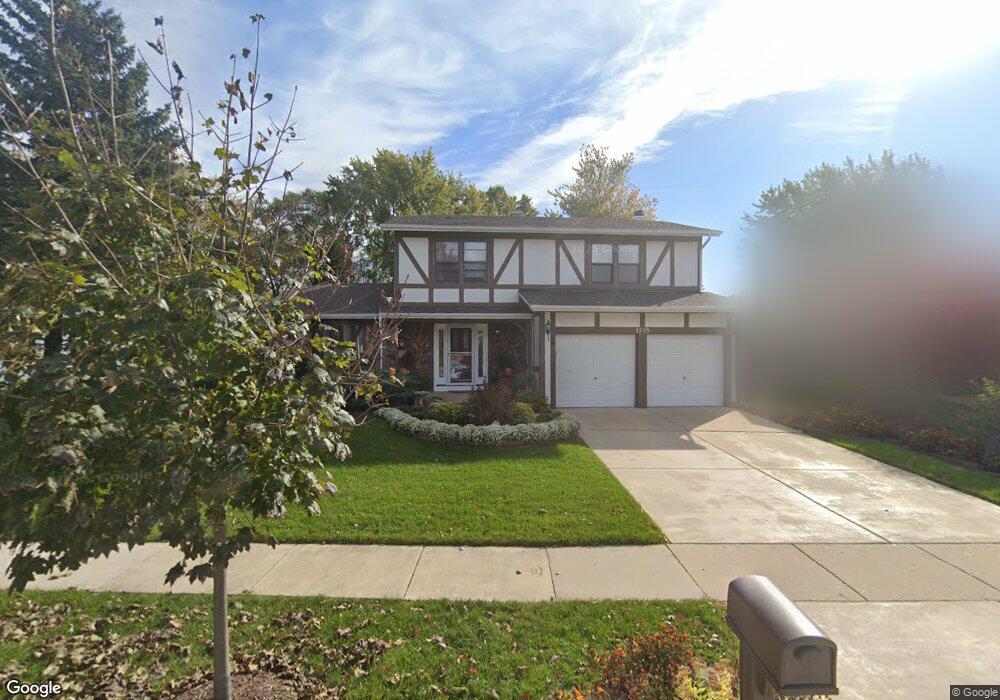
1235 Cumberland Rd Aurora, IL 60504
South East Village NeighborhoodEstimated Value: $383,000 - $469,000
4
Beds
3
Baths
2,253
Sq Ft
$184/Sq Ft
Est. Value
About This Home
This home is located at 1235 Cumberland Rd, Aurora, IL 60504 and is currently estimated at $414,823, approximately $184 per square foot. 1235 Cumberland Rd is a home located in DuPage County with nearby schools including Georgetown Elementary School, Fischer Middle School, and Waubonsie Valley High School.
Ownership History
Date
Name
Owned For
Owner Type
Purchase Details
Closed on
Jun 30, 2022
Sold by
Brandon Antje D
Bought by
Antje D Brandon Trust
Current Estimated Value
Create a Home Valuation Report for This Property
The Home Valuation Report is an in-depth analysis detailing your home's value as well as a comparison with similar homes in the area
Home Values in the Area
Average Home Value in this Area
Purchase History
| Date | Buyer | Sale Price | Title Company |
|---|---|---|---|
| Antje D Brandon Trust | -- | Patankar Law Pc |
Source: Public Records
Tax History Compared to Growth
Tax History
| Year | Tax Paid | Tax Assessment Tax Assessment Total Assessment is a certain percentage of the fair market value that is determined by local assessors to be the total taxable value of land and additions on the property. | Land | Improvement |
|---|---|---|---|---|
| 2024 | $8,214 | $124,033 | $31,818 | $92,215 |
| 2023 | $7,757 | $111,450 | $28,590 | $82,860 |
| 2022 | $7,630 | $101,980 | $25,940 | $76,040 |
| 2021 | $7,409 | $98,340 | $25,010 | $73,330 |
| 2020 | $7,500 | $98,340 | $25,010 | $73,330 |
| 2019 | $7,210 | $93,530 | $23,790 | $69,740 |
| 2018 | $5,783 | $76,470 | $19,590 | $56,880 |
| 2017 | $5,665 | $73,880 | $18,930 | $54,950 |
| 2016 | $5,539 | $70,900 | $18,170 | $52,730 |
| 2015 | $5,448 | $67,320 | $17,250 | $50,070 |
| 2014 | $5,743 | $68,640 | $17,450 | $51,190 |
| 2013 | $5,689 | $69,120 | $17,570 | $51,550 |
Source: Public Records
Map
Nearby Homes
- 2476 Village Ct Unit 2
- 2297 Lakeside Dr Unit 10
- 1629 Silver Springs Ct
- 2632 Emma Cir
- 1335 Lawrence Ct
- 2489 Rosehall Ln
- 2509 Rosehall Ln
- 1465 Bridgeport Ln Unit 19D
- 2730 Dorothy Dr Unit 1
- 2860 Bridgeport Ln Unit 19D
- 2723 Rosehall Ln
- 1875 Keating Dr
- 1871 Keating Dr
- 1855 Keating Dr
- 1882 Westridge Place
- 2484 Warwick Ct
- 2750 Shelly Ln
- 1896 Sedgegrass Trail
- 2901 Shelly Ln
- 1853 Westridge Place
- 1245 Cumberland Rd
- 1215 Cumberland Rd
- 1255 Cumberland Rd
- 2377 Dogwood Ln Unit 5
- 2400 Cove Ct
- 2370 Dogwood Ln
- 2405 Oakdale Ct
- 2415 Oakdale Ct Unit 2
- 2365 Dogwood Ln
- 2410 Cove Ct
- 2421 Oakdale Ct
- 2360 Dogwood Ln
- 2355 Dogwood Ln
- 2395 Dogwood Ln Unit 5
- 2420 Cove Ct
- 2379 Cove Ct Unit 2
- 2385 Dogwood Ln
- 2345 Dogwood Ln
- 1200 Dogwood Ln
- 2429 Oakdale Ct