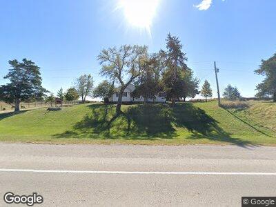
1238 Highway 34 Unit US Murray, IA 50174
Estimated Value: $275,000 - $594,000
3
Beds
2
Baths
1,647
Sq Ft
$236/Sq Ft
Est. Value
About This Home
This home is located at 1238 Highway 34 Unit US, Murray, IA 50174 and is currently estimated at $389,146, approximately $236 per square foot. 1238 Highway 34 Unit US is a home located in Clarke County with nearby schools including Murray Elementary School and Murray Junior/Senior High School.
Ownership History
Date
Name
Owned For
Owner Type
Purchase Details
Closed on
Mar 30, 2011
Sold by
Abell Carolyn L
Bought by
Oswald James L
Current Estimated Value
Home Financials for this Owner
Home Financials are based on the most recent Mortgage that was taken out on this home.
Original Mortgage
$285,000
Outstanding Balance
$234,407
Interest Rate
4.12%
Mortgage Type
USDA
Estimated Equity
$143,367
Create a Home Valuation Report for This Property
The Home Valuation Report is an in-depth analysis detailing your home's value as well as a comparison with similar homes in the area
Home Values in the Area
Average Home Value in this Area
Purchase History
| Date | Buyer | Sale Price | Title Company |
|---|---|---|---|
| Oswald James L | $304,000 | -- |
Source: Public Records
Mortgage History
| Date | Status | Borrower | Loan Amount |
|---|---|---|---|
| Open | Oswald James | $29,947 | |
| Closed | Oswald James Laurence | $0 | |
| Closed | Oswald James Laurence | $0 | |
| Closed | Oswald James Laurence | $0 | |
| Open | Oswald James Laurence | $285,000 | |
| Closed | Oswald James Laurence | $285,000 | |
| Closed | Oswald James L | $285,000 |
Source: Public Records
Tax History Compared to Growth
Tax History
| Year | Tax Paid | Tax Assessment Tax Assessment Total Assessment is a certain percentage of the fair market value that is determined by local assessors to be the total taxable value of land and additions on the property. | Land | Improvement |
|---|---|---|---|---|
| 2024 | $3,450 | $212,160 | $32,900 | $179,260 |
| 2023 | $4,160 | $212,160 | $32,900 | $179,260 |
| 2022 | $3,926 | $220,940 | $24,670 | $196,270 |
| 2021 | $3,758 | $195,820 | $29,400 | $166,420 |
| 2020 | $3,652 | $195,820 | $29,400 | $166,420 |
| 2019 | $3,476 | $189,980 | $0 | $0 |
| 2018 | $3,522 | $189,980 | $0 | $0 |
| 2017 | $3,522 | $185,750 | $0 | $0 |
| 2016 | $3,308 | $185,750 | $0 | $0 |
| 2014 | $3,188 | $172,200 | $0 | $0 |
Source: Public Records
Map
Nearby Homes
- 1238 Highway 34 Unit US
- 1910 120th Ave
- 1911 120th Ave
- 0 SE Hwy 34
- 0 Highway 34 Unit 5422041
- 0 Highway 34
- 0 130th Ave
- 1939 130th Ave
- 1961 130th Ave
- 0 Oakwood & 110th Ave Unit 431228
- 0 Green St & 120th Ave Unit 5478399
- 0 Oakwood & 110th Ave Unit 5478093
- 1870 130th Ave
- 1155 Highway 34 Unit US
- 1861 130th Ave
- 1154 Us Hwy 34
- 1154 Highway 34 Unit US
- 1154 Highway 34