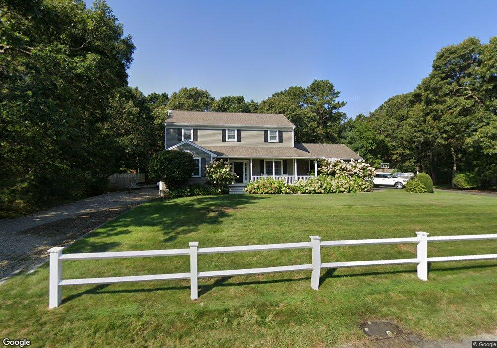
124 Captain Samadrus Rd Cotuit, MA 02635
Cotuit NeighborhoodEstimated Value: $817,719 - $957,000
4
Beds
3
Baths
2,147
Sq Ft
$409/Sq Ft
Est. Value
About This Home
This home is located at 124 Captain Samadrus Rd, Cotuit, MA 02635 and is currently estimated at $878,430, approximately $409 per square foot. 124 Captain Samadrus Rd is a home located in Barnstable County with nearby schools including West Villages Elementary School, Barnstable United Elementary School, and Barnstable Intermediate School.
Ownership History
Date
Name
Owned For
Owner Type
Purchase Details
Closed on
Mar 2, 2011
Sold by
Caprio Robert J and Caprio Charlene P
Bought by
Michael Rodney W and Michael Fiona
Current Estimated Value
Home Financials for this Owner
Home Financials are based on the most recent Mortgage that was taken out on this home.
Original Mortgage
$200,000
Outstanding Balance
$129,608
Interest Rate
4%
Mortgage Type
Purchase Money Mortgage
Estimated Equity
$748,822
Purchase Details
Closed on
Jan 8, 2001
Sold by
Galasieski Edward
Bought by
Caprio Robert J and Caprio Charlene P
Home Financials for this Owner
Home Financials are based on the most recent Mortgage that was taken out on this home.
Original Mortgage
$221,730
Interest Rate
7.69%
Mortgage Type
Purchase Money Mortgage
Create a Home Valuation Report for This Property
The Home Valuation Report is an in-depth analysis detailing your home's value as well as a comparison with similar homes in the area
Home Values in the Area
Average Home Value in this Area
Purchase History
| Date | Buyer | Sale Price | Title Company |
|---|---|---|---|
| Michael Rodney W | $402,000 | -- | |
| Caprio Robert J | $100,000 | -- |
Source: Public Records
Mortgage History
| Date | Status | Borrower | Loan Amount |
|---|---|---|---|
| Open | Michael Rodney W | $200,000 | |
| Previous Owner | Caprio Robert J | $221,730 |
Source: Public Records
Tax History
| Year | Tax Paid | Tax Assessment Tax Assessment Total Assessment is a certain percentage of the fair market value that is determined by local assessors to be the total taxable value of land and additions on the property. | Land | Improvement |
|---|---|---|---|---|
| 2025 | $6,413 | $768,000 | $180,000 | $588,000 |
| 2024 | $5,775 | $732,900 | $180,000 | $552,900 |
| 2023 | $5,490 | $655,900 | $177,800 | $478,100 |
| 2022 | $5,366 | $519,000 | $126,500 | $392,500 |
| 2021 | $0 | $483,300 | $126,500 | $356,800 |
| 2020 | $0 | $450,900 | $126,500 | $324,400 |
| 2019 | $5,404 | $454,900 | $126,500 | $328,400 |
| 2018 | $0 | $422,000 | $138,700 | $283,300 |
| 2017 | $4,884 | $413,900 | $138,700 | $275,200 |
| 2016 | $4,779 | $415,200 | $140,000 | $275,200 |
| 2015 | $4,590 | $398,400 | $137,100 | $261,300 |
Source: Public Records
Map
Nearby Homes
- 602 Putnam Ave
- 135 Putnam Avenue (Land)
- 564 Cotuit Bay Dr
- 564 Cotuit Bay Dr
- 15 Geraldine Rd
- 804 Main St
- 165 Baxter Neck Rd
- 835 Old Post Rd
- 1456 Santuit-Newtown Rd
- 75 Bob White Run
- 1415 Old Post Rd
- 239 Oxford Dr
- 226 Dunrobin Rd
- 916 Main St
- 33 Oyster Place Rd
- 71 Sand Point
- 170 Forest Hills Rd
- 70 Cape Dr Unit 14D
- 70 Cape Dr Unit 11D
- 70 Cape Dr Unit 11D
- 100 Cap'N Samadrus Rd
- 125 Captain Samadrus Rd
- 112 Captain Samadrus Rd
- 140 Captain Samadrus Rd
- 143 Captain Samadrus Rd
- 112 Cap'N Samadrus
- 100 Captain Samadrus Rd
- 99 Captain Samadrus Rd
- 66 Captain Carltons Rd
- 10 Captain Carltons Rd
- 54 Captain Carltons Rd
- 71 Capn Carletons Rd Unit Rd
- 71 Capn Carletons Rd
- 71 Cap'N Carleton's Rd
- 71 Captain Carletons Rd
- 140 Captain Carltons Rd
- 140 Captain Carleton's Rd
- 34 Captain Carltons Rd
- 164 Captain Samadrus Rd
- 100 Captain Carltons Rd
Your Personal Tour Guide
Ask me questions while you tour the home.