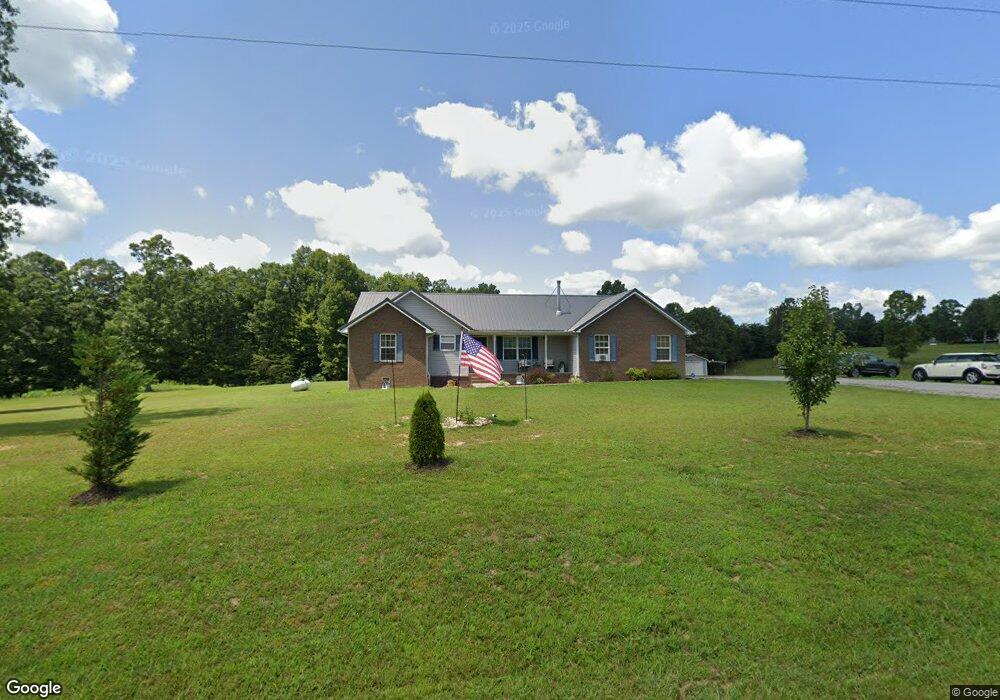
124 Gallaher Ln Clarkrange, TN 38553
Estimated Value: $312,000 - $388,000
Studio
2
Baths
1,659
Sq Ft
$217/Sq Ft
Est. Value
About This Home
This home is located at 124 Gallaher Ln, Clarkrange, TN 38553 and is currently estimated at $360,333, approximately $217 per square foot. 124 Gallaher Ln is a home located in Fentress County.
Ownership History
Date
Name
Owned For
Owner Type
Purchase Details
Closed on
Jul 29, 2016
Sold by
Burks Roger
Bought by
Burks Roger M and Burks Stephanie
Current Estimated Value
Home Financials for this Owner
Home Financials are based on the most recent Mortgage that was taken out on this home.
Original Mortgage
$146,639
Outstanding Balance
$115,942
Interest Rate
3.37%
Mortgage Type
FHA
Estimated Equity
$244,391
Purchase Details
Closed on
Oct 10, 2006
Bought by
Burks Roger and Burks Dorothy
Home Financials for this Owner
Home Financials are based on the most recent Mortgage that was taken out on this home.
Original Mortgage
$125,000
Interest Rate
6.36%
Mortgage Type
Cash
Purchase Details
Closed on
Jul 1, 2004
Bought by
Howard Michael Paul
Create a Home Valuation Report for This Property
The Home Valuation Report is an in-depth analysis detailing your home's value as well as a comparison with similar homes in the area
Purchase History
| Date | Buyer | Sale Price | Title Company |
|---|---|---|---|
| Burks Roger M | $150,000 | -- | |
| Burks Roger | $147,000 | -- | |
| Howard Michael Paul | $15,000 | -- |
Source: Public Records
Mortgage History
| Date | Status | Borrower | Loan Amount |
|---|---|---|---|
| Open | Burks Roger M | $146,639 | |
| Previous Owner | Howard Michael Paul | $125,000 |
Source: Public Records
Tax History
| Year | Tax Paid | Tax Assessment Tax Assessment Total Assessment is a certain percentage of the fair market value that is determined by local assessors to be the total taxable value of land and additions on the property. | Land | Improvement |
|---|---|---|---|---|
| 2025 | $819 | $60,650 | $10,225 | $50,425 |
| 2024 | $819 | $60,650 | $10,225 | $50,425 |
| 2023 | $819 | $60,650 | $10,225 | $50,425 |
| 2022 | $681 | $35,650 | $5,725 | $29,925 |
| 2021 | $681 | $35,650 | $5,725 | $29,925 |
| 2020 | $681 | $35,650 | $5,725 | $29,925 |
| 2019 | $681 | $35,650 | $5,725 | $29,925 |
| 2018 | $681 | $35,650 | $5,725 | $29,925 |
| 2017 | $687 | $34,650 | $5,725 | $28,925 |
| 2016 | $687 | $34,650 | $5,725 | $28,925 |
| 2015 | $687 | $34,638 | $0 | $0 |
| 2014 | $687 | $34,638 | $0 | $0 |
Source: Public Records
Map
Nearby Homes
- 813 Clear Creek Pkwy
- 229 Craig Rd
- 221 Craig Rd
- 3695 Martha Washington Rd
- 3669 Martha Washington Rd
- 469 Ferry Bend Trail
- 515 Ferry Bend Trail
- 523 Ferry Bend Trail
- 4.62 ac 523 Ferry Bend Trail
- 120 Miller Rd
- 4.62 ac 523 Ferry Bend Tr
- 462 523 Ferry Bend Tr
- Lot 12 Ferry Bend Trail
- Lot 11 Ferry Bend Trail
- Lot 10 Ferry Bend Trail
- 205 Ferry Bend Trail
- 1188 Clarkrange Monterey Hwy
- 0 Ferry Bend Tr Unit 1292974
- 0 Ferry Bend Tr Unit RTC2995085
- 0 Ferry Bend Tr Unit RTC2995089
- 0 Gallaher Ln Unit RTC2999304
- 0 Gallaher Ln Unit 201878
- 0 Gallaher Ln Unit 739832
- 0 Gallaher Ln Unit 1108121
- 0 Gallaher Ln Unit 1137693
- 123 Gallaher Ln
- 127 Gallaher Ln
- 129 Gallaher Ln
- 111 Gallaher Ln
- 830 Clear Creek Pkwy
- 810 Clear Creek Pkwy
- 141 Gallaher Ln
- 823 Clear Creek Pkwy
- 130 Gallaher Ln
- 802 Clear Creek Pkwy
- 0 Clear Creek Pkwy Unit RTC2999256
- 0 Clear Creek Pkwy Unit 139162
- 0 Clear Creek Pkwy Unit 649672
- 0 Clear Creek Pkwy Unit 657198
- 0 Clear Creek Pkwy Unit 704367
Your Personal Tour Guide
Ask me questions while you tour the home.