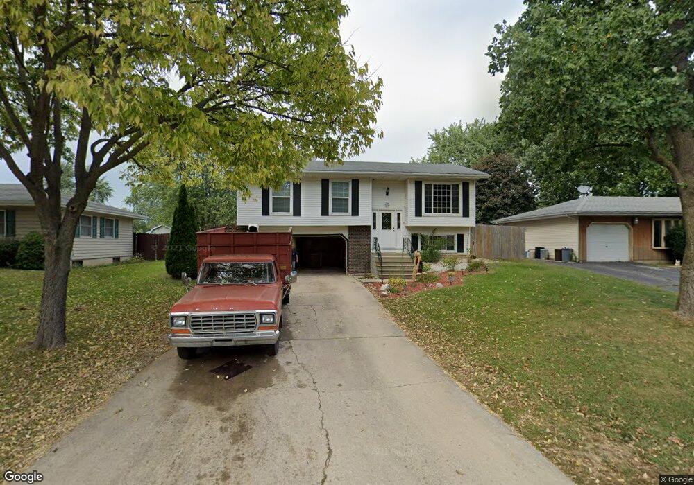
124 Laurie Ln Unit 1 Oswego, IL 60543
Northwest Oswego NeighborhoodEstimated Value: $294,982 - $335,000
3
Beds
2
Baths
976
Sq Ft
$325/Sq Ft
Est. Value
About This Home
This home is located at 124 Laurie Ln Unit 1, Oswego, IL 60543 and is currently estimated at $316,746, approximately $324 per square foot. 124 Laurie Ln Unit 1 is a home located in Kendall County with nearby schools including Fox Chase Elementary School, Traughber Junior High School, and Oswego High School.
Ownership History
Date
Name
Owned For
Owner Type
Purchase Details
Closed on
Jun 27, 1997
Sold by
Mills Larry G and Mills Tiffany
Bought by
Norton Jeff and Norton Amy J
Current Estimated Value
Home Financials for this Owner
Home Financials are based on the most recent Mortgage that was taken out on this home.
Original Mortgage
$119,479
Outstanding Balance
$17,884
Interest Rate
8%
Mortgage Type
FHA
Estimated Equity
$298,862
Purchase Details
Closed on
Dec 1, 1990
Bought by
Mills Larry G and Mills Tiffany L
Purchase Details
Closed on
Jul 1, 1988
Create a Home Valuation Report for This Property
The Home Valuation Report is an in-depth analysis detailing your home's value as well as a comparison with similar homes in the area
Home Values in the Area
Average Home Value in this Area
Purchase History
| Date | Buyer | Sale Price | Title Company |
|---|---|---|---|
| Norton Jeff | $120,500 | Law Title Insurance Co Inc | |
| Mills Larry G | $106,300 | -- | |
| -- | $81,500 | -- |
Source: Public Records
Mortgage History
| Date | Status | Borrower | Loan Amount |
|---|---|---|---|
| Open | Norton Jeff | $119,479 | |
| Closed | Mills Larry G | -- |
Source: Public Records
Tax History Compared to Growth
Tax History
| Year | Tax Paid | Tax Assessment Tax Assessment Total Assessment is a certain percentage of the fair market value that is determined by local assessors to be the total taxable value of land and additions on the property. | Land | Improvement |
|---|---|---|---|---|
| 2024 | $6,216 | $84,525 | $18,767 | $65,758 |
| 2023 | $5,789 | $76,148 | $16,907 | $59,241 |
| 2022 | $5,789 | $71,166 | $15,801 | $55,365 |
| 2021 | $5,514 | $65,895 | $14,631 | $51,264 |
| 2020 | $5,391 | $63,976 | $14,205 | $49,771 |
| 2019 | $5,296 | $62,062 | $14,205 | $47,857 |
| 2018 | $4,447 | $52,814 | $12,088 | $40,726 |
| 2017 | $4,287 | $48,453 | $11,090 | $37,363 |
| 2016 | $4,206 | $47,042 | $10,767 | $36,275 |
| 2015 | $3,871 | $42,001 | $9,613 | $32,388 |
| 2014 | -- | $40,778 | $9,333 | $31,445 |
| 2013 | -- | $43,847 | $10,035 | $33,812 |
Source: Public Records
Map
Nearby Homes
- 2100 Light Rd Unit 109
- 2300 Light Rd Unit 209
- 2600 Light Rd Unit 210
- 1415 State Route 31
- 107 Kristine St
- 7.43 Acres Vacant La State Route 31
- 11-13 W Anchor Rd
- 5.43 B-3 Commercial State Route 31
- 409 Fawn Dr
- 141 River Mist Dr
- 156 River Mist Dr
- 608 Clearwater Ct
- 602 Clearwater Ct Unit 2
- 458 Greenview Ln
- 2110 State Route 31
- 38 Ashlawn Ave
- 435 Fawn Dr
- 9 Cebold Dr
- 805 Cougar Ln
- 505 Parkland Ct
- 126 Laurie Ln
- 122 Laurie Ln
- 120 Laurie Ln
- 128 Laurie Ln
- 123 Laurie Ln
- 118 Laurie Ln Unit 1
- 121 Laurie Ln
- 127 Laurie Ln
- 119 Laurie Ln Unit 1
- 129 Laurie Ln Unit 1
- 116 Laurie Ln
- 130 Laurie Ln
- 117 Laurie Ln
- 2100 Light Rd Unit 209
- 2100 Light Rd Unit 207
- 2100 Light Rd Unit 104
- 2100 Light Rd Unit 110
- 2100 Light Rd Unit 107
- 2100 Light Rd Unit 103
- 2100 Light Rd Unit 102