Estimated Value: $427,000 - $510,000
3
Beds
2
Baths
1,528
Sq Ft
$310/Sq Ft
Est. Value
About This Home
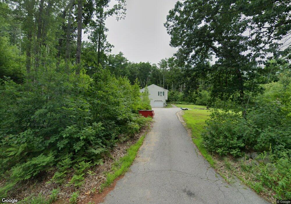
This home is located at 124 New Rye Rd, Epsom, NH 03234 and is currently estimated at $474,056, approximately $310 per square foot. 124 New Rye Rd is a home located in Merrimack County with nearby schools including Epsom Central School, Epsom Better Buddies, and Cornerstone Christian Academy.
Ownership History
Date
Name
Owned For
Owner Type
Purchase Details
Closed on
Jan 24, 2018
Sold by
Sharon A Gelinas Ret
Bought by
Ahr Residential Realty
Current Estimated Value
Purchase Details
Closed on
Dec 22, 2017
Sold by
Gelinas Sharon A
Bought by
Sharon A Gelinas Ret
Purchase Details
Closed on
Dec 10, 2010
Sold by
Department Of Housing & Urban Dev
Bought by
Gelinas William J and Gelinas Sharon A
Purchase Details
Closed on
May 21, 2010
Sold by
Furey Andre M
Bought by
Wells Fargo Bank Na
Purchase Details
Closed on
Jun 13, 2006
Sold by
Audette Paul J
Bought by
Furey Andre M and Furey Lauren C
Home Financials for this Owner
Home Financials are based on the most recent Mortgage that was taken out on this home.
Original Mortgage
$229,600
Interest Rate
8%
Mortgage Type
Adjustable Rate Mortgage/ARM
Create a Home Valuation Report for This Property
The Home Valuation Report is an in-depth analysis detailing your home's value as well as a comparison with similar homes in the area
Home Values in the Area
Average Home Value in this Area
Purchase History
| Date | Buyer | Sale Price | Title Company |
|---|---|---|---|
| Ahr Residential Realty | -- | -- | |
| Sharon A Gelinas Ret | -- | -- | |
| William J Gelinas Ret | -- | -- | |
| Gelinas William J | $145,000 | -- | |
| Wells Fargo Bank Na | $318,500 | -- | |
| Furey Andre M | $287,000 | -- | |
| Furey Andre M | $287,000 | -- |
Source: Public Records
Mortgage History
| Date | Status | Borrower | Loan Amount |
|---|---|---|---|
| Previous Owner | Furey Andre M | $279,600 | |
| Previous Owner | Furey Andre M | $25,000 | |
| Previous Owner | Furey Andre M | $229,600 |
Source: Public Records
Tax History Compared to Growth
Tax History
| Year | Tax Paid | Tax Assessment Tax Assessment Total Assessment is a certain percentage of the fair market value that is determined by local assessors to be the total taxable value of land and additions on the property. | Land | Improvement |
|---|---|---|---|---|
| 2024 | $7,206 | $270,500 | $104,000 | $166,500 |
| 2023 | $6,662 | $270,500 | $104,000 | $166,500 |
| 2022 | $6,449 | $270,500 | $104,000 | $166,500 |
| 2021 | $6,395 | $270,500 | $104,000 | $166,500 |
| 2020 | $5,905 | $270,500 | $104,000 | $166,500 |
| 2019 | $6,152 | $227,100 | $88,000 | $139,100 |
| 2018 | $5,898 | $227,100 | $88,000 | $139,100 |
| 2017 | $5,830 | $227,100 | $88,000 | $139,100 |
| 2016 | $5,684 | $227,100 | $88,000 | $139,100 |
| 2015 | $5,410 | $227,100 | $88,000 | $139,100 |
| 2014 | $4,946 | $222,200 | $83,300 | $138,900 |
| 2013 | $5,015 | $222,200 | $83,300 | $138,900 |
Source: Public Records
Map
Nearby Homes
- 14 Queens Ln
- 9 Princess Ln
- 19 Silver Hill Dr
- 370 River Rd
- 24 Towle Pasture Dr
- 0 Poor Town Rd Unit 4
- 42 Windymere Dr
- 43 Black Hall Rd Unit A2
- 0 Dover Unit 5027742
- 15 Fred Wood Dr
- 43 Catamount Hill Dr
- 8 Bush Ave
- 6 Jackson Ave
- 20 Mountain Rd
- 11 Presidential Dr
- 1 Jefferson Ave
- 14 Short Falls Rd
- 5 Catamount Hill Dr
- 611 N Pembroke Rd
- 101 4th Range Rd Unit 4