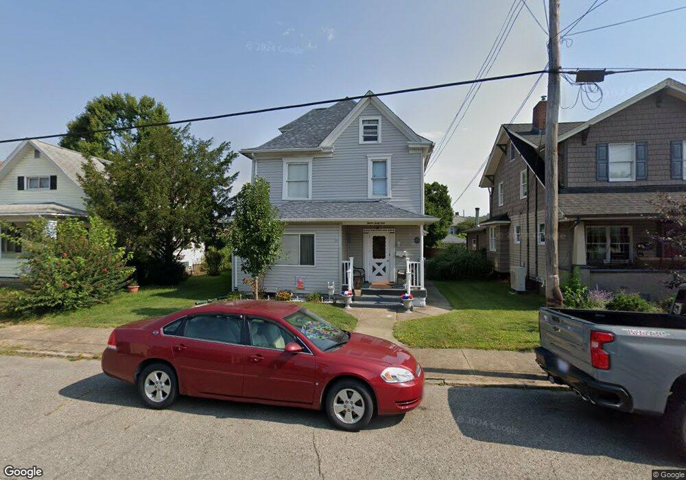
1241 Indiana Ave Monaca, PA 15061
Estimated Value: $156,000 - $180,718
3
Beds
1
Bath
1,840
Sq Ft
$91/Sq Ft
Est. Value
About This Home
This home is located at 1241 Indiana Ave, Monaca, PA 15061 and is currently estimated at $167,180, approximately $90 per square foot. 1241 Indiana Ave is a home located in Beaver County with nearby schools including Center Grange Primary School, Todd Lane Elementary School, and Central Valley Middle School.
Ownership History
Date
Name
Owned For
Owner Type
Purchase Details
Closed on
Jan 29, 2022
Sold by
Neil Port
Bought by
Port Neilson A and Port Dawn M
Current Estimated Value
Home Financials for this Owner
Home Financials are based on the most recent Mortgage that was taken out on this home.
Original Mortgage
$104,000
Outstanding Balance
$96,584
Interest Rate
3.56%
Mortgage Type
New Conventional
Estimated Equity
$70,596
Purchase Details
Closed on
May 30, 2001
Sold by
Salser Patricia Ann
Bought by
Port Neil
Home Financials for this Owner
Home Financials are based on the most recent Mortgage that was taken out on this home.
Original Mortgage
$64,600
Interest Rate
7.08%
Mortgage Type
Purchase Money Mortgage
Create a Home Valuation Report for This Property
The Home Valuation Report is an in-depth analysis detailing your home's value as well as a comparison with similar homes in the area
Home Values in the Area
Average Home Value in this Area
Purchase History
| Date | Buyer | Sale Price | Title Company |
|---|---|---|---|
| Port Neilson A | -- | Assured Settlement Solutions | |
| Port Neil | -- | Assured Settlement Solutions | |
| Port Neil | $68,000 | -- |
Source: Public Records
Mortgage History
| Date | Status | Borrower | Loan Amount |
|---|---|---|---|
| Open | Port Neil | $104,000 | |
| Closed | Port Neilson A | $104,000 | |
| Previous Owner | Port Neil | $64,600 |
Source: Public Records
Tax History Compared to Growth
Tax History
| Year | Tax Paid | Tax Assessment Tax Assessment Total Assessment is a certain percentage of the fair market value that is determined by local assessors to be the total taxable value of land and additions on the property. | Land | Improvement |
|---|---|---|---|---|
| 2025 | $1,335 | $79,450 | $15,350 | $64,100 |
| 2024 | $2,883 | $79,450 | $15,350 | $64,100 |
| 2023 | $2,326 | $19,000 | $3,250 | $15,750 |
| 2022 | $2,223 | $19,000 | $3,250 | $15,750 |
| 2021 | $2,223 | $19,000 | $3,250 | $15,750 |
| 2020 | $2,142 | $19,000 | $3,250 | $15,750 |
| 2019 | $2,142 | $19,000 | $3,250 | $15,750 |
| 2018 | $2,063 | $19,000 | $3,250 | $15,750 |
| 2017 | $2,063 | $19,000 | $3,250 | $15,750 |
| 2016 | $1,907 | $19,000 | $3,250 | $15,750 |
| 2015 | $422 | $19,000 | $3,250 | $15,750 |
| 2014 | $422 | $19,000 | $3,250 | $15,750 |
Source: Public Records
Map
Nearby Homes
- 1218 Indiana Ave
- 1213 Virginia Ave
- 1129 Atlantic Ave
- 211 11th St
- 1533 Indiana Ave
- 1540 Virginia Ave
- 938 Atlantic Ave
- 919 Atlantic Ave
- 810 Indiana Ave
- 807 Kaye Ave
- 600 Indiana Ave
- 216 6th St
- 1032 Grove St
- 609 Lincoln St
- 1105 Linden St
- 0 Beaver Ave
- 433 Pinney St
- 1108 Walnut St
- 627 Wayne Ave
- 166 Pennsylvania Ave
- 1245 Indiana Ave
- 1235 Indiana Ave
- 1233 Indiana Ave
- 1238 Indiana Ave
- 1229 Indiana Ave
- 1298 Indiana Ave
- 116 13th St
- 1227 Indiana Ave
- 1228 Indiana Ave
- 1232 Indiana Ave
- 1221 Indiana Ave
- 1248 Atlantic Ave
- 1300 Indiana Ave
- 1294 Atlantic Ave
- 1240 Atlantic Ave
- 1236 Atlantic Ave
- 1217 Indiana Ave
- 1298 Atlantic Ave
- 1234 Atlantic Ave
- 1216 Indiana Ave