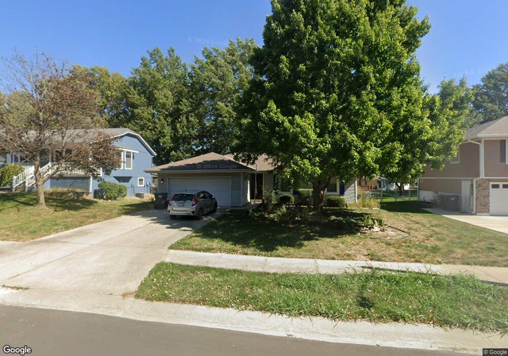
1241 NE Florence St Lees Summit, MO 64086
Estimated Value: $297,000 - $317,000
3
Beds
2
Baths
1,252
Sq Ft
$246/Sq Ft
Est. Value
About This Home
This home is located at 1241 NE Florence St, Lees Summit, MO 64086 and is currently estimated at $308,176, approximately $246 per square foot. 1241 NE Florence St is a home located in Jackson County with nearby schools including Meadow Lane Elementary School, Bernard C. Campbell Middle School, and Lee's Summit North High School.
Ownership History
Date
Name
Owned For
Owner Type
Purchase Details
Closed on
Jul 21, 2017
Sold by
Jeffrey Doreen and Skaggs Lulu Bell
Bought by
King Deborah C
Current Estimated Value
Home Financials for this Owner
Home Financials are based on the most recent Mortgage that was taken out on this home.
Original Mortgage
$125,406
Outstanding Balance
$103,174
Interest Rate
3.89%
Mortgage Type
FHA
Estimated Equity
$205,002
Purchase Details
Closed on
Apr 16, 2014
Sold by
Salyer Betty J
Bought by
Skaggs Lulu Bell
Create a Home Valuation Report for This Property
The Home Valuation Report is an in-depth analysis detailing your home's value as well as a comparison with similar homes in the area
Home Values in the Area
Average Home Value in this Area
Purchase History
| Date | Buyer | Sale Price | Title Company |
|---|---|---|---|
| King Deborah C | -- | Stewart Title Company | |
| Skaggs Lulu Bell | -- | Platinum Title Llc |
Source: Public Records
Mortgage History
| Date | Status | Borrower | Loan Amount |
|---|---|---|---|
| Open | King Deborah C | $125,406 |
Source: Public Records
Tax History
| Year | Tax Paid | Tax Assessment Tax Assessment Total Assessment is a certain percentage of the fair market value that is determined by local assessors to be the total taxable value of land and additions on the property. | Land | Improvement |
|---|---|---|---|---|
| 2025 | $4,179 | $44,224 | $8,219 | $36,005 |
| 2024 | $4,179 | $57,880 | $7,174 | $50,706 |
| 2023 | $4,149 | $57,879 | $7,651 | $50,228 |
| 2022 | $2,699 | $33,440 | $6,156 | $27,284 |
| 2021 | $2,755 | $33,440 | $6,156 | $27,284 |
| 2020 | $2,526 | $30,359 | $6,156 | $24,203 |
| 2019 | $2,457 | $30,359 | $6,156 | $24,203 |
| 2018 | $2,262 | $25,937 | $3,453 | $22,484 |
| 2017 | $2,262 | $25,937 | $3,453 | $22,484 |
| 2016 | $2,173 | $24,662 | $3,325 | $21,337 |
| 2014 | $2,210 | $24,592 | $3,313 | $21,279 |
Source: Public Records
Map
Nearby Homes
- 1300 NE Browning Ln
- 716 NE Thames Dr
- .342 acres NE Victoria Dr
- 1217 NE Magnolia St
- 1404 NE Grand Ave
- 811 NE Mulberry St
- 810 NE Chestnut St
- 809 NE Cedar St
- 627 NE Swann Cir
- 12505 S Woodlawn Dr
- 1708 NE Balboa St
- 1108 NE Ridgeview Dr
- 928 NE Mulberry St
- 816 NE Pollard St
- 1012 NE Lindsay Ave
- 1118 NE Deerbrook Terrace
- 1138 NE Mulberry St
- 612 NE Florence Ave
- 1412 NE Ernest Way
- 403 NE Howard Ave
- 1241 NE Florence Ave
- 1303 NE Florence St
- 1237 NE Florence St
- 1307 NE Florence St
- 1307 NE Florence Ave
- 1300 NE Florence St
- 1240 NE Florence St
- 1233 NE Florence St
- 1304 NE Florence St
- 1236 NE Florence St
- 1315 NE Florence St
- 1315 NE Florence Ave
- 1308 NE Florence St
- 1306 NE Browning Ln
- 611 NE Thames Ct
- 1229 NE Florence Ave
- 1229 NE Florence St
- 613 NE Thames Ct
- 1232 NE Florence St
- 1312 NE Florence St