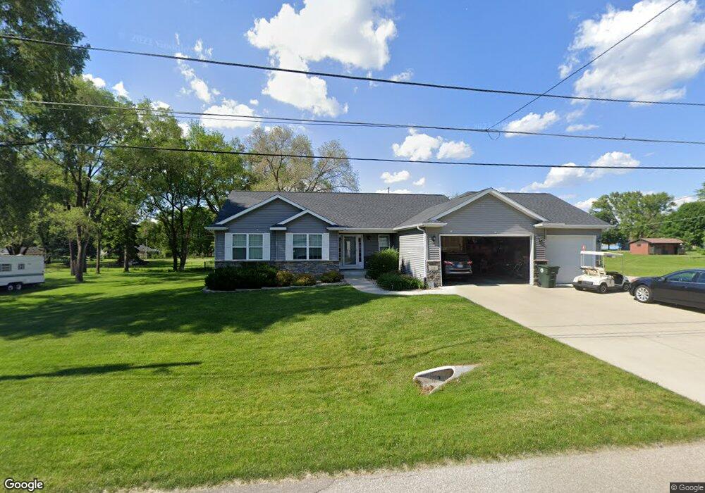
1241 Roosevelt St Waterloo, IA 50707
Maywood NeighborhoodEstimated Value: $298,000 - $400,000
3
Beds
4
Baths
2,705
Sq Ft
$135/Sq Ft
Est. Value
About This Home
This home is located at 1241 Roosevelt St, Waterloo, IA 50707 and is currently estimated at $363,829, approximately $134 per square foot. 1241 Roosevelt St is a home located in Black Hawk County with nearby schools including Highland Elementary School, Bunger Middle School, and East High School.
Ownership History
Date
Name
Owned For
Owner Type
Purchase Details
Closed on
Feb 10, 2011
Sold by
Tf 43
Bought by
Aswegan Adam and Grant Brittanny
Current Estimated Value
Purchase Details
Closed on
Jan 25, 2011
Sold by
Midwestone Bank
Bought by
Aswegan Adam and Grant Brittanny
Purchase Details
Closed on
Jan 7, 2011
Sold by
Meinders Cecilia
Bought by
Aswegan Adam and Grant Brittanny
Create a Home Valuation Report for This Property
The Home Valuation Report is an in-depth analysis detailing your home's value as well as a comparison with similar homes in the area
Home Values in the Area
Average Home Value in this Area
Purchase History
| Date | Buyer | Sale Price | Title Company |
|---|---|---|---|
| Aswegan Adam | $9,500 | Black Hawk County Abstract & | |
| Aswegan Adam | -- | Black Hawk County Abstract & | |
| Aswegan Adam | -- | Black Hawk County Abstract & |
Source: Public Records
Tax History Compared to Growth
Tax History
| Year | Tax Paid | Tax Assessment Tax Assessment Total Assessment is a certain percentage of the fair market value that is determined by local assessors to be the total taxable value of land and additions on the property. | Land | Improvement |
|---|---|---|---|---|
| 2024 | $5,662 | $271,200 | $21,600 | $249,600 |
| 2023 | $3,822 | $271,200 | $21,600 | $249,600 |
| 2022 | $3,718 | $182,860 | $21,600 | $161,260 |
| 2021 | $3,128 | $248,010 | $21,600 | $226,410 |
| 2020 | $3,074 | $228,000 | $16,200 | $211,800 |
| 2019 | $3,074 | $228,000 | $16,200 | $211,800 |
| 2018 | $1,832 | $210,960 | $16,200 | $194,760 |
| 2017 | $1,464 | $203,010 | $16,200 | $186,810 |
| 2016 | $1,018 | $203,010 | $16,200 | $186,810 |
| 2015 | $1,018 | $203,010 | $16,200 | $186,810 |
| 2014 | $24 | $9,720 | $9,720 | $0 |
Source: Public Records
Map
Nearby Homes
- 108 Ogden Ave
- 924 Creston Ave
- 1022 Short St
- 0 Skyview Rd Unit NBR20251892
- 47 Zuma St
- 312 Skyview Rd
- 2836 Independence Ave
- 427 Adrian St
- 1865 Independence Ave
- 1446 Ruth St
- 421 Miner Dr
- 244 Wema Ave
- 312 Glendale St
- 0 Madison Monroe Unit NBR20253026
- 1235 Independence Ave
- 604 Ayers Ave
- 211 Madison St
- 1127 Independence Ave
- 1912 Sycamore St
- 755 Fox Ave
- 515 Ogden Ave
- 1227 Roosevelt St
- 523 Ogden Ave
- 1236 Roosevelt St
- 1244 Roosevelt St
- 1302 Roosevelt St
- 1230 Roosevelt St
- 1308 Roosevelt St
- 1312 Roosevelt St
- 500 Bishop Ave
- 1303 Shultz St
- 1245 Shultz St
- 1311 Shultz St
- 1227 Ann St
- 1320 Roosevelt St
- 1219 Ann St
- 1305 Ann St
- 1317 Shultz St
- 1315 Ann St
- 0 Ogden Ave