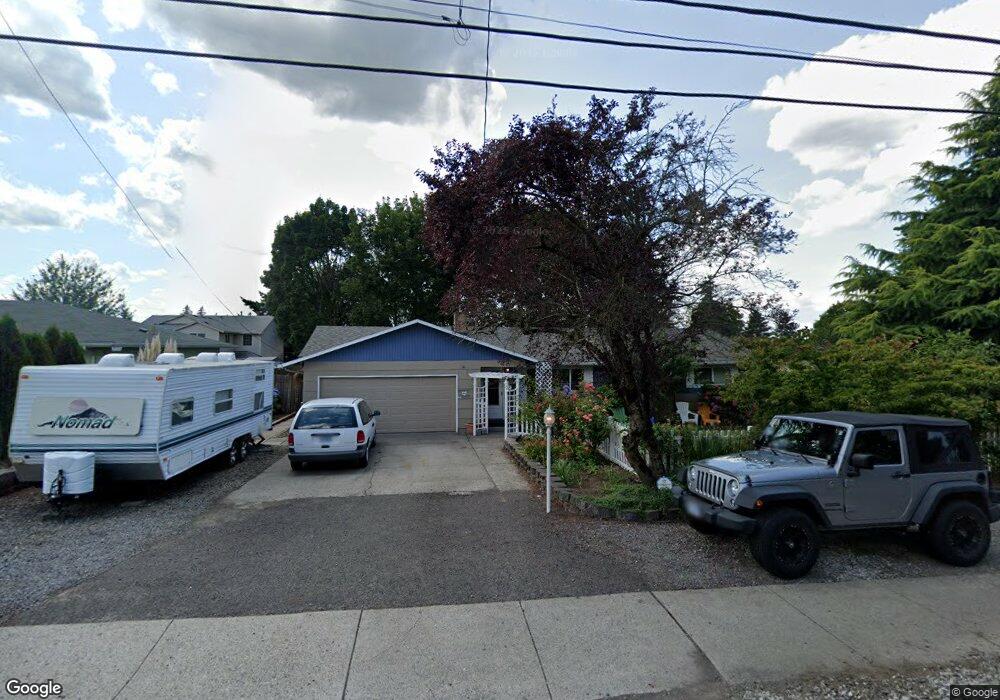
1241 SE 212th Ave Gresham, OR 97030
North Central NeighborhoodEstimated Value: $455,000 - $528,000
3
Beds
2
Baths
1,594
Sq Ft
$300/Sq Ft
Est. Value
About This Home
This home is located at 1241 SE 212th Ave, Gresham, OR 97030 and is currently estimated at $478,480, approximately $300 per square foot. 1241 SE 212th Ave is a home located in Multnomah County with nearby schools including North Gresham Elementary School, Clear Creek Middle School, and Gresham High School.
Ownership History
Date
Name
Owned For
Owner Type
Purchase Details
Closed on
Jun 10, 2005
Sold by
Chamberlain Tony B and Chamberlain Ingrid
Bought by
Goodman David N and Goodman Becky R
Current Estimated Value
Home Financials for this Owner
Home Financials are based on the most recent Mortgage that was taken out on this home.
Original Mortgage
$36,400
Interest Rate
5.28%
Mortgage Type
Stand Alone Second
Create a Home Valuation Report for This Property
The Home Valuation Report is an in-depth analysis detailing your home's value as well as a comparison with similar homes in the area
Home Values in the Area
Average Home Value in this Area
Purchase History
| Date | Buyer | Sale Price | Title Company |
|---|---|---|---|
| Goodman David N | $182,000 | Pacific Nw Title |
Source: Public Records
Mortgage History
| Date | Status | Borrower | Loan Amount |
|---|---|---|---|
| Closed | Goodman David N | $36,400 | |
| Open | Goodman David N | $145,600 |
Source: Public Records
Tax History
| Year | Tax Paid | Tax Assessment Tax Assessment Total Assessment is a certain percentage of the fair market value that is determined by local assessors to be the total taxable value of land and additions on the property. | Land | Improvement |
|---|---|---|---|---|
| 2025 | $5,261 | $258,530 | -- | -- |
| 2024 | $4,771 | $237,770 | -- | -- |
| 2023 | $4,346 | $230,850 | $0 | $0 |
| 2022 | $4,225 | $224,130 | $0 | $0 |
| 2021 | $4,119 | $217,610 | $0 | $0 |
| 2020 | $3,875 | $211,280 | $0 | $0 |
| 2019 | $3,774 | $205,130 | $0 | $0 |
| 2018 | $3,598 | $199,160 | $0 | $0 |
| 2017 | $3,452 | $193,360 | $0 | $0 |
| 2016 | $3,044 | $187,730 | $0 | $0 |
Source: Public Records
Map
Nearby Homes
- 1026 SE 213th Ave
- 1208 SE 209th Ave
- 920 SE 214th Ave
- 21001 SE Yamhill St
- 1026 SE 209th Ave
- 830 SE 214th Ave
- 1711 NW 19th St
- 21016 SE Stark St Unit 69
- 21400 SE Stark St Unit 2
- 1758 NW 18th Ct
- 21525 SE Oak St
- 209 SE 214th Ave
- 132 SE 214th Ave
- 1035 SE 225th Ave
- 1387 NW Riverview Ave Unit 14B
- 994 NW Wallula Ave
- 0 SE Burnside St
- 19776 SE Stark St Unit 147
- 85 NE 23rd St
- 805 SE 197th Ave
- 1235 SE 212th Ave
- 1255 SE 212th Ave
- 1312 SE 211th Ave
- 1263 SE 212th - Withdrawn
- 1263 SE 212th Ave
- 1252 SE 211th Ave
- 1267 SE 212th Ave
- 1231 SE 212th Ave
- 1214 SE 212th Ave
- 1323 SE 212th Ave
- 1242 SE 211th Ave
- 1313 SE 212th Ave
- 1302 SE 212th Ave
- 1324 SE 211th Ave
- 1217 SE 212th Ave
- 21225 SE Main St
- 1150 SE 212th Ave
- 21226 SE Main St
- 1310 SE 212th Ave
- 21040 SE Main Dr
Your Personal Tour Guide
Ask me questions while you tour the home.