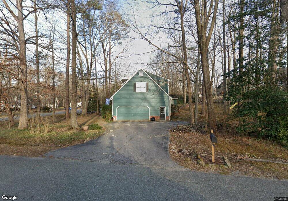
12418 Queensgate Rd Midlothian, VA 23114
Estimated Value: $515,000 - $552,000
4
Beds
3
Baths
2,503
Sq Ft
$211/Sq Ft
Est. Value
About This Home
This home is located at 12418 Queensgate Rd, Midlothian, VA 23114 and is currently estimated at $527,499, approximately $210 per square foot. 12418 Queensgate Rd is a home located in Chesterfield County with nearby schools including J B Watkins Elementary School, Midlothian Middle School, and Midlothian High School.
Ownership History
Date
Name
Owned For
Owner Type
Purchase Details
Closed on
Oct 28, 1996
Sold by
Murray Tyrone W
Bought by
Davis John M and Davis Jane D
Current Estimated Value
Home Financials for this Owner
Home Financials are based on the most recent Mortgage that was taken out on this home.
Original Mortgage
$120,000
Outstanding Balance
$11,962
Interest Rate
8.22%
Mortgage Type
New Conventional
Estimated Equity
$515,537
Create a Home Valuation Report for This Property
The Home Valuation Report is an in-depth analysis detailing your home's value as well as a comparison with similar homes in the area
Home Values in the Area
Average Home Value in this Area
Purchase History
| Date | Buyer | Sale Price | Title Company |
|---|---|---|---|
| Davis John M | $192,000 | -- |
Source: Public Records
Mortgage History
| Date | Status | Borrower | Loan Amount |
|---|---|---|---|
| Open | Davis John M | $120,000 |
Source: Public Records
Tax History
| Year | Tax Paid | Tax Assessment Tax Assessment Total Assessment is a certain percentage of the fair market value that is determined by local assessors to be the total taxable value of land and additions on the property. | Land | Improvement |
|---|---|---|---|---|
| 2025 | $4,132 | $461,500 | $81,000 | $380,500 |
| 2024 | $4,132 | $452,100 | $76,000 | $376,100 |
| 2023 | $3,841 | $422,100 | $76,000 | $346,100 |
| 2022 | $3,649 | $396,600 | $73,000 | $323,600 |
| 2021 | $3,335 | $344,100 | $71,000 | $273,100 |
| 2020 | $3,198 | $336,600 | $71,000 | $265,600 |
| 2019 | $3,132 | $329,700 | $71,000 | $258,700 |
| 2018 | $2,963 | $311,900 | $68,000 | $243,900 |
| 2017 | $2,934 | $305,600 | $68,000 | $237,600 |
| 2016 | $2,873 | $299,300 | $66,000 | $233,300 |
| 2015 | $2,819 | $291,000 | $64,000 | $227,000 |
| 2014 | $2,759 | $284,800 | $62,000 | $222,800 |
Source: Public Records
Map
Nearby Homes
- 12402 Beauridge Ct
- 12031 Gordon School Rd
- 1106 Johanna Bay Dr
- 11970 Lucks Ln
- 11960 Lucks Ln
- 1131 Arborway Ln
- 302 Ashtree Place
- 12802 Worsham Green Place
- 347 Rossmere Dr
- 351 Walton Park Rd
- 11950 Rothbury Dr
- 13007 Ashtree Rd
- 12601 Cottage Mill Rd
- 441 Farnham Dr
- 332 Glenpark Ln
- 12513 Carnoustie Ln Unit B
- 11512 Mcnair Cir
- 600 Coralberry Dr
- 12924 Glengate Rd
- 627 Hazeltine Ct
- 12405 Dannyhill Rd
- 12412 Queensgate Rd
- 12406 Beauridge Ct
- 12419 Queensgate Rd
- 12406 Dannyhill Rd
- 12404 Beauridge Ct
- 12403 Dannyhill Rd
- 12413 Queensgate Rd
- 12404 Dannyhill Rd
- 12500 Dannyhill Rd
- 12401 Dannyhill Rd
- 12506 Queensgate Rd
- 12407 Queensgate Rd
- 12400 Dannyhill Rd
- 12409 Beauridge Ct
- 12400 Queensgate Rd
- 12511 Dannyhill Rd
- 12402 Dannyhill Rd
- 12507 Queensgate Rd
- 12407 Beauridge Ct
Your Personal Tour Guide
Ask me questions while you tour the home.