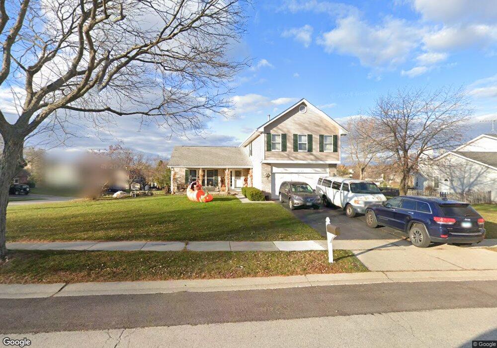
1242 Victoria Ct Algonquin, IL 60102
High Hill Farms NeighborhoodEstimated Value: $368,137 - $416,000
--
Bed
1
Bath
1,982
Sq Ft
$194/Sq Ft
Est. Value
About This Home
This home is located at 1242 Victoria Ct, Algonquin, IL 60102 and is currently estimated at $384,784, approximately $194 per square foot. 1242 Victoria Ct is a home located in McHenry County with nearby schools including Westfield Community School, Kenneth E Neubert Elementary School, and United Junior High School.
Ownership History
Date
Name
Owned For
Owner Type
Purchase Details
Closed on
Nov 30, 1998
Sold by
Shaughnessy Mark L and Shaughnessy Carol F
Bought by
Spirling Richard E and Spirling Deidree A
Current Estimated Value
Home Financials for this Owner
Home Financials are based on the most recent Mortgage that was taken out on this home.
Original Mortgage
$154,800
Interest Rate
6.76%
Create a Home Valuation Report for This Property
The Home Valuation Report is an in-depth analysis detailing your home's value as well as a comparison with similar homes in the area
Home Values in the Area
Average Home Value in this Area
Purchase History
| Date | Buyer | Sale Price | Title Company |
|---|---|---|---|
| Spirling Richard E | $174,000 | Attorneys Title Guaranty Fun |
Source: Public Records
Mortgage History
| Date | Status | Borrower | Loan Amount |
|---|---|---|---|
| Previous Owner | Spirling Richard E | $154,800 |
Source: Public Records
Tax History Compared to Growth
Tax History
| Year | Tax Paid | Tax Assessment Tax Assessment Total Assessment is a certain percentage of the fair market value that is determined by local assessors to be the total taxable value of land and additions on the property. | Land | Improvement |
|---|---|---|---|---|
| 2024 | $7,951 | $109,643 | $26,895 | $82,748 |
| 2023 | $7,539 | $98,062 | $24,054 | $74,008 |
| 2022 | $7,855 | $97,598 | $21,044 | $76,554 |
| 2021 | $7,536 | $90,924 | $19,605 | $71,319 |
| 2020 | $7,337 | $87,705 | $18,911 | $68,794 |
| 2019 | $7,157 | $83,944 | $18,100 | $65,844 |
| 2018 | $6,820 | $77,547 | $16,721 | $60,826 |
| 2017 | $6,677 | $73,054 | $15,752 | $57,302 |
| 2016 | $6,574 | $68,518 | $14,774 | $53,744 |
| 2013 | -- | $61,756 | $13,783 | $47,973 |
Source: Public Records
Map
Nearby Homes
- 1235 Fairmont Ct
- 721 Brentwood Ct
- 615 Harper Dr
- 266 Grandview Ct
- 700 Fairfield Ln
- 16 Brian Ct
- 909 Roger St
- 1 N Hubbard St
- SWC Talaga and Algonquin Rd
- 1820 Crofton Dr
- 741 Regal Ln
- 135 Arquilla Dr
- 102 Center St
- 807 Menominee Dr
- 809 Menominee Dr
- 661 Majestic Dr
- LOT 3 Blackhawk Dr
- Lots 10 & 11 Ramble Rd
- 305 Buckingham Dr
- 710 Braewood Dr
- 1232 Victoria Ct
- 545 Eagle Ridge Ln
- 550 Eagle Ridge Ln
- 560 Eagle Ridge Ln
- 1241 Victoria Ct
- 1222 Victoria Ct Unit 6
- 535 Eagle Ridge Ln
- 1231 Victoria Ct
- 540 Eagle Ridge Ln
- 1251 Victoria Ct
- 1221 Victoria Ct
- 1261 Victoria Ct
- 1211 Victoria Ct
- 525 Eagle Ridge Ln
- 551 Terrace Dr
- 561 Terrace Dr
- 541 Terrace Dr
- 1271 Victoria Ct
- 1212 Victoria Ct
- 520 Eagle Ridge Ln