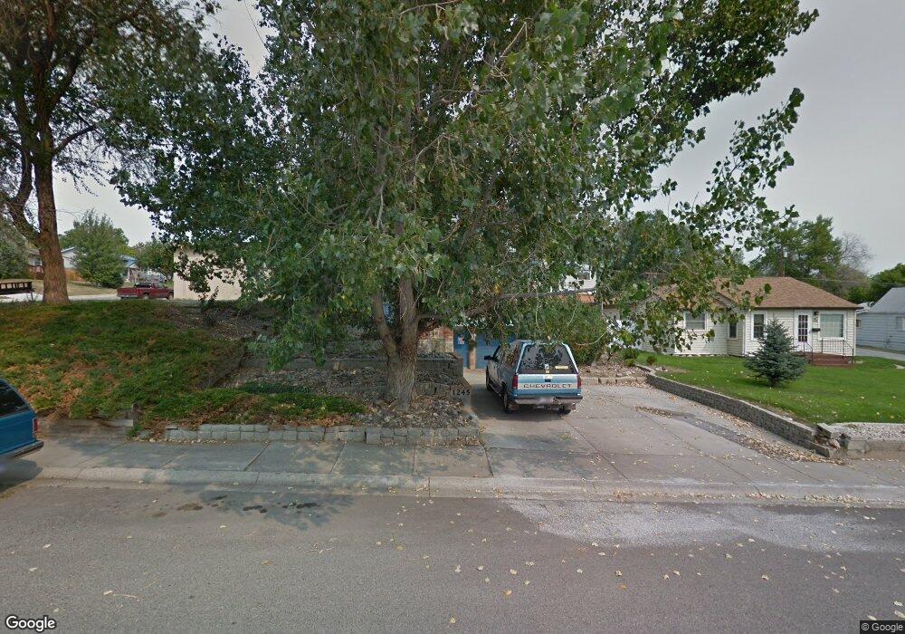
1245 Cook Ave Billings, MT 59102
East Central Billings NeighborhoodEstimated Value: $202,000 - $361,000
3
Beds
2
Baths
2,082
Sq Ft
$147/Sq Ft
Est. Value
About This Home
This home is located at 1245 Cook Ave, Billings, MT 59102 and is currently estimated at $306,018, approximately $146 per square foot. 1245 Cook Ave is a home located in Yellowstone County with nearby schools including Washington School, Lewis & Clark Junior High School, and Billings Senior High School.
Ownership History
Date
Name
Owned For
Owner Type
Purchase Details
Closed on
Jul 31, 2023
Sold by
Carrington Mortgage Loan Trust
Bought by
Bell Gard and Bell Helen
Current Estimated Value
Purchase Details
Closed on
Apr 4, 2022
Sold by
Bruce K Glenn Revocable Trust
Bought by
Bruce K Glenn Revocable Trust
Purchase Details
Closed on
Mar 24, 2022
Sold by
Bruce K Glenn Revocable Trust
Bought by
Wells Fargo Bank Na
Purchase Details
Closed on
Mar 17, 2022
Sold by
Bruce K Glenn Revocable Trust
Bought by
Wells Fargo Bank Na and Carrington Mortgage Loan Trust Series 2006-Nc2
Purchase Details
Closed on
Jun 1, 2011
Sold by
Glenn Bruce K
Bought by
Glenn Bruce K
Create a Home Valuation Report for This Property
The Home Valuation Report is an in-depth analysis detailing your home's value as well as a comparison with similar homes in the area
Home Values in the Area
Average Home Value in this Area
Purchase History
| Date | Buyer | Sale Price | Title Company |
|---|---|---|---|
| Bell Gard | $128,699 | None Listed On Document | |
| Bruce K Glenn Revocable Trust | $186,466 | None Listed On Document | |
| Wells Fargo Bank Na | $182,944 | -- | |
| Wells Fargo Bank Na | $182,944 | -- | |
| Glenn Bruce K | -- | None Available |
Source: Public Records
Tax History Compared to Growth
Tax History
| Year | Tax Paid | Tax Assessment Tax Assessment Total Assessment is a certain percentage of the fair market value that is determined by local assessors to be the total taxable value of land and additions on the property. | Land | Improvement |
|---|---|---|---|---|
| 2025 | $2,379 | $440,515 | $47,135 | $393,380 |
| 2024 | $2,379 | $245,936 | $43,756 | $202,180 |
| 2023 | $2,864 | $299,800 | $43,756 | $256,044 |
| 2022 | $2,051 | $217,200 | $0 | $0 |
| 2021 | $2,280 | $218,800 | $0 | $0 |
| 2020 | $2,316 | $212,400 | $0 | $0 |
| 2019 | $2,442 | $212,400 | $0 | $0 |
| 2018 | $464 | $200,900 | $0 | $0 |
| 2017 | $459 | $200,900 | $0 | $0 |
| 2016 | $447 | $186,000 | $0 | $0 |
| 2015 | $444 | $186,000 | $0 | $0 |
| 2014 | $439 | $93,915 | $0 | $0 |
Source: Public Records
Map
Nearby Homes
- 1231 Saint Johns Ave
- 1122 Howard Ave
- 1113 Lynn Ave
- 1212 Concord Dr
- 112 11th St W
- 141 S 12th St W
- 1019 Miles Ave
- 1346 Broadwater Ave
- 927 Miles Ave
- 925 Miles Ave
- 231 S 12th St W
- 1310 Yellowstone Ave Unit 6
- 1310 Yellowstone Ave Unit 11
- 1310 Yellowstone Ave Unit 16
- 1256 & 1260 Yellowstone Ave
- 226 Moore Ln
- 1265 Yellowstone Ave
- 1263 Yellowstone Ave
- 305 17th St W
- 1230 Clark Ave
- 1237 Cook Ave
- 1233 Cook Ave
- 1244 Howard Ave
- 1246 Howard Ave
- 1240 Howard Ave
- 1229 Cook Ave
- 1238 Howard Ave
- 206 13th St W
- 202 13th St W
- 210 13th St W
- 1234 Cook Ave
- 1228 Howard Ave
- 216 13th St W
- 1302 Cook Ave
- 1219 Cook Ave
- 220 13th St W
- 1224 Howard Ave
- 1306 Cook Ave
- 1241 Howard Ave
- 1243 Saint Johns Ave