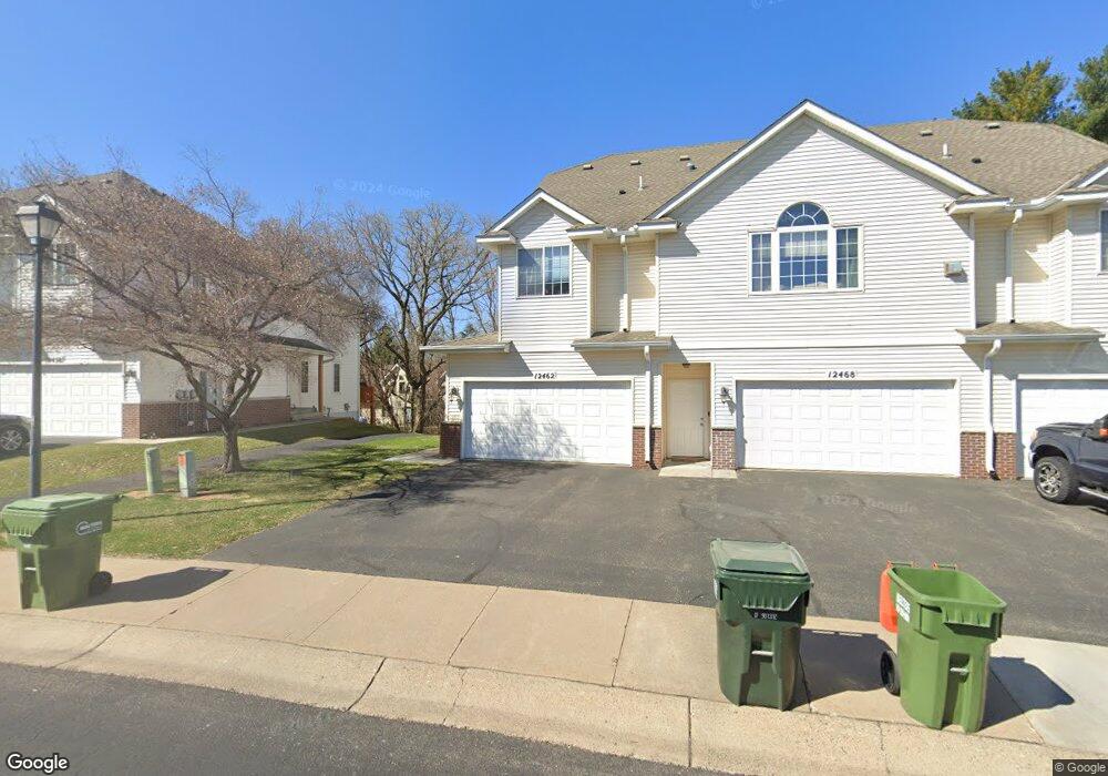
12462 Unity St NW Coon Rapids, MN 55448
Estimated Value: $256,000 - $277,000
3
Beds
3
Baths
1,334
Sq Ft
$201/Sq Ft
Est. Value
About This Home
This home is located at 12462 Unity St NW, Coon Rapids, MN 55448 and is currently estimated at $268,399, approximately $201 per square foot. 12462 Unity St NW is a home located in Anoka County with nearby schools including Sand Creek Elementary School, Northdale Middle School, and Blaine Senior High School.
Ownership History
Date
Name
Owned For
Owner Type
Purchase Details
Closed on
Jul 10, 2007
Sold by
Matthies Trevor
Bought by
Johnson Llyod L and Johnson Shirley E
Current Estimated Value
Home Financials for this Owner
Home Financials are based on the most recent Mortgage that was taken out on this home.
Original Mortgage
$165,200
Outstanding Balance
$104,649
Interest Rate
6.76%
Mortgage Type
New Conventional
Estimated Equity
$163,750
Purchase Details
Closed on
Sep 26, 2002
Sold by
Prime Builders Inc
Bought by
Beisner Charles A and Beisner Jean E
Create a Home Valuation Report for This Property
The Home Valuation Report is an in-depth analysis detailing your home's value as well as a comparison with similar homes in the area
Home Values in the Area
Average Home Value in this Area
Purchase History
| Date | Buyer | Sale Price | Title Company |
|---|---|---|---|
| Johnson Llyod L | $206,500 | -- | |
| Beisner Charles A | $158,655 | -- |
Source: Public Records
Mortgage History
| Date | Status | Borrower | Loan Amount |
|---|---|---|---|
| Open | Johnson Llyod L | $165,200 |
Source: Public Records
Tax History
| Year | Tax Paid | Tax Assessment Tax Assessment Total Assessment is a certain percentage of the fair market value that is determined by local assessors to be the total taxable value of land and additions on the property. | Land | Improvement |
|---|---|---|---|---|
| 2025 | $2,696 | $271,700 | $50,000 | $221,700 |
| 2024 | $2,696 | $266,100 | $55,000 | $211,100 |
| 2023 | $2,297 | $263,400 | $40,000 | $223,400 |
| 2022 | $2,250 | $243,300 | $31,500 | $211,800 |
| 2021 | $2,179 | $213,900 | $20,000 | $193,900 |
| 2020 | $2,052 | $203,400 | $20,000 | $183,400 |
| 2019 | $1,976 | $185,900 | $20,000 | $165,900 |
| 2018 | $1,829 | $175,100 | $0 | $0 |
| 2017 | $1,665 | $159,600 | $0 | $0 |
| 2016 | $1,679 | $144,000 | $0 | $0 |
| 2015 | $1,662 | $144,000 | $7,000 | $137,000 |
| 2014 | -- | $126,300 | $7,000 | $119,300 |
Source: Public Records
Map
Nearby Homes
- 923 123rd Ln NW
- 12250 Unity St NW
- 1258 127th Ave NW
- 12118 Bluebird Cir NW
- 12806 Yellow Pine St NW
- 12459 Drake St NW
- 12463 Drake St NW
- 12036 Yellow Pine St NW
- 12113 Drake St NW
- 11975 Yellow Pine St NW
- 11923 Wintergreen St NW
- 12739 Drake Cir NW
- 11852 Yellow Pine St NW
- 11824 Larch St NW
- 12041 Ibis St NW
- 12121 Killdeer St NW Unit 110
- 1681 128th Ave NW
- 1277 Northdale Blvd NW
- 1694 119th Ave NW
- 12240 Killdeer St NW Unit 1203
- 12468 Unity St NW
- 12472 Unity St NW Unit 6
- 12458 Unity St NW
- 12458 12458 Unity-Street-nw
- 12454 Unity St NW Unit 2
- 12476 Unity St NW
- 12454 12454 Unity-Street-nw
- 12454 12454 Unity St NW
- 12450 Unity St NW
- 12450 12450 Unity-Street-nw
- 12450 12450 Unity St NW
- 12480 Unity St NW Unit 8
- 12484 Unity St NW Unit 9
- 1039 124th Cir NW
- 12463 Unity St NW
- 1037 124th Cir NW
- 1035 124th Cir NW
- 12467 Unity St NW
- 12459 Unity St NW
- 12459 Unity St NW
Your Personal Tour Guide
Ask me questions while you tour the home.