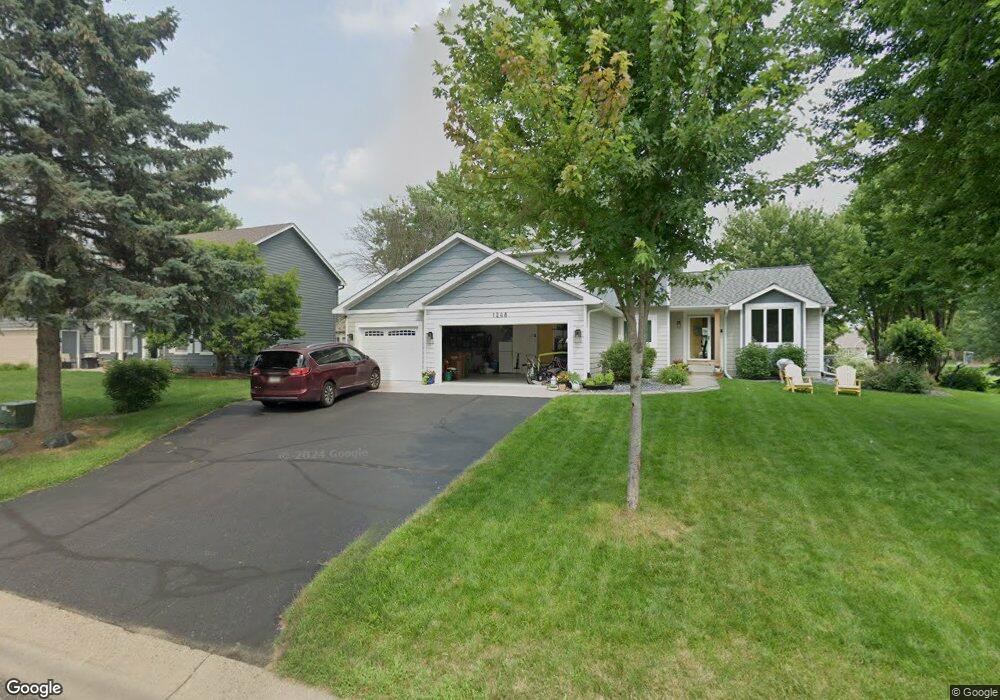
1248 Dunbar Way Saint Paul, MN 55115
Estimated Value: $645,246 - $690,000
5
Beds
4
Baths
3,008
Sq Ft
$221/Sq Ft
Est. Value
About This Home
This home is located at 1248 Dunbar Way, Saint Paul, MN 55115 and is currently estimated at $665,562, approximately $221 per square foot. 1248 Dunbar Way is a home located in Washington County with nearby schools including O.H. Anderson Elementary School, Wildwood Elementary School, and Mahtomedi Middle School.
Ownership History
Date
Name
Owned For
Owner Type
Purchase Details
Closed on
Jan 9, 2015
Sold by
Langmade Katherine M and Langmade Todd G
Bought by
Whitson Drew S and Whitson Erica J
Current Estimated Value
Home Financials for this Owner
Home Financials are based on the most recent Mortgage that was taken out on this home.
Original Mortgage
$314,400
Interest Rate
3.12%
Mortgage Type
Adjustable Rate Mortgage/ARM
Create a Home Valuation Report for This Property
The Home Valuation Report is an in-depth analysis detailing your home's value as well as a comparison with similar homes in the area
Home Values in the Area
Average Home Value in this Area
Purchase History
| Date | Buyer | Sale Price | Title Company |
|---|---|---|---|
| Whitson Drew S | $393,000 | Edina Realty Title Inc |
Source: Public Records
Mortgage History
| Date | Status | Borrower | Loan Amount |
|---|---|---|---|
| Previous Owner | Whitson Drew S | $314,400 |
Source: Public Records
Tax History Compared to Growth
Tax History
| Year | Tax Paid | Tax Assessment Tax Assessment Total Assessment is a certain percentage of the fair market value that is determined by local assessors to be the total taxable value of land and additions on the property. | Land | Improvement |
|---|---|---|---|---|
| 2024 | $6,708 | $565,000 | $161,500 | $403,500 |
| 2023 | $6,708 | $546,800 | $171,500 | $375,300 |
| 2022 | $6,040 | $538,000 | $171,500 | $366,500 |
| 2021 | $6,298 | $429,900 | $140,000 | $289,900 |
| 2020 | $6,200 | $463,600 | $175,000 | $288,600 |
| 2019 | $5,830 | $448,900 | $153,000 | $295,900 |
| 2018 | $5,106 | $427,900 | $160,000 | $267,900 |
| 2017 | $4,934 | $402,400 | $159,000 | $243,400 |
| 2016 | $5,114 | $370,900 | $149,400 | $221,500 |
| 2015 | $4,998 | $360,400 | $117,900 | $242,500 |
| 2013 | -- | $334,400 | $103,400 | $231,000 |
Source: Public Records
Map
Nearby Homes
- 78 Dunbar Way
- 941 Pineridge Ct
- 907 Ledgestone Dr
- 13 Echo Lake Blvd
- 180 Bevins Ln
- 2728 Century Ct
- 739 Echo Shores Ct
- 285 Old Wildwood Rd
- 824 Woodland Dr
- 745 Sterling Ct
- 766 Sterling Ct
- 169 Wedgewood Dr
- 2671 Sumac Ridge
- 2667 Sumac Ridge
- 3533 Long Lake Rd E
- 5562 Golfview Ln N
- 2608 Sumac Ridge
- 3150 Glen Oaks Ave Unit 305
- 3150 Glen Oaks Ave Unit 311
- 2572 Sumac Ridge
- 1228 1228 Dunbar-Way-
- 1248 1248 Dunbar Way
- 1228 Dunbar Way
- 1258 Dunbar Way
- 1258 1258 Dunbar-Way-
- 1258 1258 Dunbar Way
- 1245 Hillswick Terrace
- 1233 Hillswick Terrace
- 1208 Dunbar Way
- 382 Barrington Place
- 383 Barrington Place
- 1221 Hillswick Terrace
- 1221 Hillswick Tr
- 1268 Dunbar Way
- 1221 1221 Hillswick-Terrace-
- 1221 1221 Hillswick Terrace
- 394 Barrington Place
- 1313 Hillswick Place
- 394 Barrington Place
- 1188 Dunbar Way