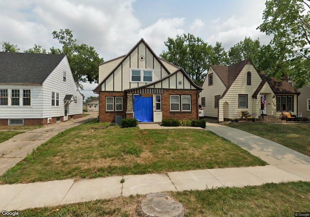
125 17th St SW Cedar Rapids, IA 52404
Cleveland Area NeighborhoodEstimated Value: $178,088 - $200,000
3
Beds
2
Baths
1,590
Sq Ft
$117/Sq Ft
Est. Value
About This Home
This home is located at 125 17th St SW, Cedar Rapids, IA 52404 and is currently estimated at $186,522, approximately $117 per square foot. 125 17th St SW is a home located in Linn County with nearby schools including Junction City Elementary School, Cleveland Elementary School, and Kentucky Tech - Ashland Reg Tech Center.
Ownership History
Date
Name
Owned For
Owner Type
Purchase Details
Closed on
Jul 6, 2013
Sold by
Stocks Douglas W
Bought by
Stocks Colette M
Current Estimated Value
Purchase Details
Closed on
Dec 21, 2007
Sold by
Slocum Kaye B and Slocum Kathleen A
Bought by
Stocks Douglas W and Stocks Colette M
Home Financials for this Owner
Home Financials are based on the most recent Mortgage that was taken out on this home.
Original Mortgage
$110,000
Outstanding Balance
$69,661
Interest Rate
6.31%
Mortgage Type
Unknown
Estimated Equity
$116,861
Purchase Details
Closed on
Apr 2, 2002
Sold by
First Construction Company
Bought by
Bartosh Lisa C and Kress Patrick J
Home Financials for this Owner
Home Financials are based on the most recent Mortgage that was taken out on this home.
Original Mortgage
$200,000
Interest Rate
6.82%
Create a Home Valuation Report for This Property
The Home Valuation Report is an in-depth analysis detailing your home's value as well as a comparison with similar homes in the area
Home Values in the Area
Average Home Value in this Area
Purchase History
| Date | Buyer | Sale Price | Title Company |
|---|---|---|---|
| Stocks Colette M | -- | None Available | |
| Stocks Douglas W | $109,500 | None Available | |
| Bartosh Lisa C | $35,000 | -- |
Source: Public Records
Mortgage History
| Date | Status | Borrower | Loan Amount |
|---|---|---|---|
| Open | Stocks Douglas W | $110,000 | |
| Previous Owner | Bartosh Lisa C | $200,000 |
Source: Public Records
Tax History Compared to Growth
Tax History
| Year | Tax Paid | Tax Assessment Tax Assessment Total Assessment is a certain percentage of the fair market value that is determined by local assessors to be the total taxable value of land and additions on the property. | Land | Improvement |
|---|---|---|---|---|
| 2025 | $2,496 | $169,100 | $23,600 | $145,500 |
| 2024 | $2,418 | $160,900 | $21,400 | $139,500 |
| 2023 | $2,418 | $151,500 | $21,400 | $130,100 |
| 2022 | $2,362 | $123,500 | $18,200 | $105,300 |
| 2021 | $2,498 | $123,000 | $18,200 | $104,800 |
| 2020 | $2,498 | $121,800 | $17,100 | $104,700 |
| 2019 | $2,208 | $111,000 | $17,100 | $93,900 |
| 2018 | $2,144 | $111,000 | $17,100 | $93,900 |
| 2017 | $2,152 | $107,300 | $17,100 | $90,200 |
| 2016 | $2,419 | $113,800 | $17,100 | $96,700 |
| 2015 | $2,521 | $118,457 | $17,136 | $101,321 |
| 2014 | $2,336 | $122,723 | $17,136 | $105,587 |
| 2013 | $2,370 | $122,723 | $17,136 | $105,587 |
Source: Public Records
Map
Nearby Homes
- 1602 1st Ave NW
- 1807 9th Ave SW
- 1832 8th Ave SW
- 1400 7th Ave SW
- 235 Highland Dr NW
- 263 Highland Dr NW
- 1311 Burch Ave NW
- 290 Highland Dr NW
- 1649 B Ave NW
- 1206 18th St SW
- 1118 2nd Ave SW
- 1253 20th St SW
- 1020 A Ave NW
- 217 11th St NW
- 1025 3rd Ave SW
- 2433 8th Ave SW
- 2178 Chandler St SW
- 2437 9th Ave SW
- 1818 Holly Meadow Ave SW
- 1812 Holly Meadow Ave SW
- 121 17th St SW
- 129 17th St SW
- 135 17th St SW
- 115 17th St SW
- 139 17th St SW
- 111 17th St SW
- 141 17th St SW
- 1619 1st Ave SW
- 124 17th St SW
- 128 17th St SW
- 120 17th St SW
- 1627 1st Ave SW
- 145 17th St SW
- 132 17th St SW
- 114 17th St SW
- 136 17th St SW
- 110 17th St SW
- 149 17th St SW
- 140 17th St SW
- 1703 1st Ave SW