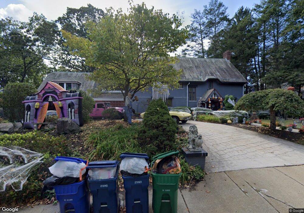
125 Aspen Ave Auburndale, MA 02466
Auburndale NeighborhoodEstimated Value: $1,709,000 - $2,782,000
3
Beds
5
Baths
2,896
Sq Ft
$818/Sq Ft
Est. Value
About This Home
This home is located at 125 Aspen Ave, Auburndale, MA 02466 and is currently estimated at $2,368,569, approximately $817 per square foot. 125 Aspen Ave is a home located in Middlesex County with nearby schools including Williams Elementary School, Charles E Brown Middle School, and Newton South High School.
Ownership History
Date
Name
Owned For
Owner Type
Purchase Details
Closed on
Dec 29, 2010
Sold by
Robert H Earle T and Bove Alexander A
Bought by
D F Earle Coppola Irt and Bove Alexander A
Current Estimated Value
Purchase Details
Closed on
Jan 2, 1992
Sold by
Lerner Henry M and Scherr Phyllis W
Bought by
Earle Robert H
Home Financials for this Owner
Home Financials are based on the most recent Mortgage that was taken out on this home.
Original Mortgage
$400,000
Interest Rate
8.56%
Mortgage Type
Purchase Money Mortgage
Purchase Details
Closed on
Feb 19, 1987
Sold by
Bunker William W
Bought by
Lerner Henry M
Home Financials for this Owner
Home Financials are based on the most recent Mortgage that was taken out on this home.
Original Mortgage
$420,000
Interest Rate
9.24%
Mortgage Type
Purchase Money Mortgage
Create a Home Valuation Report for This Property
The Home Valuation Report is an in-depth analysis detailing your home's value as well as a comparison with similar homes in the area
Home Values in the Area
Average Home Value in this Area
Purchase History
| Date | Buyer | Sale Price | Title Company |
|---|---|---|---|
| D F Earle Coppola Irt | -- | -- | |
| Earle Robert H | $650,000 | -- | |
| Lerner Henry M | $525,000 | -- |
Source: Public Records
Mortgage History
| Date | Status | Borrower | Loan Amount |
|---|---|---|---|
| Previous Owner | Lerner Henry M | $418,500 | |
| Previous Owner | Lerner Henry M | $203,000 | |
| Previous Owner | Lerner Henry M | $400,000 | |
| Previous Owner | Lerner Henry M | $420,000 |
Source: Public Records
Tax History Compared to Growth
Tax History
| Year | Tax Paid | Tax Assessment Tax Assessment Total Assessment is a certain percentage of the fair market value that is determined by local assessors to be the total taxable value of land and additions on the property. | Land | Improvement |
|---|---|---|---|---|
| 2025 | $24,261 | $2,475,600 | $1,686,200 | $789,400 |
| 2024 | $23,458 | $2,403,500 | $1,637,100 | $766,400 |
| 2023 | $22,321 | $2,192,600 | $1,322,700 | $869,900 |
| 2022 | $21,358 | $2,030,200 | $1,224,700 | $805,500 |
| 2021 | $20,609 | $1,915,300 | $1,155,400 | $759,900 |
| 2020 | $19,996 | $1,915,300 | $1,155,400 | $759,900 |
| 2019 | $19,432 | $1,859,500 | $1,121,700 | $737,800 |
| 2018 | $18,479 | $1,707,900 | $991,400 | $716,500 |
| 2017 | $17,917 | $1,611,200 | $935,300 | $675,900 |
| 2016 | $17,136 | $1,505,800 | $874,100 | $631,700 |
| 2015 | $16,339 | $1,407,300 | $816,900 | $590,400 |
Source: Public Records
Map
Nearby Homes
- 1754 Washington St
- 283 Woodland Rd
- 1639 Washington St
- 1640 Commonwealth Ave
- 17 Lasell St
- 224 Auburn St Unit 224
- 224 Auburn St Unit A
- 226 Auburn St Unit 226
- 10 Lorraine Cir
- 17 Gilbert St
- 27 Oakwood Rd
- 51 Bourne St
- 13 Weir St
- 2084 Washington St
- 33 Metacomet Rd
- 0 Duncan Rd Unit 72925240
- 10 Ruane Rd
- 283 Melrose St
- 62-64 Rowe St Unit B
- 1801 Beacon St
- 141 Aspen Ave
- 115 Aspen Ave
- 115 Aspen Ave
- 147 Aspen Ave
- 142 Aspen Ave
- 99 Aspen Ave
- 153 Aspen Ave Unit 155
- 150 Aspen Ave
- 66 Forest Ave
- 66 Forest Ave
- 160 Aspen Ave
- 71 Studio Rd
- 91 Aspen Ave
- 1831 Washington St
- 1819 Washington St
- 165 Aspen Ave
- 18 Mary Mount Rd
- 1839 Washington St
- 1839 Washington St Unit A
- 84 Aspen Ave