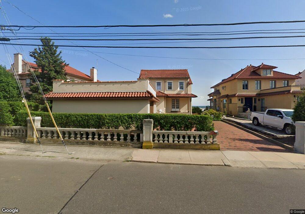
125 Merwin Ave Milford, CT 06460
East Milford NeighborhoodEstimated Value: $1,058,000 - $1,718,000
3
Beds
4
Baths
3,070
Sq Ft
$464/Sq Ft
Est. Value
About This Home
This home is located at 125 Merwin Ave, Milford, CT 06460 and is currently estimated at $1,424,105, approximately $463 per square foot. 125 Merwin Ave is a home located in New Haven County with nearby schools including Live Oaks School, East Shore Middle School, and Joseph A. Foran High School.
Ownership History
Date
Name
Owned For
Owner Type
Purchase Details
Closed on
May 9, 2016
Sold by
Richard K Shaw Ret
Bought by
Qprt Marie Shaw
Current Estimated Value
Purchase Details
Closed on
Sep 15, 1997
Sold by
Diamond Alan and Diamond Elaine
Bought by
Shaw Richard
Home Financials for this Owner
Home Financials are based on the most recent Mortgage that was taken out on this home.
Original Mortgage
$550,000
Interest Rate
7.31%
Mortgage Type
Unknown
Create a Home Valuation Report for This Property
The Home Valuation Report is an in-depth analysis detailing your home's value as well as a comparison with similar homes in the area
Home Values in the Area
Average Home Value in this Area
Purchase History
| Date | Buyer | Sale Price | Title Company |
|---|---|---|---|
| Qprt Marie Shaw | -- | -- | |
| Marie Shaw Qprt | -- | -- | |
| Shaw Richard | $550,000 | -- | |
| Shaw Richard | $550,000 | -- |
Source: Public Records
Mortgage History
| Date | Status | Borrower | Loan Amount |
|---|---|---|---|
| Previous Owner | Shaw Richard | $515,000 | |
| Previous Owner | Shaw Richard | $550,000 |
Source: Public Records
Tax History Compared to Growth
Tax History
| Year | Tax Paid | Tax Assessment Tax Assessment Total Assessment is a certain percentage of the fair market value that is determined by local assessors to be the total taxable value of land and additions on the property. | Land | Improvement |
|---|---|---|---|---|
| 2025 | $24,725 | $836,720 | $501,040 | $335,680 |
| 2024 | $24,382 | $836,720 | $501,040 | $335,680 |
| 2023 | $22,734 | $836,720 | $501,040 | $335,680 |
| 2022 | $22,299 | $836,720 | $501,040 | $335,680 |
| 2021 | $19,359 | $700,150 | $419,330 | $280,820 |
| 2020 | $19,380 | $700,150 | $419,330 | $280,820 |
| 2019 | $19,401 | $700,150 | $419,330 | $280,820 |
| 2018 | $19,422 | $700,150 | $419,330 | $280,820 |
| 2017 | $19,457 | $700,150 | $419,330 | $280,820 |
| 2016 | $23,184 | $832,760 | $578,820 | $253,940 |
| 2015 | $27,102 | $972,080 | $646,910 | $325,170 |
| 2014 | $26,460 | $972,080 | $646,910 | $325,170 |
Source: Public Records
Map
Nearby Homes
- 207 Merwin Ave
- 49 Merwin Ave Unit 49
- 152 Beach Ave
- 10 Sperry St
- 29 Meetinghouse Ln
- 157 Kings Hwy Unit E
- 25 Village Rd
- 1120 New Haven Ave Unit 148
- 1080 New Haven Ave Unit 113
- 30 Salem Walk
- 32 Burwell Ave
- 15 Greenwich Way
- 64 Greenwich Way
- 22 Hillside Ave
- 32 Wall St
- 40 Hawley Ave
- 18 Riverdale Rd
- 26 Riverdale Rd
- 36 Kenwood Rd
- 30 Gerard St
- 121 Merwin Ave
- 117 Merwin Ave
- 161 Merwin Ave
- 115 Merwin Ave
- 107 Merwin Ave
- 151 Merwin Ave
- 113 Merwin Ave
- 111 Merwin Ave
- 124 Merwin Ave
- 128 Merwin Ave
- 130 Merwin Ave
- 109 Merwin Ave
- 122 Merwin Ave
- 134 Merwin Ave
- 136 Merwin Ave
- 18 Abigail St
- 105 Merwin Ave
- 142 Merwin Ave
- 106 Merwin Ave
- 106 Merwin Ave Unit B