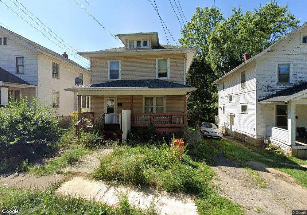
125 Rae Ave Mansfield, OH 44903
Estimated Value: $74,785 - $82,000
3
Beds
1
Bath
1,449
Sq Ft
$54/Sq Ft
Est. Value
About This Home
This home is located at 125 Rae Ave, Mansfield, OH 44903 and is currently estimated at $78,696, approximately $54 per square foot. 125 Rae Ave is a home located in Richland County with nearby schools including Goal Digital Academy, Mansfield Elective Academy, and Interactive Media & Construction (IMAC) Academy.
Ownership History
Date
Name
Owned For
Owner Type
Purchase Details
Closed on
Feb 13, 2023
Sold by
Towd Point Master Funding Trust
Bought by
Boomtown Investments Llc
Current Estimated Value
Purchase Details
Closed on
Jan 19, 2023
Sold by
Sheldon J Steve
Bought by
Towd Point Master Funding Trust
Purchase Details
Closed on
Jul 28, 1997
Sold by
Henry Kenneth H
Bought by
Haney Edmond
Home Financials for this Owner
Home Financials are based on the most recent Mortgage that was taken out on this home.
Original Mortgage
$40,787
Interest Rate
7.81%
Mortgage Type
FHA
Create a Home Valuation Report for This Property
The Home Valuation Report is an in-depth analysis detailing your home's value as well as a comparison with similar homes in the area
Home Values in the Area
Average Home Value in this Area
Purchase History
| Date | Buyer | Sale Price | Title Company |
|---|---|---|---|
| Boomtown Investments Llc | $26,250 | Southern Title | |
| Towd Point Master Funding Trust | $20,000 | None Listed On Document | |
| Haney Edmond | $40,400 | -- |
Source: Public Records
Mortgage History
| Date | Status | Borrower | Loan Amount |
|---|---|---|---|
| Previous Owner | Haney Edmond | $40,787 |
Source: Public Records
Tax History Compared to Growth
Tax History
| Year | Tax Paid | Tax Assessment Tax Assessment Total Assessment is a certain percentage of the fair market value that is determined by local assessors to be the total taxable value of land and additions on the property. | Land | Improvement |
|---|---|---|---|---|
| 2024 | $621 | $13,260 | $1,430 | $11,830 |
| 2023 | $621 | $13,260 | $1,430 | $11,830 |
| 2022 | $0 | $8,550 | $1,380 | $7,170 |
| 2021 | $61 | $8,550 | $1,380 | $7,170 |
| 2020 | $61 | $8,550 | $1,380 | $7,170 |
| 2019 | $61 | $8,550 | $1,380 | $7,170 |
| 2018 | $29 | $8,550 | $1,380 | $7,170 |
| 2017 | $58 | $8,550 | $1,380 | $7,170 |
| 2016 | $61 | $9,710 | $2,910 | $6,800 |
| 2015 | $58 | $9,710 | $2,910 | $6,800 |
| 2014 | $57 | $9,710 | $2,910 | $6,800 |
| 2012 | $34 | $10,230 | $3,070 | $7,160 |
Source: Public Records
Map
Nearby Homes
- 170 Western Ave
- 185 Rowland Ave
- 237 Helen Ave
- 21 Glenwood Blvd
- 120 Gettings Place
- 24 Stewart Ave S
- 269 Parkway Dr
- 41 Parkwood Blvd
- 212 Penn Ave
- 78 Glenwood Blvd
- 37 Baldwin Ave
- 76 Bartley Ave
- 118 Parkwood Blvd
- 126 Dawson Ave
- 133 Stewart Ave S
- 362-364 W 6th St
- 129 Fairlawn Ave
- 37 S Linden Rd
- 114 Vennum Ave
- 135 Fairlawn Ave