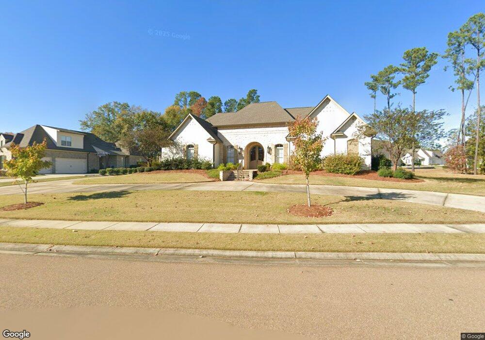
125 Wethersfield Dr Madison, MS 39110
Estimated Value: $748,443 - $820,000
5
Beds
5
Baths
3,898
Sq Ft
$201/Sq Ft
Est. Value
About This Home
This home is located at 125 Wethersfield Dr, Madison, MS 39110 and is currently estimated at $784,222, approximately $201 per square foot. 125 Wethersfield Dr is a home located in Madison County with nearby schools including Madison Avenue Upper Elementary School, Madison Avenue Elementary, and Madison Middle School.
Ownership History
Date
Name
Owned For
Owner Type
Purchase Details
Closed on
Jul 3, 2023
Sold by
Pro Building Systems Llc
Bought by
Ware Tonya H and Ware Adrian D
Current Estimated Value
Home Financials for this Owner
Home Financials are based on the most recent Mortgage that was taken out on this home.
Original Mortgage
$491,000
Outstanding Balance
$477,789
Interest Rate
6.57%
Mortgage Type
New Conventional
Estimated Equity
$306,433
Purchase Details
Closed on
Sep 30, 2016
Sold by
Ashton Park Llc
Bought by
Pro Building Systems Llc
Create a Home Valuation Report for This Property
The Home Valuation Report is an in-depth analysis detailing your home's value as well as a comparison with similar homes in the area
Home Values in the Area
Average Home Value in this Area
Purchase History
| Date | Buyer | Sale Price | Title Company |
|---|---|---|---|
| Ware Tonya H | -- | None Listed On Document | |
| Ware Tonya H | -- | None Listed On Document | |
| Pro Building Systems Llc | -- | Luckett Land Title |
Source: Public Records
Mortgage History
| Date | Status | Borrower | Loan Amount |
|---|---|---|---|
| Open | Ware Tonya H | $491,000 | |
| Closed | Ware Tonya H | $491,000 |
Source: Public Records
Tax History
| Year | Tax Paid | Tax Assessment Tax Assessment Total Assessment is a certain percentage of the fair market value that is determined by local assessors to be the total taxable value of land and additions on the property. | Land | Improvement |
|---|---|---|---|---|
| 2025 | $5,705 | $51,534 | $0 | $0 |
| 2024 | $5,705 | $51,534 | $0 | $0 |
| 2023 | $9,008 | $77,301 | $0 | $0 |
| 2022 | $9,008 | $77,301 | $0 | $0 |
| 2021 | $8,633 | $74,082 | $0 | $0 |
| 2020 | $1,136 | $74,082 | $0 | $0 |
| 2019 | $1,136 | $9,750 | $0 | $0 |
| 2018 | $1,136 | $9,750 | $0 | $0 |
| 2017 | $0 | $5,850 | $0 | $0 |
Source: Public Records
Map
Nearby Homes
- 116 Carrington Dr
- 133 Oak Ridge Cir
- 213 Ironwood Plantation Blvd
- 186 Ironwood Plantation Blvd
- 116 Anna Cove
- 504 Ironwood Ct
- 114 Anna Cove
- 112 Saddle Creek Cove
- 213 S Woodcreek Rd
- 106 Shadow Hill Dr
- 115 Shadow Hill Dr
- 101 Saddle Creek Cove
- 133 Shadow Hill Dr
- 441 W Oak Cir
- 102 Channel Ln
- 0 Cottesbrooke Cir Unit 4122984
- 222 Trace Harbor Rd
- 268 Sundial Rd
- 202 Saint Pierre Cove
- 157 Quail Hollow
- 127 Wethersfield Dr
- 125 Winterbury Dr
- 129 Wethersfield Dr
- 126 Wethersfield Dr
- 128 Wethersfield Dr
- 158 Carrington Dr
- 130 Wethersfield Dr
- 120 Carrington Dr
- 115 Wethersfield Dr
- 154 Carrington Dr
- 117 Winterbury Dr
- 116 Winterbury Dr
- 113 Wethersfield Dr
- 114 Carrington Dr
- 100 Carrington Dr
- 0 Carrington Dr Unit Lot 31 1179160
- 0 Carrington Dr Unit Lot 37
- 142 Carrington Dr
- 128 Carrington Dr
- 114 Winterbury Dr
Your Personal Tour Guide
Ask me questions while you tour the home.