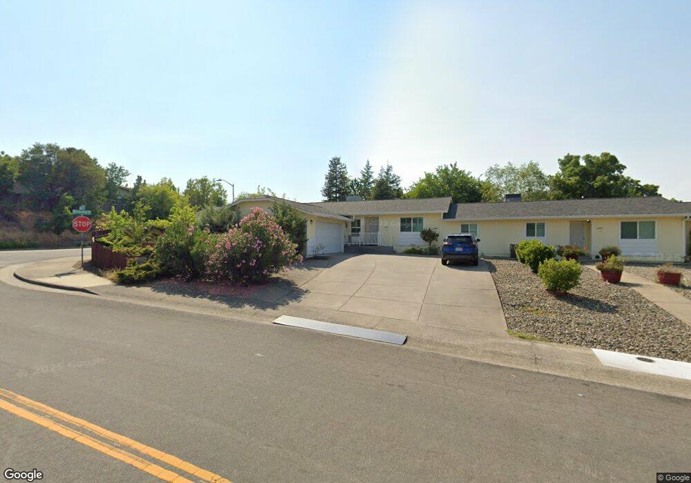
1250 Gabriel St Unit 2 Redding, CA 96003
Boulder Creek NeighborhoodEstimated Value: $498,169 - $666,000
3
Beds
2
Baths
1,641
Sq Ft
$369/Sq Ft
Est. Value
About This Home
This home is located at 1250 Gabriel St Unit 2, Redding, CA 96003 and is currently estimated at $606,292, approximately $369 per square foot. 1250 Gabriel St Unit 2 is a home located in Shasta County with nearby schools including Boulder Creek Elementary School, Enterprise High School, and Montessori Children's House of Shady Oaks.
Ownership History
Date
Name
Owned For
Owner Type
Purchase Details
Closed on
Jun 29, 2022
Sold by
Holmes Albert F and Revo Joanne
Bought by
Schoenhofer Donald R and Schoenhofer Stacey S
Current Estimated Value
Purchase Details
Closed on
Apr 3, 2018
Sold by
Holmes Albert F and Holmes Joanne J
Bought by
Holmes Albert F and Holmes Joanne J
Purchase Details
Closed on
Aug 8, 2002
Sold by
Holmes Albert F and Holmes Joanne J
Bought by
Holmes Albert F and Holmes Joanne J
Purchase Details
Closed on
Dec 2, 1998
Sold by
Christensen Shirley D and Christensen Diane
Bought by
Holmes Albert F and Holmes Joanne J
Home Financials for this Owner
Home Financials are based on the most recent Mortgage that was taken out on this home.
Original Mortgage
$94,500
Interest Rate
6.86%
Mortgage Type
Purchase Money Mortgage
Create a Home Valuation Report for This Property
The Home Valuation Report is an in-depth analysis detailing your home's value as well as a comparison with similar homes in the area
Home Values in the Area
Average Home Value in this Area
Purchase History
| Date | Buyer | Sale Price | Title Company |
|---|---|---|---|
| Schoenhofer Donald R | $600,000 | Fidelity National Title | |
| Holmes Albert F | -- | None Available | |
| Holmes Albert F | -- | -- | |
| Holmes Albert F | $135,000 | Redding Title Company |
Source: Public Records
Mortgage History
| Date | Status | Borrower | Loan Amount |
|---|---|---|---|
| Previous Owner | Holmes Albert F | $94,500 |
Source: Public Records
Tax History
| Year | Tax Paid | Tax Assessment Tax Assessment Total Assessment is a certain percentage of the fair market value that is determined by local assessors to be the total taxable value of land and additions on the property. | Land | Improvement |
|---|---|---|---|---|
| 2025 | $7,118 | $624,135 | $104,040 | $520,095 |
| 2024 | $7,018 | $611,898 | $102,000 | $509,898 |
| 2023 | $7,018 | $599,900 | $100,000 | $499,900 |
| 2022 | $2,637 | $237,610 | $29,207 | $208,403 |
| 2021 | $2,572 | $232,952 | $28,635 | $204,317 |
| 2020 | $2,538 | $230,564 | $28,342 | $202,222 |
| 2019 | $2,515 | $226,044 | $27,787 | $198,257 |
| 2018 | $2,508 | $221,613 | $27,243 | $194,370 |
| 2017 | $2,548 | $217,268 | $26,709 | $190,559 |
| 2016 | $2,387 | $213,009 | $26,186 | $186,823 |
| 2015 | $2,366 | $209,810 | $25,793 | $184,017 |
| 2014 | $2,344 | $205,701 | $25,288 | $180,413 |
Source: Public Records
Map
Nearby Homes
- 1088 Burton Dr
- 1285 Lancers Ln
- 1110 Grouse Dr
- 825 Mission Sierra Ct
- 771 Flower Ash Ln
- 953 Oakmont Dr
- 856 Mission de Oro Dr
- 667 Reddington Dr
- 1991 Tiburon Dr
- 1750 Hawthorne Ct
- 651 Mission de Oro Dr
- 965 Willow Brook Ln
- 1026 Palisades Ave
- 531 Fair Hill Dr
- 790 Volcano View Trail
- 592 Mill Valley Pkwy
- 1018 Pineland Dr
- 775 Stonebriar Trail
- 720 Stonebriar Trail
- 724 Oakhurst Trail
- 1250 Gabriel St Unit 1&2
- 1250 Gabriel St
- 1247 Grouse Ct
- 1215 Grouse Ct
- 976 Grouse Dr
- 1255 Gabriel St
- 1255 Gabriel St
- 964 Grouse Dr
- 993 Grouse Dr
- 1080 Burton Dr
- 1096 Burton Dr
- 1279 Grouse Ct
- 1279 Grouse Ct
- 1008 Grouse Dr
- 975 Grouse Dr
- 1072 Burton Dr
- 1212 Grouse Ct
- 1005 Grouse Dr
- 963 Grouse Dr
- 1014 Grouse Dr
Your Personal Tour Guide
Ask me questions while you tour the home.