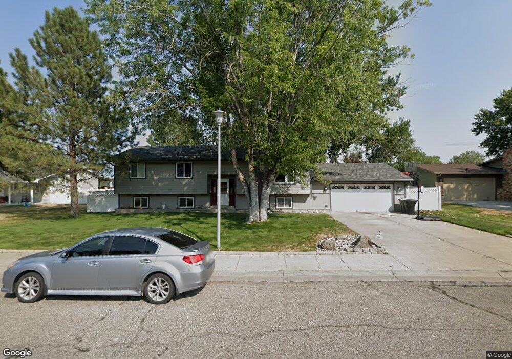
1251 Hardrock Ln Billings, MT 59105
Billings Heights NeighborhoodEstimated Value: $407,000 - $427,000
4
Beds
3
Baths
2,686
Sq Ft
$154/Sq Ft
Est. Value
About This Home
This home is located at 1251 Hardrock Ln, Billings, MT 59105 and is currently estimated at $414,244, approximately $154 per square foot. 1251 Hardrock Ln is a home located in Yellowstone County with nearby schools including Sandstone School, Castle Rock Junior High School, and Skyview High School.
Ownership History
Date
Name
Owned For
Owner Type
Purchase Details
Closed on
Aug 17, 2022
Sold by
Grove Steve E
Bought by
Derudder Ian A and Kern Heather R
Current Estimated Value
Home Financials for this Owner
Home Financials are based on the most recent Mortgage that was taken out on this home.
Original Mortgage
$380,000
Outstanding Balance
$362,684
Interest Rate
5.3%
Mortgage Type
New Conventional
Estimated Equity
$51,560
Purchase Details
Closed on
May 30, 2008
Sold by
Hobbs Mary Ann
Bought by
Grove Steve E and Grove Cathy R
Create a Home Valuation Report for This Property
The Home Valuation Report is an in-depth analysis detailing your home's value as well as a comparison with similar homes in the area
Home Values in the Area
Average Home Value in this Area
Purchase History
| Date | Buyer | Sale Price | Title Company |
|---|---|---|---|
| Derudder Ian A | -- | First Montana Title Company | |
| Grove Steve E | -- | None Available |
Source: Public Records
Mortgage History
| Date | Status | Borrower | Loan Amount |
|---|---|---|---|
| Open | Derudder Ian A | $380,000 |
Source: Public Records
Tax History Compared to Growth
Tax History
| Year | Tax Paid | Tax Assessment Tax Assessment Total Assessment is a certain percentage of the fair market value that is determined by local assessors to be the total taxable value of land and additions on the property. | Land | Improvement |
|---|---|---|---|---|
| 2025 | $3,699 | $403,000 | $65,847 | $337,153 |
| 2024 | $3,699 | $365,800 | $65,301 | $300,499 |
| 2023 | $3,701 | $365,800 | $65,301 | $300,499 |
| 2022 | $3,163 | $271,900 | $0 | $0 |
| 2021 | $3,005 | $271,900 | $0 | $0 |
| 2020 | $2,882 | $247,800 | $0 | $0 |
| 2019 | $2,757 | $247,800 | $0 | $0 |
| 2018 | $2,713 | $239,300 | $0 | $0 |
| 2017 | $2,215 | $239,300 | $0 | $0 |
| 2016 | $2,412 | $219,500 | $0 | $0 |
| 2015 | $2,361 | $219,500 | $0 | $0 |
| 2014 | $2,177 | $106,795 | $0 | $0 |
Source: Public Records
Map
Nearby Homes
- 69 Nugget Place
- 1029 Nutter Blvd
- 1410 Twin Oaks Dr
- 1422 Watson Peak Rd
- 218 Reda Ln Unit 4
- 218 Reda Ln Unit 3
- 225 Windsor Cir N
- 228 Nash Ln
- 277 Westchester Square S
- 1443 Twin Oaks Dr
- 1322 Babcock Cir
- TBD Saint Andrews Dr
- 385 Prospectors Ln
- 320 Stewart Ct N
- 324 Stewart Ct N
- 211 Stillwater Ln
- 130 132 Stillwater Ln
- lot 12 Southern Sky Estates
- 1717 Sylvan Ln
- 475 Republic Ave
- 1261 Hardrock Ln
- 1241 Hardrock Ln
- 1260 Calendula Cir
- 1231 Hardrock Ln
- 1271 Hardrock Ln
- 1250 Hardrock Ln
- 1240 Hardrock Ln
- 1260 Hardrock Ln
- 1248 Calendula Cir
- 1221 Hardrock Ln
- 1230 Hardrock Ln
- 1270 Hardrock Ln
- 1281 Hardrock Ln
- 1220 Hardrock Ln
- 1281 Grubstake Cir
- 1211 Hardrock Ln
- 1251 Grubstake Cir
- 1261 Grubstake Cir
- 1301 Hardrock Ln
- 1271 Grubstake Cir