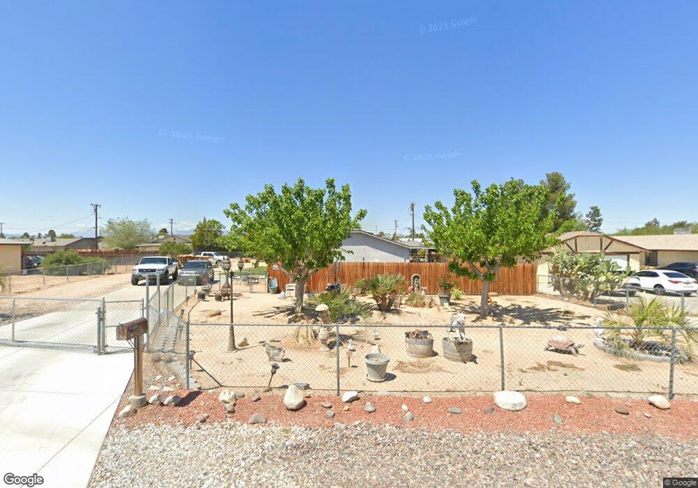
12530 Red Wing Rd Apple Valley, CA 92308
High Desert NeighborhoodEstimated Value: $348,463 - $389,000
3
Beds
2
Baths
1,100
Sq Ft
$339/Sq Ft
Est. Value
About This Home
This home is located at 12530 Red Wing Rd, Apple Valley, CA 92308 and is currently estimated at $372,366, approximately $338 per square foot. 12530 Red Wing Rd is a home located in San Bernardino County with nearby schools including Yucca Loma Elementary School and Apple Valley High School.
Ownership History
Date
Name
Owned For
Owner Type
Purchase Details
Closed on
Feb 17, 2004
Sold by
Smith William R
Bought by
Cortez Gonzalo
Current Estimated Value
Home Financials for this Owner
Home Financials are based on the most recent Mortgage that was taken out on this home.
Original Mortgage
$82,925
Outstanding Balance
$38,378
Interest Rate
5.64%
Mortgage Type
Purchase Money Mortgage
Estimated Equity
$333,988
Purchase Details
Closed on
May 15, 2000
Sold by
Smith William R
Bought by
Smith William R
Home Financials for this Owner
Home Financials are based on the most recent Mortgage that was taken out on this home.
Original Mortgage
$48,750
Interest Rate
8.18%
Purchase Details
Closed on
Sep 8, 1998
Sold by
Smith William R and Smith William R
Bought by
Smith William R and Smith William Robert
Create a Home Valuation Report for This Property
The Home Valuation Report is an in-depth analysis detailing your home's value as well as a comparison with similar homes in the area
Home Values in the Area
Average Home Value in this Area
Purchase History
| Date | Buyer | Sale Price | Title Company |
|---|---|---|---|
| Cortez Gonzalo | $86,000 | Fidelity National Title Co | |
| Smith William R | -- | Landsafe Title | |
| Smith William R | -- | First American Title Ins Co |
Source: Public Records
Mortgage History
| Date | Status | Borrower | Loan Amount |
|---|---|---|---|
| Open | Cortez Gonzalo | $82,925 | |
| Previous Owner | Smith William R | $48,750 |
Source: Public Records
Tax History
| Year | Tax Paid | Tax Assessment Tax Assessment Total Assessment is a certain percentage of the fair market value that is determined by local assessors to be the total taxable value of land and additions on the property. | Land | Improvement |
|---|---|---|---|---|
| 2025 | $1,523 | $122,275 | $24,455 | $97,820 |
| 2024 | $1,481 | $119,877 | $23,975 | $95,902 |
| 2023 | $1,466 | $117,527 | $23,505 | $94,022 |
| 2022 | $1,444 | $115,222 | $23,044 | $92,178 |
| 2021 | $1,411 | $112,963 | $22,592 | $90,371 |
| 2020 | $1,394 | $111,804 | $22,360 | $89,444 |
| 2019 | $1,687 | $109,612 | $21,922 | $87,690 |
| 2018 | $1,335 | $107,463 | $21,492 | $85,971 |
| 2017 | $1,316 | $105,356 | $21,071 | $84,285 |
| 2016 | $1,236 | $103,290 | $20,658 | $82,632 |
| 2015 | -- | $101,739 | $20,348 | $81,391 |
| 2014 | $1,201 | $99,746 | $19,949 | $79,797 |
Source: Public Records
Map
Nearby Homes
- 21021 Geronimo Rd
- 0 Matawan Rd
- 12850 Lakota Rd
- 0 Rancho Rd Unit HD26024460
- 12655 Pocono Rd
- 20958 Nisqually Rd
- 12765 Pocomoke Rd
- 21215 Multnomah Rd
- 20592 Mockingbird Ave
- 12443 Bannock Dr
- 20404 Half Moon Ct
- 20726 Nisqually Rd
- 21100 Bear Valley Rd
- 21275 Pocomoke Rd
- 12563 Sarsi Ct
- 20715 Teton Rd
- 12574 Sarsi Ct
- 20365 Hohokam Rd
- 21224 Vidal Ct
- 13100 Skiomah Rd
- 12540 Red Wing Rd
- 20965 Geronimo Rd
- 12535 Kiowa Rd Unit 1-3
- 12535 Kiowa Rd Unit 1
- 12535 Kiowa Rd Unit 3
- 12535 Kiowa Rd
- 12525 Kiowa Rd Unit 2
- 12525 Kiowa Rd Unit 1
- 12525 Kiowa Rd Unit 3
- 12525 Kiowa Rd
- 12560 Redwing Rd
- 12551 Kiowa Rd Unit 2
- 12551 Kiowa Rd
- 12545 Red Wing Rd
- 20975 Geronimo Rd
- 12511 Kiowa Rd
- 12565 Kiowa Rd
- 12580 Red Wing Rd
- 20934 Pahute Rd Unit A
- 20934 Pahute Rd
Your Personal Tour Guide
Ask me questions while you tour the home.