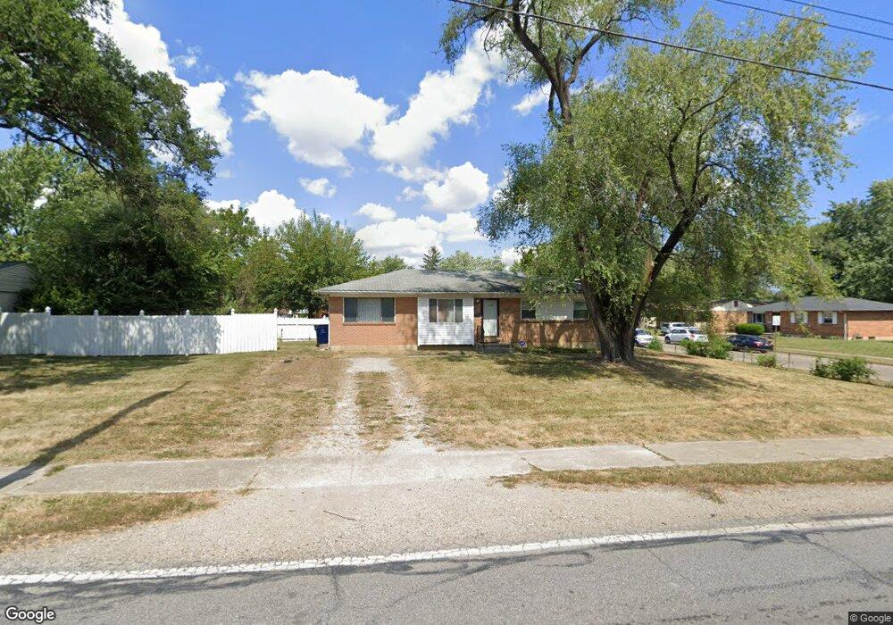
1254 Watkins Rd Columbus, OH 43207
Marion Franklin NeighborhoodEstimated Value: $163,000 - $211,000
3
Beds
1
Bath
1,184
Sq Ft
$157/Sq Ft
Est. Value
About This Home
This home is located at 1254 Watkins Rd, Columbus, OH 43207 and is currently estimated at $185,786, approximately $156 per square foot. 1254 Watkins Rd is a home located in Franklin County with nearby schools including Watkins Elementary School, Buckeye Middle School, and Marion-Franklin High School.
Ownership History
Date
Name
Owned For
Owner Type
Purchase Details
Closed on
Nov 8, 2004
Sold by
Estate Of Sadie S Martin
Bought by
Martin Robert Andrew
Current Estimated Value
Purchase Details
Closed on
Nov 5, 2004
Sold by
Martin Robert Andrew
Bought by
Guess Martin Carolyn L
Purchase Details
Closed on
Jul 2, 1974
Bought by
Martin Sadie S
Create a Home Valuation Report for This Property
The Home Valuation Report is an in-depth analysis detailing your home's value as well as a comparison with similar homes in the area
Home Values in the Area
Average Home Value in this Area
Purchase History
| Date | Buyer | Sale Price | Title Company |
|---|---|---|---|
| Martin Robert Andrew | -- | -- | |
| Guess Martin Carolyn L | -- | -- | |
| Martin Sadie S | -- | -- |
Source: Public Records
Tax History Compared to Growth
Tax History
| Year | Tax Paid | Tax Assessment Tax Assessment Total Assessment is a certain percentage of the fair market value that is determined by local assessors to be the total taxable value of land and additions on the property. | Land | Improvement |
|---|---|---|---|---|
| 2024 | $1,981 | $53,940 | $13,970 | $39,970 |
| 2023 | $1,984 | $53,935 | $13,965 | $39,970 |
| 2022 | $961 | $27,270 | $10,150 | $17,120 |
| 2021 | $962 | $27,270 | $10,150 | $17,120 |
| 2020 | $963 | $27,270 | $10,150 | $17,120 |
| 2019 | $873 | $23,140 | $8,820 | $14,320 |
| 2018 | $955 | $23,140 | $8,820 | $14,320 |
| 2017 | $1,009 | $23,140 | $8,820 | $14,320 |
| 2016 | $1,145 | $26,040 | $5,810 | $20,230 |
| 2015 | $1,040 | $26,040 | $5,810 | $20,230 |
| 2014 | $1,042 | $26,040 | $5,810 | $20,230 |
| 2013 | $555 | $27,405 | $6,125 | $21,280 |
Source: Public Records
Map
Nearby Homes
- 3018 Nuway Rd
- 1382 Southfield Dr S
- 3060 Durham Dr
- 3072 Bluefield Dr
- 2626 Diane Place
- 2685 Bulen Ave
- 1204 Koebel Rd
- 2512 Kitchner Dr
- 3172 Weirton Dr
- 2496 Navarre Rd
- 1299 Yolanda Dr
- 1138 Hilock Rd Unit 35
- 3369 Norwalk Rd
- 884 Bruckner Rd
- 868 Koebel Ave
- 868 Lawndale Ave
- 1124 Rumsey Rd
- 3551 Groveport Rd
- 3302 Hilock Place
- 780 Basswood Rd
- 2913 Pamella Dr
- 1242 Watkins Rd
- 2905 Pamella Dr
- 1236 Watkins Rd
- 2899 Pamella Dr
- 1280 Watkins Rd
- 1251 Watkins Rd
- 1257 Watkins Rd
- 2912 Pamella Dr
- 1243 Watkins Rd
- 1265 Watkins Rd
- 1245 Silverbrook Dr
- 1228 Watkins Rd
- 2904 Pamella Dr
- 1255 Silverbrook Dr
- 1237 Watkins Rd
- 1271 Watkins Rd
- 1239 Silverbrook Dr
- 2900 Pamella Dr
- 1222 Watkins Rd