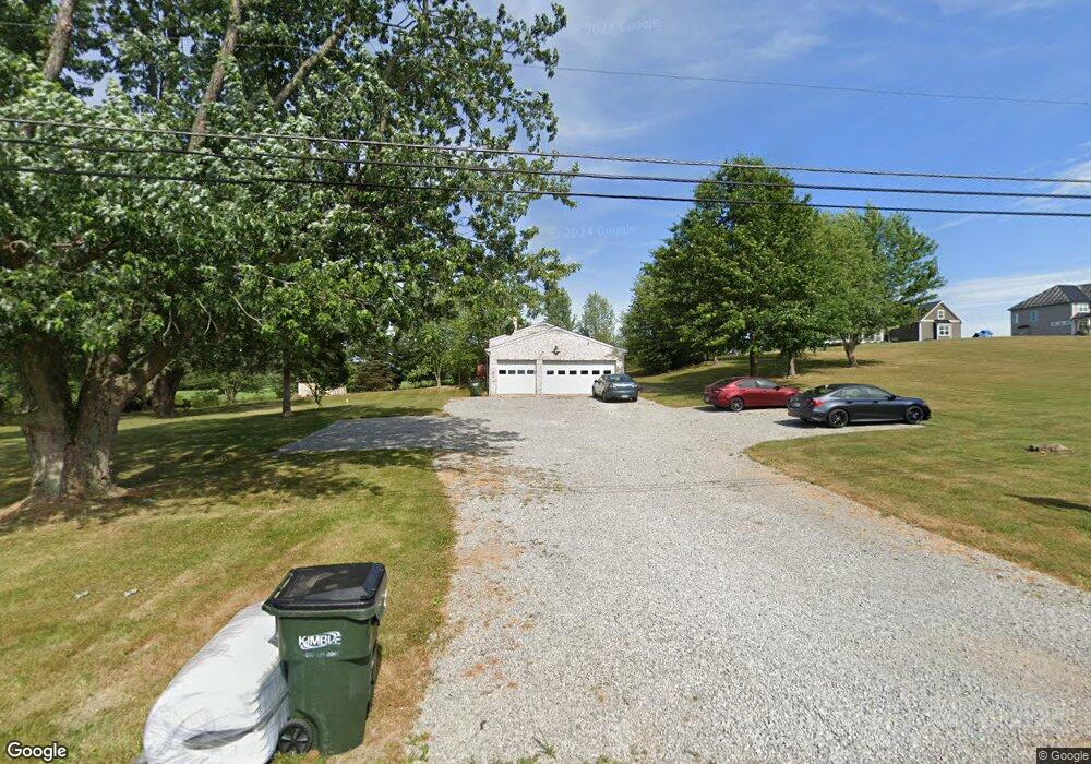
12542 Osborne Ave NE Alliance, OH 44601
Estimated Value: $204,703 - $305,000
1
Bed
1
Bath
1,456
Sq Ft
$171/Sq Ft
Est. Value
About This Home
This home is located at 12542 Osborne Ave NE, Alliance, OH 44601 and is currently estimated at $248,676, approximately $170 per square foot. 12542 Osborne Ave NE is a home located in Stark County with nearby schools including Marlington High School.
Ownership History
Date
Name
Owned For
Owner Type
Purchase Details
Closed on
Jul 30, 2021
Sold by
Jurecki Deborah S
Bought by
Carrero Al and Carrero Diana
Current Estimated Value
Home Financials for this Owner
Home Financials are based on the most recent Mortgage that was taken out on this home.
Original Mortgage
$136,500
Outstanding Balance
$124,177
Interest Rate
2.93%
Mortgage Type
New Conventional
Estimated Equity
$124,500
Purchase Details
Closed on
Nov 17, 2005
Sold by
Fuller Doris L
Bought by
Jurecki Deborah S
Purchase Details
Closed on
Jan 4, 1993
Purchase Details
Closed on
Aug 24, 1992
Create a Home Valuation Report for This Property
The Home Valuation Report is an in-depth analysis detailing your home's value as well as a comparison with similar homes in the area
Home Values in the Area
Average Home Value in this Area
Purchase History
| Date | Buyer | Sale Price | Title Company |
|---|---|---|---|
| Carrero Al | $182,000 | Patriot Title Agency Inc | |
| Jurecki Deborah S | -- | -- | |
| -- | $93,000 | -- | |
| -- | $93,000 | -- |
Source: Public Records
Mortgage History
| Date | Status | Borrower | Loan Amount |
|---|---|---|---|
| Open | Carrero Al | $136,500 |
Source: Public Records
Tax History Compared to Growth
Tax History
| Year | Tax Paid | Tax Assessment Tax Assessment Total Assessment is a certain percentage of the fair market value that is determined by local assessors to be the total taxable value of land and additions on the property. | Land | Improvement |
|---|---|---|---|---|
| 2025 | -- | $60,900 | $13,930 | $46,970 |
| 2024 | -- | $60,900 | $13,930 | $46,970 |
| 2023 | $1,992 | $52,990 | $11,200 | $41,790 |
| 2022 | $1,999 | $52,990 | $11,200 | $41,790 |
| 2021 | $2,316 | $62,510 | $12,040 | $50,470 |
| 2020 | $2,110 | $52,190 | $10,120 | $42,070 |
| 2019 | $2,095 | $52,190 | $10,120 | $42,070 |
| 2018 | $2,000 | $52,190 | $10,120 | $42,070 |
| 2017 | $3,202 | $49,430 | $8,830 | $40,600 |
| 2016 | $4,093 | $49,430 | $8,830 | $40,600 |
| 2015 | $509 | $49,430 | $8,830 | $40,600 |
| 2014 | $1,931 | $43,060 | $7,670 | $35,390 |
| 2013 | $945 | $43,060 | $7,670 | $35,390 |
Source: Public Records
Map
Nearby Homes
- 8736 Lynn Park St NE
- 14265 Reeder Ave NE
- 6180 Edison St NE
- 7377 Pontius St NE
- 0 New Milford Rd Unit 5119787
- 167 State Route 44
- 3952 Laubert Rd
- 4829 Laubert Rd
- 0 Pontius St NE
- 3990 Edison St NE
- 12561 Duquette Ave NE
- 12355 Edison St NE
- 12415 Snode St NE
- 5615 Laubert Rd
- 14920 Mccallum Ave NE
- 11960 Freshley Ave NE
- 10666 Wilma Ave NE
- 13004 Edison St NE
- 13109 Edison St NE
- 545 E Maple St
- 12540 Osborne Ave NE
- 12467 Osborne Ave NE
- 12488 Osborne Ave NE
- 12470 Osborne Ave NE
- 0 Osborne Ave NE Unit 3967721
- 8585 Edison St
- 12707 Osborne Ave NE
- 8640 Lynnett St NE
- 8670 Lynnett St NE
- 8647 Edison St NE
- 8586 Edison St NE
- 12656 Osborne Ave NE
- 8630 Edison St NE
- 8700 Lynnett St NE
- 8639 Lynnett St NE
- 8775 Edison St
- 8687 Lynnett St NE
- 8795 Edison St
- 8857 Edison St NE
- 12762 Osborne Ave NE