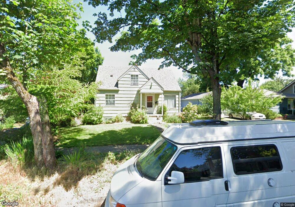
1259 W 4th Ave Eugene, OR 97402
Whiteaker NeighborhoodEstimated Value: $472,000 - $552,000
4
Beds
2
Baths
1,972
Sq Ft
$254/Sq Ft
Est. Value
About This Home
This home is located at 1259 W 4th Ave, Eugene, OR 97402 and is currently estimated at $500,755, approximately $253 per square foot. 1259 W 4th Ave is a home located in Lane County with nearby schools including River Road/El Camino del Río Elementary School, Kelly Middle School, and North Eugene High School.
Ownership History
Date
Name
Owned For
Owner Type
Purchase Details
Closed on
Sep 30, 2009
Sold by
Howells Gregory S and Howells Frances C F
Bought by
Rempel Jeff S and Gingerich Erica S
Current Estimated Value
Home Financials for this Owner
Home Financials are based on the most recent Mortgage that was taken out on this home.
Original Mortgage
$202,000
Outstanding Balance
$131,234
Interest Rate
5.14%
Mortgage Type
New Conventional
Estimated Equity
$369,521
Purchase Details
Closed on
Aug 3, 2001
Sold by
Mattson David W and Mattson Solveig R
Bought by
Howells Gregory S and Howells Frances C F
Home Financials for this Owner
Home Financials are based on the most recent Mortgage that was taken out on this home.
Original Mortgage
$126,000
Interest Rate
7.1%
Create a Home Valuation Report for This Property
The Home Valuation Report is an in-depth analysis detailing your home's value as well as a comparison with similar homes in the area
Home Values in the Area
Average Home Value in this Area
Purchase History
| Date | Buyer | Sale Price | Title Company |
|---|---|---|---|
| Rempel Jeff S | $270,000 | Fidelity National Title Insu | |
| Howells Gregory S | $140,000 | Fidelity National Title Co |
Source: Public Records
Mortgage History
| Date | Status | Borrower | Loan Amount |
|---|---|---|---|
| Open | Rempel Jeff S | $202,000 | |
| Previous Owner | Howells Gregory S | $126,000 |
Source: Public Records
Tax History
| Year | Tax Paid | Tax Assessment Tax Assessment Total Assessment is a certain percentage of the fair market value that is determined by local assessors to be the total taxable value of land and additions on the property. | Land | Improvement |
|---|---|---|---|---|
| 2025 | $3,858 | $197,985 | -- | -- |
| 2024 | $3,810 | $192,219 | -- | -- |
| 2023 | $3,810 | $186,621 | $0 | $0 |
| 2022 | $3,569 | $181,186 | $0 | $0 |
| 2021 | $3,352 | $175,909 | $0 | $0 |
| 2020 | $3,364 | $170,786 | $0 | $0 |
| 2019 | $3,249 | $165,812 | $0 | $0 |
| 2018 | $3,058 | $156,294 | $0 | $0 |
| 2017 | $2,921 | $156,294 | $0 | $0 |
| 2016 | $2,849 | $151,742 | $0 | $0 |
| 2015 | $2,767 | $147,322 | $0 | $0 |
| 2014 | $2,711 | $143,031 | $0 | $0 |
Source: Public Records
Map
Nearby Homes
- 1391 W 5th Ave
- 5713 Durst St
- 461 Blair Blvd
- 1030 W 5th Ave
- 1230 W 7th Ave
- 710 Van Buren St
- 780 Van Buren St
- 990 W 7th Ave
- 960 W 7th Ave
- 211 Monroe St
- 996 W 8th Ave
- 561 Madison St
- 561 577 Madison St
- 577 Madison St
- 9 N Monroe St Unit C
- 9 N Monroe St Unit B
- 9 N Monroe St Unit D
- 9 N Monroe St Unit A
- 1197 W 11th Ave
- 1445 W 11th Ave
Your Personal Tour Guide
Ask me questions while you tour the home.