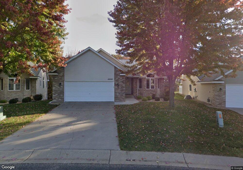
12593 Quinn St NW Coon Rapids, MN 55448
Estimated Value: $374,000 - $439,617
3
Beds
3
Baths
1,733
Sq Ft
$240/Sq Ft
Est. Value
About This Home
This home is located at 12593 Quinn St NW, Coon Rapids, MN 55448 and is currently estimated at $415,654, approximately $239 per square foot. 12593 Quinn St NW is a home located in Anoka County with nearby schools including Lucile Bruner Elementary School, Morris Bye Elementary School, and Laughlin Junior/Senior High School.
Ownership History
Date
Name
Owned For
Owner Type
Purchase Details
Closed on
Dec 5, 2017
Sold by
Nickel Vicki and Nickel Timothy
Bought by
Roy Robert A and Roy Carmen
Current Estimated Value
Purchase Details
Closed on
Apr 12, 2006
Sold by
Shamrock Builders Inc
Bought by
Nickel Timothy and Nickel Vicki
Create a Home Valuation Report for This Property
The Home Valuation Report is an in-depth analysis detailing your home's value as well as a comparison with similar homes in the area
Home Values in the Area
Average Home Value in this Area
Purchase History
| Date | Buyer | Sale Price | Title Company |
|---|---|---|---|
| Roy Robert A | $318,000 | Executive Title | |
| Nickel Timothy | $347,699 | -- |
Source: Public Records
Tax History Compared to Growth
Tax History
| Year | Tax Paid | Tax Assessment Tax Assessment Total Assessment is a certain percentage of the fair market value that is determined by local assessors to be the total taxable value of land and additions on the property. | Land | Improvement |
|---|---|---|---|---|
| 2025 | $4,571 | $439,000 | $71,500 | $367,500 |
| 2024 | $4,571 | $428,000 | $68,200 | $359,800 |
| 2023 | $3,785 | $433,300 | $71,500 | $361,800 |
| 2022 | $4,216 | $383,400 | $60,500 | $322,900 |
| 2021 | $4,034 | $377,000 | $55,000 | $322,000 |
| 2020 | $4,066 | $353,500 | $49,500 | $304,000 |
| 2019 | $3,802 | $341,800 | $49,500 | $292,300 |
| 2018 | $3,671 | $312,000 | $0 | $0 |
| 2017 | $3,465 | $292,800 | $0 | $0 |
| 2016 | $3,513 | $270,200 | $0 | $0 |
| 2015 | $3,246 | $270,200 | $38,500 | $231,700 |
| 2014 | -- | $224,500 | $21,500 | $203,000 |
Source: Public Records
Map
Nearby Homes
- 2147 125th Ln NW
- 2068 124th Ln NW
- 12760 Raven St NW
- 1930 127th Cir NW
- 12888 Nightingale St NW
- 12365 Jay St NW
- 12554 Grouse St NW
- 12759 Ibis St NW
- 2675 128th Ave NW
- 1593 126th Ln NW
- 1727 121st Ln NW
- 12463 Drake St NW
- 1450 126th Ln NW
- 1520 129th Ave NW
- 1687 131st Ln NW
- 13182 Zion St NW
- 12019 Zion St NW
- 1776 133rd Ave NW
- 13416 Swallow St NW
- 12010 Eagle St NW
- 2125 126th Ave NW
- 12581 Quinn St NW
- 12569 Quinn St NW
- 2131 126th Ave NW
- 12597 Swallow St NW
- 2065 125th Ln NW
- XXX 125th Ln NW
- 12557 Quinn St NW
- 2137 126th Ave NW
- 12593 Swallow St NW
- 2143 126th Ave NW
- 2055 125th Ln NW
- 12587 Swallow St NW
- 12594 Swallow St NW
- 2149 126th Ave NW
- 12583 Swallow St NW
- 2117 125th Ln NW
- 2123 125th Ln NW
- 12570 Shenandoah Blvd NW
- 12580 Shenandoah Blvd NW