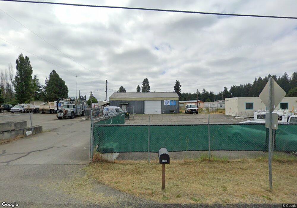
126 188th St S Spanaway, WA 98387
Estimated Value: $534,234
--
Bed
--
Bath
2,180
Sq Ft
$245/Sq Ft
Est. Value
About This Home
This home is located at 126 188th St S, Spanaway, WA 98387 and is currently estimated at $534,234, approximately $245 per square foot. 126 188th St S is a home located in Pierce County with nearby schools including Camas Prairie Elementary School, Cedarcrest Junior High School, and Spanaway Lake High School.
Ownership History
Date
Name
Owned For
Owner Type
Purchase Details
Closed on
Feb 20, 2018
Sold by
Grossruck Daniel R and Grossruck Linda M
Bought by
Spanaway Property 29 11 Llc
Current Estimated Value
Purchase Details
Closed on
Mar 23, 2017
Sold by
Patton Cynthia Sue and Gordon Patton Cynthia
Bought by
Grossruck Daniel R and Grossruck Linda M
Purchase Details
Closed on
Oct 25, 2004
Sold by
Patton Kevin Lee
Bought by
Patton Cynthia Sue and Gordon Cynthia
Purchase Details
Closed on
Jul 24, 2000
Sold by
Roy South Associates
Bought by
Patton Kevin L and Gordon Patton Cynthia S
Home Financials for this Owner
Home Financials are based on the most recent Mortgage that was taken out on this home.
Original Mortgage
$65,000
Interest Rate
8.2%
Mortgage Type
Seller Take Back
Create a Home Valuation Report for This Property
The Home Valuation Report is an in-depth analysis detailing your home's value as well as a comparison with similar homes in the area
Home Values in the Area
Average Home Value in this Area
Purchase History
| Date | Buyer | Sale Price | Title Company |
|---|---|---|---|
| Spanaway Property 29 11 Llc | -- | None Available | |
| Grossruck Daniel R | $265,219 | F A T C O | |
| Patton Cynthia Sue | -- | -- | |
| Patton Kevin L | $115,000 | Chicago Title Insurance Co |
Source: Public Records
Mortgage History
| Date | Status | Borrower | Loan Amount |
|---|---|---|---|
| Previous Owner | Patton Kevin L | $65,000 |
Source: Public Records
Tax History Compared to Growth
Tax History
| Year | Tax Paid | Tax Assessment Tax Assessment Total Assessment is a certain percentage of the fair market value that is determined by local assessors to be the total taxable value of land and additions on the property. | Land | Improvement |
|---|---|---|---|---|
| 2025 | $4,979 | $517,200 | $441,300 | $75,900 |
| 2024 | $4,979 | $348,100 | $268,100 | $80,000 |
| 2023 | $4,979 | $343,000 | $268,100 | $74,900 |
| 2022 | $4,806 | $347,700 | $268,100 | $79,600 |
| 2021 | $4,745 | $291,800 | $234,200 | $57,600 |
| 2019 | $3,736 | $297,200 | $211,600 | $85,600 |
| 2018 | $6,999 | $270,400 | $207,200 | $63,200 |
| 2017 | $7,013 | $441,900 | $256,500 | $185,400 |
| 2016 | $7,381 | $441,900 | $256,500 | $185,400 |
| 2014 | $7,143 | $441,900 | $256,500 | $185,400 |
| 2013 | $7,143 | $441,900 | $256,500 | $185,400 |
Source: Public Records
Map
Nearby Homes
- 205 187th St E
- 2 189th Street Ct E
- Plan 2605 at Rolling Brook
- Plan 2755 at Rolling Brook
- Plan 2330 Modeled at Rolling Brook
- Plan 2230 at Rolling Brook
- Plan 2070 at Rolling Brook
- Plan 1990 at Rolling Brook
- Plan 1870 at Rolling Brook
- Plan 1860 Modeled at Rolling Brook
- Plan 1630 at Rolling Brook
- 336 185th Street Ct E Unit 1
- 511 190th St E
- 18512 4th Avenue Ct E Unit 14
- 450 185th Street Ct E Unit 22
- 450 185th St E
- 454 185th Street Ct E Unit 23
- 451 185th Street Ct E Unit 16
- 458 185th Street Ct E
- 458 185th Street Ct E Unit 24
- 18829 Pacific Ave S
- 18720 1st Avenue Ct S
- 3705 189th St E
- 3715 189th St E
- 3741 189th St E
- 3739 189th St E
- 18216 1st Avenue Ct S
- 18702 1st Avenue Ct S
- 18621 1st Avenue Ct S
- 18618 A St S
- 18611 1st Avenue Ct S
- 18612 A St S
- 18812 2nd Ave E
- 18920 Pacific Ave S
- 18806 2nd Ave E
- 18818 2nd Ave E
- 18710 2nd Ave E
- 18916 2nd Ave E
- 18702 2nd Ave E
- 18918 2nd Ave E