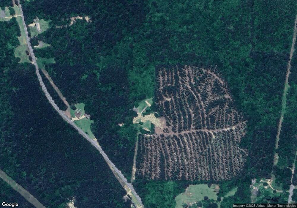
126 Fred Jones Rd Braxton, MS 39044
Estimated Value: $70,746 - $149,000
Studio
--
Bath
925
Sq Ft
$113/Sq Ft
Est. Value
About This Home
This home is located at 126 Fred Jones Rd, Braxton, MS 39044 and is currently estimated at $104,687, approximately $113 per square foot. 126 Fred Jones Rd is a home located in Simpson County with nearby schools including Mendenhall Elementary School, Mendenhall Junior High School, and Mendenhall High School.
Ownership History
Date
Name
Owned For
Owner Type
Purchase Details
Closed on
Dec 10, 2024
Sold by
Jones Pamela M and Mikell Pamela M
Bought by
Harrington Amanda
Current Estimated Value
Home Financials for this Owner
Home Financials are based on the most recent Mortgage that was taken out on this home.
Original Mortgage
$62,464
Interest Rate
6.54%
Mortgage Type
Construction
Purchase Details
Closed on
Dec 9, 2011
Sold by
Keys Elijah
Bought by
Jones Pamela M
Create a Home Valuation Report for This Property
The Home Valuation Report is an in-depth analysis detailing your home's value as well as a comparison with similar homes in the area
Purchase History
| Date | Buyer | Sale Price | Title Company |
|---|---|---|---|
| Harrington Amanda | -- | None Listed On Document | |
| Harrington Amanda | -- | None Listed On Document | |
| Harrington Amanda | -- | None Listed On Document | |
| Jones Pamela M | -- | -- |
Source: Public Records
Mortgage History
| Date | Status | Borrower | Loan Amount |
|---|---|---|---|
| Closed | Harrington Amanda | $62,464 |
Source: Public Records
Tax History
| Year | Tax Paid | Tax Assessment Tax Assessment Total Assessment is a certain percentage of the fair market value that is determined by local assessors to be the total taxable value of land and additions on the property. | Land | Improvement |
|---|---|---|---|---|
| 2025 | $560 | $4,896 | $0 | $0 |
| 2024 | $560 | $2,960 | $0 | $0 |
| 2023 | $217 | $2,945 | $0 | $0 |
| 2022 | $184 | $2,650 | $0 | $0 |
| 2021 | $178 | $2,650 | $0 | $0 |
| 2020 | $173 | $2,543 | $0 | $0 |
| 2019 | $161 | $2,543 | $0 | $0 |
| 2018 | $161 | $2,543 | $0 | $0 |
| 2017 | $161 | $2,543 | $0 | $0 |
| 2016 | $142 | $2,448 | $0 | $0 |
| 2015 | $133 | $2,448 | $0 | $0 |
| 2014 | $133 | $2,448 | $0 | $0 |
Source: Public Records
Map
Nearby Homes
- 0 Hwy 49 Unit 4110472
- 0 Mississippi 149
- 811 N Maple Dr
- 104 Willow St
- 1739 Saint John Rd
- 0 Christian Heights Rd
- 0 Campbell Creek Rd
- 0 E-S Dr Unit 4130813
- 0 Simpson Highway 13 Unit 4111635
- 0 Hwy 13 Hwy Unit 4131982
- 000 Hwy 13 Hwy
- 0 Hwy 13 Hwy Unit 145578
- 0 Hwy 13 Hwy
- 503 Mississippi 13
- 0 Mississippi 13 Unit 4137027
- 00 Mississippi 13
- 1002 Mark Dr
- 278 Poplar Springs Rd
- 0 Jack Rd
- 2794 Simpson Hwy 13
- 2027 Saint John Rd
- 2068 John Rd
- 2068 Saint John Rd
- 1991 St. Johns Rd
- 2074 Saint John Rd
- 1991 Saint John Rd
- 1991 St John Rd
- 1983 Saint John Rd
- 1969 Saint John Rd
- 107 Rock Dr
- 112 Donnell Dr
- 1974 Saint John Rd
- 2341 Simpson Highway 149
- 4418 Simpson Highway 49
- 3678 Cato Rd
- 1961 Saint John Rd
- 109 Isberto Dr
- 1952 Saint John Rd
- 1943 Saint John Rd
- 2116 Saint John Rd
Your Personal Tour Guide
Ask me questions while you tour the home.
