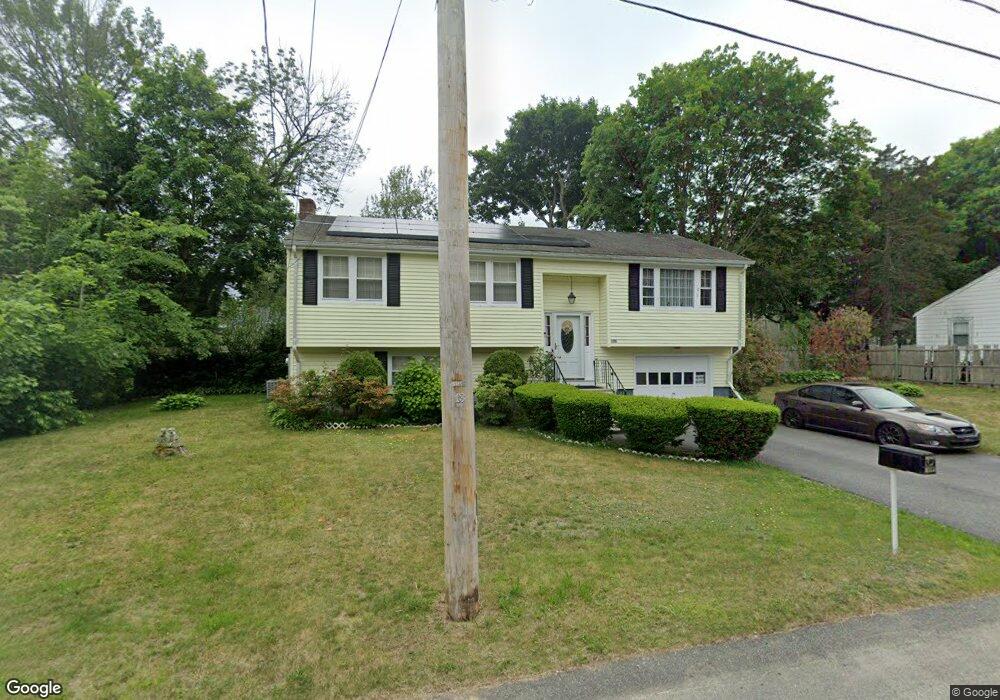
126 Hubbard Ave Brockton, MA 02301
Campello NeighborhoodEstimated Value: $570,989 - $624,000
3
Beds
2
Baths
1,769
Sq Ft
$333/Sq Ft
Est. Value
About This Home
This home is located at 126 Hubbard Ave, Brockton, MA 02301 and is currently estimated at $588,247, approximately $332 per square foot. 126 Hubbard Ave is a home located in Plymouth County with nearby schools including Gilmore Elementary School, Davis K-8 School, and John F. Kennedy Elementary School.
Ownership History
Date
Name
Owned For
Owner Type
Purchase Details
Closed on
Nov 23, 2021
Sold by
Goncalves Eugenia M and Goncalves Jose L
Bought by
Goncalves Family 2021 Ret
Current Estimated Value
Purchase Details
Closed on
Mar 11, 1991
Sold by
Lloyd Owen H T and Lloyd Beverly A
Bought by
Lopes Maria G and Gonsalves Eugenia M
Home Financials for this Owner
Home Financials are based on the most recent Mortgage that was taken out on this home.
Original Mortgage
$90,000
Interest Rate
9.51%
Mortgage Type
Purchase Money Mortgage
Create a Home Valuation Report for This Property
The Home Valuation Report is an in-depth analysis detailing your home's value as well as a comparison with similar homes in the area
Home Values in the Area
Average Home Value in this Area
Purchase History
| Date | Buyer | Sale Price | Title Company |
|---|---|---|---|
| Goncalves Family 2021 Ret | -- | None Available | |
| Lopes Maria G | $120,000 | -- |
Source: Public Records
Mortgage History
| Date | Status | Borrower | Loan Amount |
|---|---|---|---|
| Previous Owner | Lopes Maria G | $90,000 | |
| Previous Owner | Lopes Maria G | $40,000 |
Source: Public Records
Tax History Compared to Growth
Tax History
| Year | Tax Paid | Tax Assessment Tax Assessment Total Assessment is a certain percentage of the fair market value that is determined by local assessors to be the total taxable value of land and additions on the property. | Land | Improvement |
|---|---|---|---|---|
| 2025 | $6,124 | $505,700 | $160,600 | $345,100 |
| 2024 | $5,731 | $476,800 | $160,600 | $316,200 |
| 2023 | $5,546 | $427,300 | $110,900 | $316,400 |
| 2022 | $5,120 | $366,500 | $100,800 | $265,700 |
| 2021 | $4,956 | $341,800 | $93,700 | $248,100 |
| 2020 | $5,139 | $339,200 | $82,200 | $257,000 |
| 2019 | $5,058 | $325,500 | $78,500 | $247,000 |
| 2018 | $4,744 | $295,400 | $78,500 | $216,900 |
| 2017 | $4,373 | $271,600 | $78,500 | $193,100 |
| 2016 | $4,352 | $250,700 | $74,900 | $175,800 |
| 2015 | $4,214 | $232,200 | $74,900 | $157,300 |
| 2014 | $3,941 | $217,400 | $74,900 | $142,500 |
Source: Public Records
Map
Nearby Homes
- 358 Copeland St
- 15 Longworth Ave Unit 231
- 13 Finny's Way
- 35 Longworth Ave Unit 17
- 15 Fieldstone Dr
- 1 Fairway Dr
- 47 Southworth St
- 1435 Main St
- 57 Copeland St
- 15 Otto St
- 21 Roosevelt Ave
- 163 S Leyden St
- 115 Market St
- 16 Friendship Dr
- 223 Clinton St Unit 10
- 223 Clinton St Unit 3
- 223 Clinton St Unit 16
- 65 Tremont St
- 18 American Ave
- 1036 Ash St
- 130 Hubbard Ave
- 110 Hubbard Ave
- 67 Glendale Ave
- 71 Glendale Ave
- 63 Glendale Ave
- 77 Glendale Ave
- 125 Hubbard Ave
- 104 Hubbard Ave
- 81 Glendale Ave
- 57 Glendale Ave
- 133 Hubbard Ave
- 138 Hubbard Ave
- 115 Hubbard Ave
- 87 Glendale Ave
- 142 Hubbard Ave
- 137 Hubbard Ave
- 74 Glendale Ave
- 68 Glendale Ave
- 64 Glendale Ave
- 80 Glendale Ave