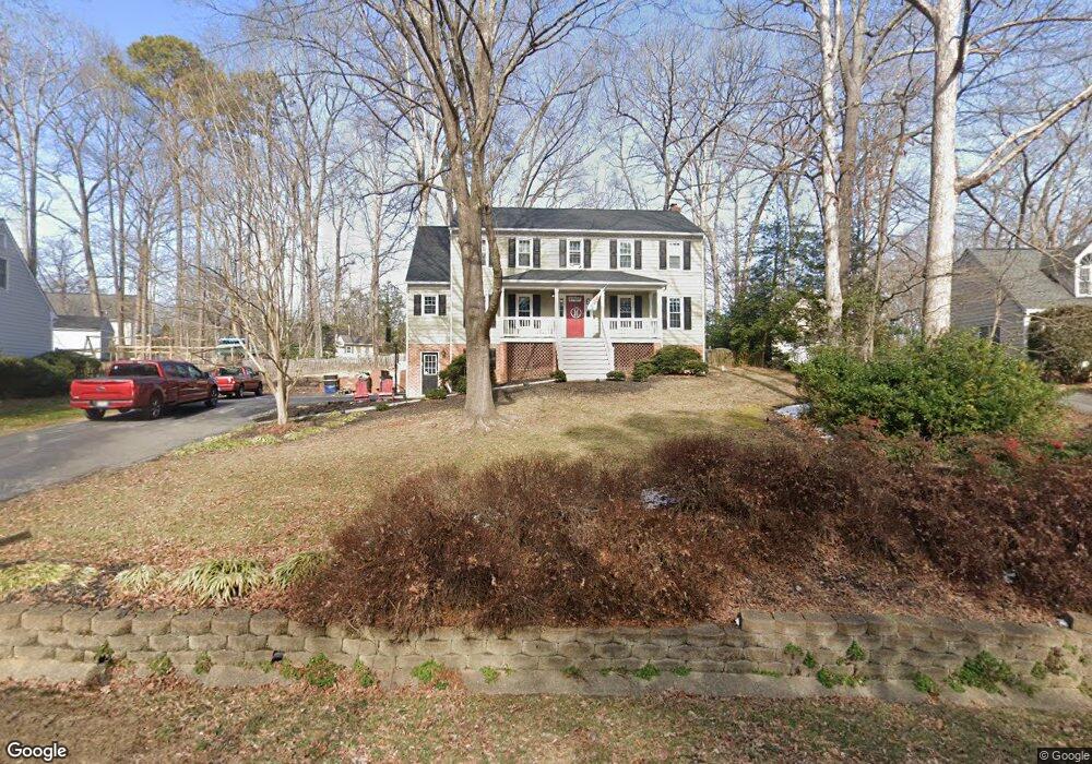
12612 Queensgate Rd Midlothian, VA 23114
Estimated Value: $541,000 - $585,108
4
Beds
4
Baths
3,168
Sq Ft
$179/Sq Ft
Est. Value
About This Home
This home is located at 12612 Queensgate Rd, Midlothian, VA 23114 and is currently estimated at $568,277, approximately $179 per square foot. 12612 Queensgate Rd is a home located in Chesterfield County with nearby schools including J B Watkins Elementary School, Midlothian Middle School, and Midlothian High School.
Ownership History
Date
Name
Owned For
Owner Type
Purchase Details
Closed on
Sep 29, 2004
Sold by
Leake Raymond
Bought by
Krohn Douglas
Current Estimated Value
Purchase Details
Closed on
Feb 2, 1999
Sold by
Dziuba Stanley J
Bought by
Leake Raymond I and Leake Carla W
Home Financials for this Owner
Home Financials are based on the most recent Mortgage that was taken out on this home.
Original Mortgage
$164,350
Interest Rate
6.67%
Mortgage Type
New Conventional
Create a Home Valuation Report for This Property
The Home Valuation Report is an in-depth analysis detailing your home's value as well as a comparison with similar homes in the area
Home Values in the Area
Average Home Value in this Area
Purchase History
| Date | Buyer | Sale Price | Title Company |
|---|---|---|---|
| Krohn Douglas | $263,960 | -- | |
| Leake Raymond I | $173,000 | -- |
Source: Public Records
Mortgage History
| Date | Status | Borrower | Loan Amount |
|---|---|---|---|
| Previous Owner | Leake Raymond I | $164,350 |
Source: Public Records
Tax History
| Year | Tax Paid | Tax Assessment Tax Assessment Total Assessment is a certain percentage of the fair market value that is determined by local assessors to be the total taxable value of land and additions on the property. | Land | Improvement |
|---|---|---|---|---|
| 2025 | $4,704 | $525,700 | $81,000 | $444,700 |
| 2024 | $4,704 | $508,500 | $76,000 | $432,500 |
| 2023 | $4,258 | $467,900 | $76,000 | $391,900 |
| 2022 | $3,985 | $433,200 | $73,000 | $360,200 |
| 2021 | $3,587 | $374,900 | $71,000 | $303,900 |
| 2020 | $3,484 | $366,700 | $71,000 | $295,700 |
| 2019 | $3,411 | $359,000 | $71,000 | $288,000 |
| 2018 | $3,225 | $339,500 | $68,000 | $271,500 |
| 2017 | $3,192 | $332,500 | $68,000 | $264,500 |
| 2016 | $3,127 | $325,700 | $66,000 | $259,700 |
| 2015 | $2,912 | $300,700 | $64,000 | $236,700 |
| 2014 | $2,850 | $294,300 | $62,000 | $232,300 |
Source: Public Records
Map
Nearby Homes
- 12402 Beauridge Ct
- 1106 Johanna Bay Dr
- 12031 Gordon School Rd
- 302 Ashtree Place
- 347 Rossmere Dr
- 351 Walton Park Rd
- 13007 Ashtree Rd
- 11950 Rothbury Dr
- 332 Glenpark Ln
- 12513 Carnoustie Ln Unit B
- 12924 Glengate Rd
- 441 Farnham Dr
- 1131 Arborway Ln
- 627 Hazeltine Ct
- 12802 Worsham Green Place
- 11970 Lucks Ln
- 11960 Lucks Ln
- 13101 N Brattice Loop
- 13300 Ridgemoor Ln
- 247 Brattice Dr
- 12618 Queensgate Rd
- 12606 Queensgate Rd
- 13607 Knobhill Ct
- 13609 Knobhill Ct
- 13605 Knobhill Ct
- 13611 Knobhill Ct
- 12624 Queensgate Rd
- 12611 Queensgate Rd
- 12617 Queensgate Rd
- 12600 Queensgate Rd
- 13613 Knobhill Ct
- 12623 Queensgate Rd
- 702 Shadyglen Dr
- 13603 Knobhill Ct
- 12601 Queensgate Rd
- 12630 Queensgate Rd
- 13615 Knobhill Ct
- 12510 Shadyglen Ct
- 13601 Knobhill Ct
- 12518 Shadyglen Ct
Your Personal Tour Guide
Ask me questions while you tour the home.