Estimated Value: $1,637,822 - $1,710,000
5
Beds
3
Baths
3,099
Sq Ft
$544/Sq Ft
Est. Value
About This Home
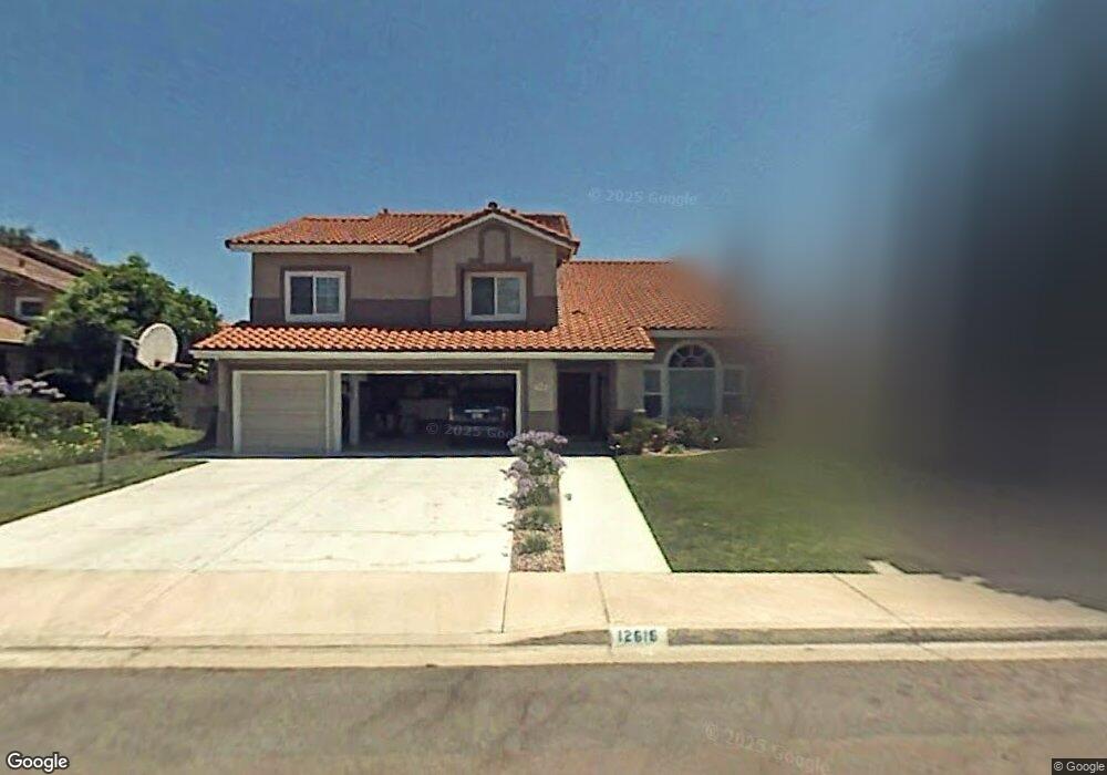
This home is located at 12616 Brookstone Ct, Poway, CA 92064 and is currently estimated at $1,684,456, approximately $543 per square foot. 12616 Brookstone Ct is a home located in San Diego County with nearby schools including Tierra Bonita Elementary, Twin Peaks Middle, and Poway High.
Ownership History
Date
Name
Owned For
Owner Type
Purchase Details
Closed on
Mar 26, 2018
Sold by
Bourne James Michael and Bourne Kelly
Bought by
Neuman Lee B and Neuman Kathleen M
Current Estimated Value
Purchase Details
Closed on
Jun 23, 2017
Sold by
Bourne James Michael and Bourne Kelly
Bought by
Bourne James Michael and Bourne Kelly
Home Financials for this Owner
Home Financials are based on the most recent Mortgage that was taken out on this home.
Original Mortgage
$612,950
Interest Rate
3.89%
Mortgage Type
New Conventional
Purchase Details
Closed on
Jul 29, 2003
Sold by
Poppitz Gary A and Poppitz Jill
Bought by
Bourne Michael and Bourne Kelly
Home Financials for this Owner
Home Financials are based on the most recent Mortgage that was taken out on this home.
Original Mortgage
$546,400
Interest Rate
5.29%
Mortgage Type
Unknown
Purchase Details
Closed on
Jul 27, 1987
Create a Home Valuation Report for This Property
The Home Valuation Report is an in-depth analysis detailing your home's value as well as a comparison with similar homes in the area
Home Values in the Area
Average Home Value in this Area
Purchase History
| Date | Buyer | Sale Price | Title Company |
|---|---|---|---|
| Neuman Lee B | $967,500 | California Title Company | |
| Bourne James Michael | -- | Chicago Title Company Sd | |
| Bourne Michael | $683,000 | Chicago Title Co | |
| -- | $226,500 | -- |
Source: Public Records
Mortgage History
| Date | Status | Borrower | Loan Amount |
|---|---|---|---|
| Previous Owner | Bourne James Michael | $612,950 | |
| Previous Owner | Bourne Michael | $546,400 |
Source: Public Records
Tax History
| Year | Tax Paid | Tax Assessment Tax Assessment Total Assessment is a certain percentage of the fair market value that is determined by local assessors to be the total taxable value of land and additions on the property. | Land | Improvement |
|---|---|---|---|---|
| 2025 | $12,313 | $1,100,842 | $475,502 | $625,340 |
| 2024 | $12,313 | $1,079,258 | $466,179 | $613,079 |
| 2023 | $12,056 | $1,058,097 | $457,039 | $601,058 |
| 2022 | $11,859 | $1,037,351 | $448,078 | $589,273 |
| 2021 | $11,707 | $1,017,012 | $439,293 | $577,719 |
| 2020 | $11,551 | $1,006,585 | $434,789 | $571,796 |
| 2019 | $11,254 | $986,849 | $426,264 | $560,585 |
| 2018 | $9,760 | $867,857 | $374,866 | $492,991 |
| 2017 | $9,502 | $850,841 | $367,516 | $483,325 |
| 2016 | $9,310 | $834,159 | $360,310 | $473,849 |
| 2015 | $9,173 | $821,630 | $354,898 | $466,732 |
| 2014 | $8,898 | $800,000 | $344,000 | $456,000 |
Source: Public Records
Map
Nearby Homes
- 14725 Fieldview Way
- 14811 Summerbreeze Way
- 14109 Arbolitos Dr
- 0 La Manda Dr Unit 260002248
- 14872 Summerbreeze Way
- 12708 Casa Avenida
- 14637 Poway Mesa Dr
- 14230 Jonah Way
- 14138 Brent Wilsey Place Unit 3
- 14110 Brent Wilsey Place Unit 1
- 14955 Avenida Venusto Unit 85
- Hawkeye Waverly Downs Way Unit A70
- 12885 Rockwell Ct
- 12047 Tivoli Park Row Unit 4
- 12445 Witt Place
- 12311 Witt Rd
- 11908 Tivoli Park Row Unit 7
- 13303 Betty Lee Way
- 12124 Riley Ln
- 11975 Wilmington Rd
- 12622 Brookstone Ct
- 12610 Brookstone Ct
- 12628 Brookstone Ct
- 12615 Hedgetree Ct
- 12604 Brookstone Ct
- 12609 Hedgetree Ct
- 12621 Hedgetree Ct
- 12617 Brookstone Ct
- 12603 Hedgetree Ct
- 12611 Brookstone Ct
- 12623 Brookstone Ct
- 12627 Hedgetree Ct
- 12634 Brookstone Ct
- 12605 Brookstone Ct
- 12629 Brookstone Ct
- 12633 Hedgetree Ct
- 12640 Brookstone Ct
- 14608 Brookstone Dr
- 14656 Brookstone Dr
- 12635 Brookstone Ct
Your Personal Tour Guide
Ask me questions while you tour the home.