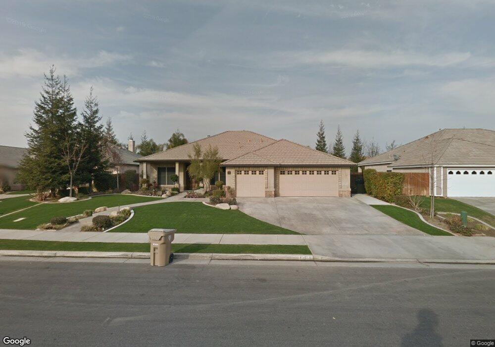
12616 Savonburg Dr Bakersfield, CA 93312
Brimhall Estates NeighborhoodEstimated Value: $579,000 - $613,000
3
Beds
2
Baths
2,433
Sq Ft
$247/Sq Ft
Est. Value
About This Home
This home is located at 12616 Savonburg Dr, Bakersfield, CA 93312 and is currently estimated at $600,796, approximately $246 per square foot. 12616 Savonburg Dr is a home located in Kern County with nearby schools including American Elementary School, Rosedale Middle School, and Liberty High School.
Ownership History
Date
Name
Owned For
Owner Type
Purchase Details
Closed on
Sep 17, 2018
Sold by
Brock Eric Maher and Brock Jennifer Leigh
Bought by
Maher Brock Eric
Current Estimated Value
Purchase Details
Closed on
Nov 9, 2011
Sold by
Hicks Terri L
Bought by
Brock Eric Maher and Brock Jennifer Leigh
Purchase Details
Closed on
Mar 24, 2005
Sold by
Mioni Kevin L
Bought by
Hicks James E and Hicks Terri L
Purchase Details
Closed on
Sep 2, 2003
Sold by
John Balfanz Homes Inc
Bought by
Mioni Kevin L
Home Financials for this Owner
Home Financials are based on the most recent Mortgage that was taken out on this home.
Original Mortgage
$255,652
Interest Rate
5.89%
Mortgage Type
Purchase Money Mortgage
Create a Home Valuation Report for This Property
The Home Valuation Report is an in-depth analysis detailing your home's value as well as a comparison with similar homes in the area
Home Values in the Area
Average Home Value in this Area
Purchase History
| Date | Buyer | Sale Price | Title Company |
|---|---|---|---|
| Maher Brock Eric | -- | None Available | |
| Brock Eric Maher | $332,000 | Placer Title Company | |
| Hicks James E | $440,000 | Ticor Title | |
| Mioni Kevin L | $269,500 | Stewart Title |
Source: Public Records
Mortgage History
| Date | Status | Borrower | Loan Amount |
|---|---|---|---|
| Previous Owner | Mioni Kevin L | $255,652 |
Source: Public Records
Tax History Compared to Growth
Tax History
| Year | Tax Paid | Tax Assessment Tax Assessment Total Assessment is a certain percentage of the fair market value that is determined by local assessors to be the total taxable value of land and additions on the property. | Land | Improvement |
|---|---|---|---|---|
| 2025 | $5,648 | $441,622 | $87,918 | $353,704 |
| 2024 | $5,542 | $432,965 | $86,195 | $346,770 |
| 2023 | $5,542 | $424,476 | $84,505 | $339,971 |
| 2022 | $5,451 | $416,154 | $82,849 | $333,305 |
| 2021 | $5,297 | $407,996 | $81,225 | $326,771 |
| 2020 | $5,224 | $403,814 | $80,393 | $323,421 |
| 2019 | $5,146 | $403,814 | $80,393 | $323,421 |
| 2018 | $5,003 | $388,136 | $77,272 | $310,864 |
| 2017 | $5,229 | $380,526 | $75,757 | $304,769 |
| 2016 | $4,881 | $373,066 | $74,272 | $298,794 |
| 2015 | $4,819 | $367,464 | $73,157 | $294,307 |
| 2014 | $4,585 | $347,000 | $87,000 | $260,000 |
Source: Public Records
Map
Nearby Homes
- 12401 Longmeadow Way
- 12925 Appaloosa Ave
- 12204 Tule River Way
- 12307 Fairburn Way
- 12303 Fairburn Way
- 12008 Stonington St
- 11917 Leigh River St
- 307 Coachman Way
- 11808 Wethersfield St
- 12608 Fallstaff Ln
- 12023 Winger St
- 12512 Cheswolde Dr
- 13115 Nantucket Place
- 11717 Old Town Rd
- 11901 Kimelford Dr
- 13801 Laverton Ave
- 12217 French Park Ln
- 11510 Finsbury Ct
- 13207 Phoenix Palm Ct
- 201 El Paso Rd
- 12612 Savonburg Dr
- 12620 Savonburg Dr
- 12701 Clay Creek Ct
- 12608 Savonburg Dr
- 12705 Clay Creek Ct
- 12615 Clay Creek Ct
- 12621 Savonburg Dr
- 12613 Savonburg Dr
- 12609 Savonburg Dr
- 12709 Clay Creek Ct
- 12604 Savonburg Dr
- 12611 Clay Creek Ct
- 12601 Savonburg Dr
- 12713 Clay Creek Ct
- 12614 Gila River Dr
- 903 Vermillion Dr
- 12610 Gila River Dr
- 907 Vermillion Dr
- 12600 Savonburg Dr
- 12606 Gila River Dr