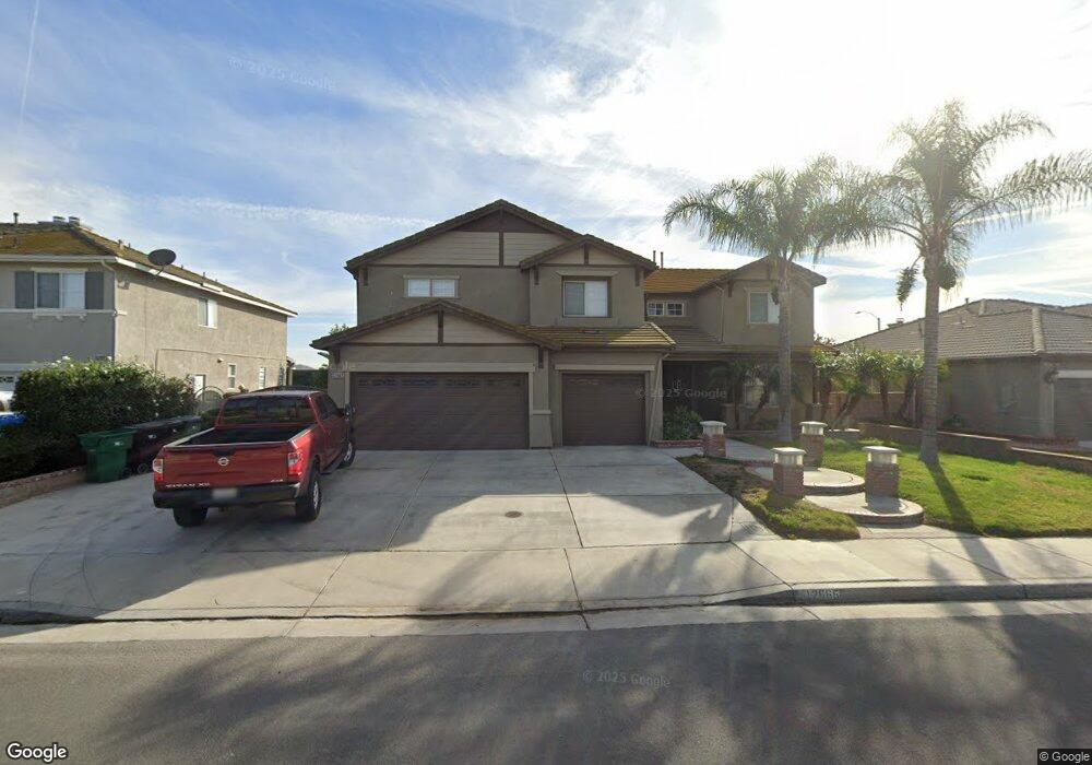
12665 Bridgewater Dr Corona, CA 92880
Estimated Value: $955,485 - $1,051,000
4
Beds
3
Baths
3,604
Sq Ft
$282/Sq Ft
Est. Value
About This Home
This home is located at 12665 Bridgewater Dr, Corona, CA 92880 and is currently estimated at $1,017,121, approximately $282 per square foot. 12665 Bridgewater Dr is a home located in Riverside County with nearby schools including Harada Elementary School, River Heights Intermediate School, and Eleanor Roosevelt High School.
Ownership History
Date
Name
Owned For
Owner Type
Purchase Details
Closed on
Feb 26, 2019
Sold by
Bento Francisco A and Bento Maria M
Bought by
Bento Maria M and Bento Francisco A
Current Estimated Value
Purchase Details
Closed on
Aug 29, 2002
Sold by
Regent Norco Llc
Bought by
Bento Francisco A and Bento Maria M
Home Financials for this Owner
Home Financials are based on the most recent Mortgage that was taken out on this home.
Original Mortgage
$151,495
Interest Rate
5.72%
Create a Home Valuation Report for This Property
The Home Valuation Report is an in-depth analysis detailing your home's value as well as a comparison with similar homes in the area
Home Values in the Area
Average Home Value in this Area
Purchase History
| Date | Buyer | Sale Price | Title Company |
|---|---|---|---|
| Bento Maria M | -- | None Available | |
| Bento Francisco A | $303,000 | Stewart Title |
Source: Public Records
Mortgage History
| Date | Status | Borrower | Loan Amount |
|---|---|---|---|
| Previous Owner | Bento Francisco A | $151,495 | |
| Closed | Bento Francisco A | $65,000 |
Source: Public Records
Tax History Compared to Growth
Tax History
| Year | Tax Paid | Tax Assessment Tax Assessment Total Assessment is a certain percentage of the fair market value that is determined by local assessors to be the total taxable value of land and additions on the property. | Land | Improvement |
|---|---|---|---|---|
| 2025 | $7,015 | $438,674 | $76,599 | $362,075 |
| 2023 | $7,015 | $421,642 | $73,626 | $348,016 |
| 2022 | $6,822 | $413,376 | $72,183 | $341,193 |
| 2021 | $6,689 | $405,271 | $70,768 | $334,503 |
| 2020 | $6,601 | $401,117 | $70,043 | $331,074 |
| 2019 | $6,475 | $393,253 | $68,670 | $324,583 |
| 2018 | $6,334 | $385,543 | $67,325 | $318,218 |
| 2017 | $6,197 | $377,984 | $66,005 | $311,979 |
| 2016 | $6,097 | $370,573 | $64,711 | $305,862 |
| 2015 | $5,990 | $365,009 | $63,740 | $301,269 |
| 2014 | $5,801 | $357,861 | $62,493 | $295,368 |
Source: Public Records
Map
Nearby Homes
- 5764 Territory Ln
- 12745 Longhorne Dr
- 5800 Hamner Ave Unit 249
- 5800 Hamner Ave Unit 237
- 5800 Hamner Ave Unit 159
- 5800 Hamner Ave Unit 354
- 5722 Canoe Dr
- 5986 Dr
- 6388 Pictor
- 6064 Bryce Dr
- 12931 Royale Dr
- 12865 Auburn Dr
- 416 Hamner Ave
- 4613 S Amherst Privado
- 6046 Fairfax Dr
- 6052 Fairfax Dr
- 6045 Fairfax Dr
- 12903 Paradiso Dr Unit 101
- 6123 Valentina Way Unit 301
- 6053 Fairfax Dr
- 12653 Bridgewater Dr
- 12677 Bridgewater Dr
- 12641 Bridgewater Dr
- 5793 Territory Ln
- 12682 Bridgewater Dr
- 12629 Bridgewater Dr
- 12701 Bridgewater Dr
- 5796 Territory Ln
- 5785 Territory Ln
- 12694 Bridgewater Dr
- 12617 Bridgewater Dr
- 5788 Territory Ln
- 12713 Bridgewater Dr
- 5795 Cairo Ct
- 5777 Territory Ln
- 12718 Bridgewater Dr
- 12733 Longhorne Dr
- 5780 Territory Ln
- 5787 Cairo Ct
- 12725 Bridgewater Dr