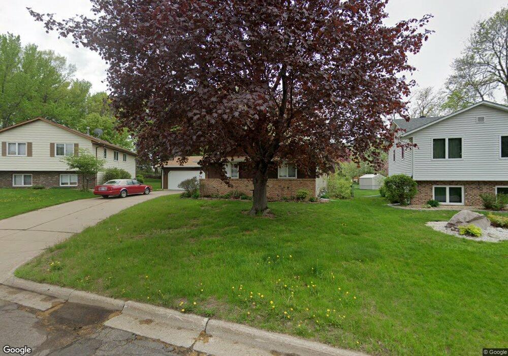
1267 Allen Ave Saint Paul, MN 55118
Estimated Value: $325,000 - $432,000
3
Beds
3
Baths
1,400
Sq Ft
$270/Sq Ft
Est. Value
About This Home
This home is located at 1267 Allen Ave, Saint Paul, MN 55118 and is currently estimated at $378,658, approximately $270 per square foot. 1267 Allen Ave is a home located in Dakota County with nearby schools including Moreland Arts & Health Sciences Magnet School, Heritage E-STEM Magnet School, and Two Rivers High School.
Ownership History
Date
Name
Owned For
Owner Type
Purchase Details
Closed on
Aug 1, 2025
Sold by
Zehnpfennig Aaron
Bought by
Altamirano Angela
Current Estimated Value
Home Financials for this Owner
Home Financials are based on the most recent Mortgage that was taken out on this home.
Original Mortgage
$319,113
Outstanding Balance
$318,841
Interest Rate
6.81%
Mortgage Type
New Conventional
Estimated Equity
$59,817
Purchase Details
Closed on
Aug 3, 2023
Sold by
Shefveland Jeanne
Bought by
Zehnpfennig Aaron
Home Financials for this Owner
Home Financials are based on the most recent Mortgage that was taken out on this home.
Original Mortgage
$256,500
Interest Rate
6.67%
Mortgage Type
New Conventional
Create a Home Valuation Report for This Property
The Home Valuation Report is an in-depth analysis detailing your home's value as well as a comparison with similar homes in the area
Home Values in the Area
Average Home Value in this Area
Purchase History
| Date | Buyer | Sale Price | Title Company |
|---|---|---|---|
| Altamirano Angela | $325,000 | -- | |
| Zehnpfennig Aaron | $270,000 | -- |
Source: Public Records
Mortgage History
| Date | Status | Borrower | Loan Amount |
|---|---|---|---|
| Open | Altamirano Angela | $319,113 | |
| Previous Owner | Zehnpfennig Aaron | $256,500 |
Source: Public Records
Tax History Compared to Growth
Tax History
| Year | Tax Paid | Tax Assessment Tax Assessment Total Assessment is a certain percentage of the fair market value that is determined by local assessors to be the total taxable value of land and additions on the property. | Land | Improvement |
|---|---|---|---|---|
| 2024 | $4,210 | $336,800 | $83,500 | $253,300 |
| 2023 | $4,210 | $345,100 | $88,500 | $256,600 |
| 2022 | $3,878 | $338,400 | $88,200 | $250,200 |
| 2021 | $3,802 | $302,800 | $76,700 | $226,100 |
| 2020 | $3,628 | $295,200 | $73,000 | $222,200 |
| 2019 | $3,347 | $275,600 | $69,500 | $206,100 |
| 2018 | $3,224 | $245,400 | $65,000 | $180,400 |
| 2017 | $2,992 | $246,300 | $61,900 | $184,400 |
| 2016 | $2,824 | $222,100 | $56,300 | $165,800 |
| 2015 | $2,811 | $193,077 | $50,439 | $142,638 |
| 2014 | -- | $186,101 | $46,503 | $139,598 |
| 2013 | -- | $168,661 | $42,143 | $126,518 |
Source: Public Records
Map
Nearby Homes
- 158 Southwind Ln
- 63 Langer Cir
- 69 Langer Cir
- 111 Imperial Dr W Unit 102
- 100 Imperial Dr W Unit 204
- 242 Butler Ave W
- 1220 Stryker Ave
- 1277 Hall Ave
- 280 Edith Dr
- 1450 Bidwell St Unit 110
- 1384 Smith Ave S
- 1062 Ohio St
- 389 Edith Dr
- 1084 Hall Ave
- 1016 Bidwell St
- 69 Amelia Ave
- 1076 Humboldt Ave
- 1513 Smith Ave S
- 999 Seminole Ave
- 1095 Cherokee Ave
- 1273 Allen Ave
- 1263 Allen Ave
- 1268 Harmon Ct
- 1262 Harmon Ct
- 1262 Harmon Ct
- 1255 Allen Ave
- 191 Southwind Ln
- 194 Southwind Ln
- 1254 Harmon Ct
- 191 Southwind Ln
- 1272 Harmon Ct
- 1268 1268 Harmon Ct
- 1269 1269 Harmon Ct
- 209 Logan Ave W
- 205 Logan Ave W
- 1248 1248 Allen-Avenue-
- 1247 Allen Ave
- 215 Logan Ave W
- 186 Southwind Ln
- 1246 Harmon Ct