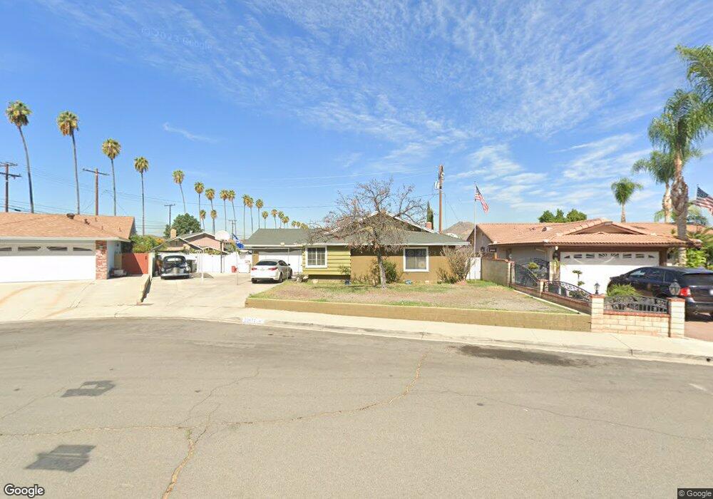
12671 Fieldstone Cir Riverside, CA 92503
Estimated Value: $595,000 - $691,000
3
Beds
2
Baths
1,429
Sq Ft
$444/Sq Ft
Est. Value
About This Home
This home is located at 12671 Fieldstone Cir, Riverside, CA 92503 and is currently estimated at $634,741, approximately $444 per square foot. 12671 Fieldstone Cir is a home located in Riverside County with nearby schools including Phillip M. Stokoe Elementary School, Ysmael Villegas Middle School, and Hillcrest High School.
Ownership History
Date
Name
Owned For
Owner Type
Purchase Details
Closed on
Jun 14, 2021
Sold by
Acosta Dennis G Sanchez and Nava Vincent
Bought by
Nava Vincent and Nava Denise Goreti
Current Estimated Value
Home Financials for this Owner
Home Financials are based on the most recent Mortgage that was taken out on this home.
Original Mortgage
$284,000
Interest Rate
2.9%
Mortgage Type
New Conventional
Purchase Details
Closed on
Aug 21, 2001
Sold by
Ward Lester A and Ward Nancy L
Bought by
Martinez Edward and Martinez Yolanda Marie
Home Financials for this Owner
Home Financials are based on the most recent Mortgage that was taken out on this home.
Original Mortgage
$181,685
Interest Rate
6.88%
Mortgage Type
FHA
Create a Home Valuation Report for This Property
The Home Valuation Report is an in-depth analysis detailing your home's value as well as a comparison with similar homes in the area
Home Values in the Area
Average Home Value in this Area
Purchase History
| Date | Buyer | Sale Price | Title Company |
|---|---|---|---|
| Nava Vincent | -- | First American Title | |
| Martinez Edward | $185,000 | -- |
Source: Public Records
Mortgage History
| Date | Status | Borrower | Loan Amount |
|---|---|---|---|
| Previous Owner | Nava Vincent | $284,000 | |
| Previous Owner | Martinez Edward | $181,685 |
Source: Public Records
Tax History
| Year | Tax Paid | Tax Assessment Tax Assessment Total Assessment is a certain percentage of the fair market value that is determined by local assessors to be the total taxable value of land and additions on the property. | Land | Improvement |
|---|---|---|---|---|
| 2025 | $3,422 | $288,042 | $88,621 | $199,421 |
| 2023 | $3,422 | $276,859 | $85,181 | $191,678 |
| 2022 | $4,057 | $271,431 | $83,511 | $187,920 |
| 2021 | $3,990 | $266,110 | $81,874 | $184,236 |
| 2020 | $3,893 | $263,382 | $81,035 | $182,347 |
| 2019 | $3,851 | $258,219 | $79,447 | $178,772 |
| 2018 | $3,801 | $253,157 | $77,891 | $175,266 |
| 2017 | $3,724 | $248,194 | $76,364 | $171,830 |
| 2016 | $2,840 | $243,328 | $74,867 | $168,461 |
| 2015 | $2,799 | $239,676 | $73,744 | $165,932 |
| 2014 | $2,787 | $234,983 | $72,300 | $162,683 |
Source: Public Records
Map
Nearby Homes
- 12660 Fieldstone Cir
- 3555 Dixie Ln
- 3370 Hollowood Ct
- 3500 Buchanan St Unit 120
- 3500 Buchanan St Unit 24
- 3500 Buchanan St Unit 145
- 3500 Buchanan St Unit 21
- 3500 Buchanan St Unit 103
- 3500 Buchanan St Unit 73
- 3500 Buchanan St
- 3500 Buchanan St Unit 107
- 3500 Buchanan St Unit 30
- 3500 Buchanan St Unit 230
- 3500 Buchanan Ave Unit 15
- 3771 Harvill Ln
- 3700 Buchanan Ave Unit Spc 131
- 3700 Buchanan Ave Unit 72
- 3700 Buchanan Ave Unit 25
- 3700 Buchanan St Unit 180
- 3700 Buchanan St Unit 98
- 12661 Fieldstone Cir
- 12670 Hollyglen Cir
- 12681 Fieldstone Cir
- 12660 Hollyglen Cir
- 12680 Hollyglen Cir
- 12690 Fieldstone Cir
- 12670 Fieldstone Cir
- 12680 Fieldstone Cir
- 12690 Hollyglen Cir
- 3545 Dixie Ln
- 3565 Dixie Ln
- 3535 Dixie Ln
- 12671 Ashland Place
- 12671 Hollyglen Cir
- 12661 Hollyglen Cir
- 12681 Hollyglen Cir
- 12707 Camino San Benito Dr
- 3575 Dixie Ln
- 12661 Ashland Place
- 12681 Ashland Place